Templars, Germans & a Poet
Un itinéraire vélo au départ de Barrowby, Angleterre, Royaume-Uni.
Vue d'ensemble
À propos du circuit
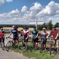
Visite du Preceptory des Templiers de Temple Bruer et des tombes de guerre de Scopwick. Je ne suis pas le genre à me concentrer et à engranger des kilomètres. Je préfère profiter de mon environnement et explorer de nouveaux endroits - tout en pédalant. Aujourd'hui était un de ces jours. Nous avions prévu de visiter les vestiges du Précepteur Templier à Temple Bruer. Après cela, il n'y avait pas de plan. Reconnaissant Scopwick comme le lieu de repos de John Gillespie Magee, le pilote de 19 ans de la WW11 qui a écrit le célèbre poème 'High Flight', nous avons fait une halte pour rendre visite. En cherchant sa tombe, nous sommes tombés sur un petit groupe de tombes allemandes. Quatre d'entre elles étaient l'équipage d'un Dornier qui avait mené une audacieuse mission aérienne solitaire sur Lincoln. Après avoir semé la mort et la destruction, ils ont eu le malheur de croiser l'un des meilleurs de la RAF, sous la forme d'un Mosquito. L'escarmouche a gravement endommagé le Mosquito, mais l'équipage a réussi à l'atterrir sans blessés, tandis que les quatre membres de l'équipage du Dornier ont tous été tués lors de l'impact de l'écrasement près de Boothby Graffoe. C'était une balade de 53 miles, mais cela ne s'est pas ressenti, principalement à cause des distractions.
- -:--
- Durée
- 84,4 km
- Distance
- 422 m
- Montée
- 422 m
- Descente
- ---
- Vit. moyenne
- ---
- Altitude max.
Qualité de l’itinéraire
Types de voies et surfaces le long de l’itinéraire
Types de routes
Route
22,8 km
(27 %)
Route tranquille
21,1 km
(25 %)
surfaces
Pavé
25,3 km
(30 %)
Asphalte
17,7 km
(21 %)
Pavé (non défini)
7,6 km
(9 %)
Indéfini
59,1 km
(70 %)
Continuer avec Bikemap
Utilise, modifie ou télécharge cet itinéraire vélo
Tu veux parcourir Templars, Germans & a Poet ou l’adapter à ton propre voyage ? Voici ce que tu peux faire avec cet itinéraire Bikemap :
Fonctionnalités gratuites
- Enregistre cet itinéraire comme favori ou dans une collection
- Copie et planifie ta propre version de cet itinéraire
- Divise-le en étapes pour créer un tour sur plusieurs jours
- Synchronise ton itinéraire avec Garmin ou Wahoo
Fonctionnalités Premium
Essai gratuit de 3 jours, ou paiement unique. En savoir plus sur Bikemap Premium.
- Navigue sur cet itinéraire sur iOS et Android
- Exporter un fichier GPX / KML de cet itinéraire
- Crée ton impression personnalisée (essaie-la gratuitement)
- Télécharge cet itinéraire pour la navigation hors ligne
Découvre plus de fonctionnalités Premium.
Obtiens Bikemap PremiumDe notre communauté
Barrowby : Autres itinéraires populaires qui commencent ici
 So you wanted hills?
- Distance
- 50,2 km
- Montée
- 478 m
- Descente
- 476 m
- Emplacement
- Barrowby, Angleterre, Royaume-Uni
 Belvoir Sunday slouch
- Distance
- 44,6 km
- Montée
- 207 m
- Descente
- 205 m
- Emplacement
- Barrowby, Angleterre, Royaume-Uni
 54 miles via Velo Verde
- Distance
- 86,3 km
- Montée
- 481 m
- Descente
- 490 m
- Emplacement
- Barrowby, Angleterre, Royaume-Uni
 A Continental Century to Velo Verde
- Distance
- 109,4 km
- Montée
- 577 m
- Descente
- 590 m
- Emplacement
- Barrowby, Angleterre, Royaume-Uni
 2017 Viking Challenge 50km Route
- Distance
- 55,5 km
- Montée
- 440 m
- Descente
- 438 m
- Emplacement
- Barrowby, Angleterre, Royaume-Uni
 Three Counties 50 miles
- Distance
- 80,4 km
- Montée
- 466 m
- Descente
- 466 m
- Emplacement
- Barrowby, Angleterre, Royaume-Uni
 Belvoir to Hickling
- Distance
- 45,4 km
- Montée
- 294 m
- Descente
- 293 m
- Emplacement
- Barrowby, Angleterre, Royaume-Uni
 Vale 32
- Distance
- 52,3 km
- Montée
- 403 m
- Descente
- 403 m
- Emplacement
- Barrowby, Angleterre, Royaume-Uni
Ouvre-la dans l’app


