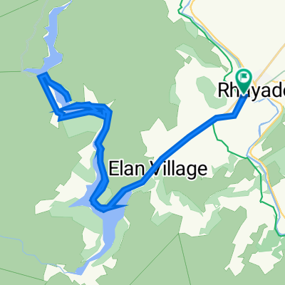
Elan Valley 15.5miles
- 25 km
- 436 m
- 435 m
- Rhayader, Pays de Galles, Royaume-Uni
<span style="color: #000000; font-family: Tahoma; font-size: small; line-height: 15px; -webkit-border-horizontal-spacing: 2px; -webkit-border-vertical-spacing: 2px;">The Trans Cambrian Cyclo Sportive is a road cycling event that traverses these mountains, starting from the old market town of Rhayader and taking a roller coaster route past Llyn Clywedog and The Star Inn down to Machynlleth and the sea. From here it snakes back through the mountains via Nant-y-Moch reservoir, Devils Bridge, and the 100 year old Elan Valley dams, finishing back in Rhayader town centre. It is 87 miles long, the highest point is 509m and the lowest point is just 6m above sea level.</span>
Essai gratuit de 3 jours, ou paiement unique. En savoir plus sur Bikemap Premium.
Découvre plus de fonctionnalités Premium.
Obtiens Bikemap PremiumOuvre-la dans l’app