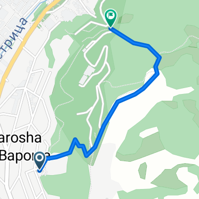
Steep route to the almond forest
Un itinéraire vélo au départ de Blagoevgrad, Blagoevgrad, Bulgarie.
Vue d'ensemble
À propos du circuit
Encore une fois, je ne suis pas sûr à 100% d'avoir bien fait. Après la balade au stade/poussée sur la route. À un moment donné, la route s'aplatit un peu et vous devriez regarder à droite pour un petit chemin. Allez-y et suivez-le en direction de Blago, la balade est belle et douce et bientôt vous atteindrez une petite colline avec des amandiers et une belle vue sur toute la ville. L'endroit est particulièrement magique au printemps lorsque les arbres fleurissent.
Profitez-en chaque fois que vous avez une heure libre et que vous voulez respirer et vous sentir libre.
- -:--
- Durée
- 0,7 km
- Distance
- 50 m
- Montée
- 29 m
- Descente
- ---
- Vit. moyenne
- ---
- Altitude max.
Points forts de l’itinéraire
Points d’intérêt le long de l’itinéraire

Photo après 0,1 km
The hill at spring

Photo après 0,7 km
View on the town
Continuer avec Bikemap
Utilise, modifie ou télécharge cet itinéraire vélo
Tu veux parcourir Steep route to the almond forest ou l’adapter à ton propre voyage ? Voici ce que tu peux faire avec cet itinéraire Bikemap :
Fonctionnalités gratuites
- Enregistre cet itinéraire comme favori ou dans une collection
- Copie et planifie ta propre version de cet itinéraire
- Synchronise ton itinéraire avec Garmin ou Wahoo
Fonctionnalités Premium
Essai gratuit de 3 jours, ou paiement unique. En savoir plus sur Bikemap Premium.
- Navigue sur cet itinéraire sur iOS et Android
- Exporter un fichier GPX / KML de cet itinéraire
- Crée ton impression personnalisée (essaie-la gratuitement)
- Télécharge cet itinéraire pour la navigation hors ligne
Découvre plus de fonctionnalités Premium.
Obtiens Bikemap PremiumDe notre communauté
Blagoevgrad : Autres itinéraires populaires qui commencent ici
 Shortcut to/and the extreme downhill path
- Distance
- 1,1 km
- Montée
- 85 m
- Descente
- 75 m
- Emplacement
- Blagoevgrad, Blagoevgrad, Bulgarie
 Dead end path with view on Bachinovo
- Distance
- 1,1 km
- Montée
- 100 m
- Descente
- 57 m
- Emplacement
- Blagoevgrad, Blagoevgrad, Bulgarie
 Blagoevgrad - Pehchevo
- Distance
- 62,3 km
- Montée
- 1 386 m
- Descente
- 731 m
- Emplacement
- Blagoevgrad, Blagoevgrad, Bulgarie
 Notre parcours en Macédoine
- Distance
- 392,5 km
- Montée
- 3 215 m
- Descente
- 2 575 m
- Emplacement
- Blagoevgrad, Blagoevgrad, Bulgarie
 6 Macedonia
- Distance
- 122,3 km
- Montée
- 1 142 m
- Descente
- 2 178 m
- Emplacement
- Blagoevgrad, Blagoevgrad, Bulgarie
 Nice route to the near villas and back to Blago
- Distance
- 9,4 km
- Montée
- 243 m
- Descente
- 213 m
- Emplacement
- Blagoevgrad, Blagoevgrad, Bulgarie
 Steep route to the almond forest
- Distance
- 0,7 km
- Montée
- 50 m
- Descente
- 29 m
- Emplacement
- Blagoevgrad, Blagoevgrad, Bulgarie
 Near the river (right side) to the lake
- Distance
- 2 km
- Montée
- 70 m
- Descente
- 26 m
- Emplacement
- Blagoevgrad, Blagoevgrad, Bulgarie
Ouvre-la dans l’app

