Shortcut to/and the extreme downhill path
Un itinéraire vélo au départ de Blagoevgrad, Blagoevgrad, Bulgarie.
Vue d'ensemble
À propos du circuit
En gros, tu montes dans le quartier, autour du côté gauche du zoo, jusqu'au jardin des roses, puis tu remontes la colline au-delà des antennes et le long de la route.
Lorsque tu atteins les premiers arbres, un endroit où les cyclistes sautent par-dessus la route, tu peux voir à ta gauche une pierre peinte en rouge. Tout au long du chemin, tu verras de telles pierres pour te montrer le chemin. Cependant, la première fois, je te conseille de prendre le chemin à pied ou très lentement.
Après le premier virage, le chemin descend fortement. Les gars ont construit quelques sauts sauvages, des virages et tout ce qui va avec la descente.
Comme mes compétences ne sont pas très bonnes, je freinai tout le temps, et pourtant il m'était assez difficile de rester sur le sol. À la fin, tu devrais beaucoup sauter sur les côtés du chemin pour rester en place. Il y a aussi quelques sauts assez hauts et terrifiants.
Regarde les photos sur la carte pour te faire une idée.
Utilise un bon équipement et une protection et crie !
- -:--
- Durée
- 1,1 km
- Distance
- 85 m
- Montée
- 75 m
- Descente
- ---
- Vit. moyenne
- ---
- Altitude max.
Points forts de l’itinéraire
Points d’intérêt le long de l’itinéraire

Photo après 0,5 km

Photo après 0,8 km

Photo après 0,8 km

Photo après 0,8 km
Start of the DH path

Photo après 0,8 km
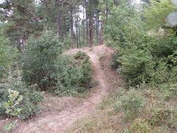
Photo après 0,9 km

Photo après 0,9 km
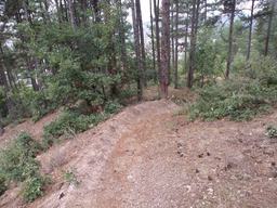
Photo après 0,9 km
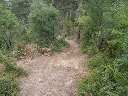
Photo après 0,9 km
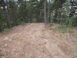
Photo après 0,9 km
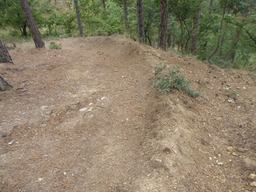
Photo après 1 km

Photo après 1 km
Crazy part here
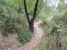
Photo après 1 km
Very steep

Photo après 1,1 km
Nice
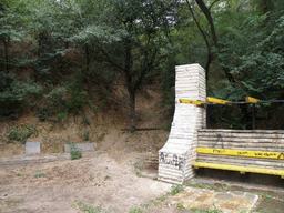
Photo après 1,1 km
The end
Continuer avec Bikemap
Utilise, modifie ou télécharge cet itinéraire vélo
Tu veux parcourir Shortcut to/and the extreme downhill path ou l’adapter à ton propre voyage ? Voici ce que tu peux faire avec cet itinéraire Bikemap :
Fonctionnalités gratuites
- Enregistre cet itinéraire comme favori ou dans une collection
- Copie et planifie ta propre version de cet itinéraire
- Synchronise ton itinéraire avec Garmin ou Wahoo
Fonctionnalités Premium
Essai gratuit de 3 jours, ou paiement unique. En savoir plus sur Bikemap Premium.
- Navigue sur cet itinéraire sur iOS et Android
- Exporter un fichier GPX / KML de cet itinéraire
- Crée ton impression personnalisée (essaie-la gratuitement)
- Télécharge cet itinéraire pour la navigation hors ligne
Découvre plus de fonctionnalités Premium.
Obtiens Bikemap PremiumDe notre communauté
Blagoevgrad : Autres itinéraires populaires qui commencent ici
 Dead end path with view on Bachinovo
- Distance
- 1,1 km
- Montée
- 100 m
- Descente
- 57 m
- Emplacement
- Blagoevgrad, Blagoevgrad, Bulgarie
 Near the river (right side) to the lake
- Distance
- 2 km
- Montée
- 70 m
- Descente
- 26 m
- Emplacement
- Blagoevgrad, Blagoevgrad, Bulgarie
 Steep route to the almond forest
- Distance
- 0,7 km
- Montée
- 50 m
- Descente
- 29 m
- Emplacement
- Blagoevgrad, Blagoevgrad, Bulgarie
 Scenic Route to Elenovo and back to Skapto
- Distance
- 8,8 km
- Montée
- 283 m
- Descente
- 303 m
- Emplacement
- Blagoevgrad, Blagoevgrad, Bulgarie
 Blagoevgrad- Sapareva banya
- Distance
- 50,3 km
- Montée
- 1 160 m
- Descente
- 798 m
- Emplacement
- Blagoevgrad, Blagoevgrad, Bulgarie
 Blagoevgrad-Demirevo-Bistrica-Blagoevgrad CLONED FROM ROUTE 819503
- Distance
- 34 km
- Montée
- 854 m
- Descente
- 858 m
- Emplacement
- Blagoevgrad, Blagoevgrad, Bulgarie
 Nice route to the near villas and back to Blago
- Distance
- 9,4 km
- Montée
- 243 m
- Descente
- 213 m
- Emplacement
- Blagoevgrad, Blagoevgrad, Bulgarie
 Shortcut to/and the extreme downhill path
- Distance
- 1,1 km
- Montée
- 85 m
- Descente
- 75 m
- Emplacement
- Blagoevgrad, Blagoevgrad, Bulgarie
Ouvre-la dans l’app

