- 25,7 km
- 760 m
- 810 m
- Blagoevgrad, Blagoevgrad, Bulgarie
Near the river (right side) to the lake
Un itinéraire vélo au départ de Blagoevgrad, Blagoevgrad, Bulgarie.
Vue d'ensemble
À propos du circuit
Celui-ci, je l'ai monté environ un million de fois, il est rapide, il est beau, il te mène au lac et c'est l'alternative de VTT à l'allée de Bachinovo.
Alors, tu commences depuis le pont de corde métallique, tu le traverses, tu vas à gauche et le long de la rivière. Peu après, tu dois monter presque jusqu'à la route. Puis sur un trottoir. Finalement, il se termine et tu vas à gauche vers une porte en métal. C'est l'entrée du terrain de baseball. Entre, roule sur les cent yards puis encore à gauche le long du filet du terrain de baseball. Voici la partie cool. Tu atteins la rivière, le chemin est pierreux et rapide, tu roules à quelques mètres de la rive dans la forêt - sympa. Après un moment, tu atteins un étrange cercle d'asphalte, le passes et tu es sur une petite route en asphalte qui te mènera bientôt au lac.
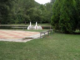
Attache le vélo et monte sur un cygne :)
- -:--
- Durée
- 2 km
- Distance
- 70 m
- Montée
- 26 m
- Descente
- ---
- Vit. moyenne
- ---
- Altitude max.
créé il y a 15 ans
Points forts de l’itinéraire
Points d’intérêt le long de l’itinéraire

Photo après 0 km
Start across the metal rope bridge

Photo après 0,1 km

Photo après 0,2 km

Photo après 0,3 km

Photo après 0,3 km

Photo après 0,5 km
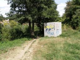
Enter the sport facilities /baseball field/ here

Point d'intérêt après 0,6 km

Photo après 0,7 km

Photo après 0,9 km

Photo après 0,9 km

Photo après 1,2 km
The path seen from the other bank

Photo après 1,3 km

Photo après 1,5 km

Photo après 1,7 km

Photo après 1,8 km

Photo après 1,9 km
Continuer avec Bikemap
Utilise, modifie ou télécharge cet itinéraire vélo
Tu veux parcourir Near the river (right side) to the lake ou l’adapter à ton propre voyage ? Voici ce que tu peux faire avec cet itinéraire Bikemap :
Fonctionnalités gratuites
- Enregistre cet itinéraire comme favori ou dans une collection
- Copie et planifie ta propre version de cet itinéraire
- Synchronise ton itinéraire avec Garmin ou Wahoo
Fonctionnalités Premium
Essai gratuit de 3 jours, ou paiement unique. En savoir plus sur Bikemap Premium.
- Navigue sur cet itinéraire sur iOS et Android
- Exporter un fichier GPX / KML de cet itinéraire
- Crée ton impression personnalisée (essaie-la gratuitement)
- Télécharge cet itinéraire pour la navigation hors ligne
Découvre plus de fonctionnalités Premium.
Obtiens Bikemap PremiumDe notre communauté
Blagoevgrad : Autres itinéraires populaires qui commencent ici
- Горно Хърсово - Айдарово
- София-Благоевград
- 104,4 km
- 1 194 m
- 931 m
- Blagoevgrad, Blagoevgrad, Bulgarie
- Jorden runt Östeuropa: Makedonien, Albanien, Grekland
- 1 519,7 km
- 21 787 m
- 22 907 m
- Blagoevgrad, Blagoevgrad, Bulgarie
- EuroVelo 13 - Iron Curtain Trail - part Bulgaria West
- 63,7 km
- 1 141 m
- 1 831 m
- Blagoevgrad, Blagoevgrad, Bulgarie
- Bistritsa 10, Blagoevgrad à pl. Velbuzhd, Kyustendil
- 60,3 km
- 1 007 m
- 871 m
- Blagoevgrad, Blagoevgrad, Bulgarie
- Обел - Горно Лешко - Благоевград
- 27,5 km
- 204 m
- 1 012 m
- Blagoevgrad, Blagoevgrad, Bulgarie
- 2023-6 Blagoevgrad-Sandanski
- 67 km
- 531 m
- 646 m
- Blagoevgrad, Blagoevgrad, Bulgarie
- Благоевград - Рилски манастир
- 38,8 km
- 924 m
- 107 m
- Blagoevgrad, Blagoevgrad, Bulgarie
Ouvre-la dans l’app


