

Garden Rd to 67
Un itinéraire vélo au départ de Poway, Californie, États Unis.
Vue d'ensemble
À propos du circuit
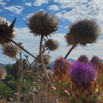
Sycamore Cyn Rd jusqu'à presque Scripps Poway Pkwy. Je suis sorti de la route. Mon objectif était de faire du VTT jusqu'à la 67 via les nombreux sentiers. À environ deux tiers en montant dans ce bosquet, j'ai perdu le sentier à cause de toute la nouvelle végétation. J'ai pris le sentier vers le tunnel du Pkwy (pour les animaux), puis suis revenu sur mes pas sur environ 0,7 mile en passant près du bosquet. J'ai en fait traversé le bosquet à pied et même traversé le lit sec. En montant la petite colline. Pour l'amour du ciel, je n'ai pas pu retrouver le sentier. Tu peux voir où j'ai bifurqué vers le sud pour rejoindre le Pkwy, puis monter la 67 jusqu'à Poway, PS. Ne descends pas Poway grade, très dangereux. Presque pas d'accotement sur la plupart du trajet !
- -:--
- Durée
- 26,2 km
- Distance
- 505 m
- Montée
- 505 m
- Descente
- ---
- Vit. moyenne
- ---
- Altitude max.
Continuer avec Bikemap
Utilise, modifie ou télécharge cet itinéraire vélo
Tu veux parcourir Garden Rd to 67 ou l’adapter à ton propre voyage ? Voici ce que tu peux faire avec cet itinéraire Bikemap :
Fonctionnalités gratuites
- Enregistre cet itinéraire comme favori ou dans une collection
- Copie et planifie ta propre version de cet itinéraire
- Synchronise ton itinéraire avec Garmin ou Wahoo
Fonctionnalités Premium
Essai gratuit de 3 jours, ou paiement unique. En savoir plus sur Bikemap Premium.
- Navigue sur cet itinéraire sur iOS et Android
- Exporter un fichier GPX / KML de cet itinéraire
- Crée ton impression personnalisée (essaie-la gratuitement)
- Télécharge cet itinéraire pour la navigation hors ligne
Découvre plus de fonctionnalités Premium.
Obtiens Bikemap PremiumDe notre communauté
Poway : Autres itinéraires populaires qui commencent ici
 Creekview - around Blue Sky Canyon
- Distance
- 52,6 km
- Montée
- 626 m
- Descente
- 626 m
- Emplacement
- Poway, Californie, États Unis
 13538 Sabre Springs Pkwy, San Diego to 11622 El Camino Real, San Diego
- Distance
- 17,5 km
- Montée
- 180 m
- Descente
- 328 m
- Emplacement
- Poway, Californie, États Unis
 Scripps Lake Dr, San Diego: Miramar Lake Circle
- Distance
- 8 km
- Montée
- 61 m
- Descente
- 62 m
- Emplacement
- Poway, Californie, États Unis
 To Lake Hodges Dam & Back
- Distance
- 55,5 km
- Montée
- 431 m
- Descente
- 431 m
- Emplacement
- Poway, Californie, États Unis
 Garden Rd to 67
- Distance
- 26,2 km
- Montée
- 505 m
- Descente
- 505 m
- Emplacement
- Poway, Californie, États Unis
 Around Poway
- Distance
- 41,7 km
- Montée
- 439 m
- Descente
- 439 m
- Emplacement
- Poway, Californie, États Unis
 Poblado Road 10978, San Diego to Del Dios Hwy. & Bing Crosby Bl., Rancho Santa Fe
- Distance
- 11,3 km
- Montée
- 188 m
- Descente
- 283 m
- Emplacement
- Poway, Californie, États Unis
 Oak Knoll Road 12223, Poway to Oak Knoll Road 12223, Poway
- Distance
- 15,4 km
- Montée
- 219 m
- Descente
- 220 m
- Emplacement
- Poway, Californie, États Unis
Ouvre-la dans l’app