

North Arran
Un itinéraire vélo au départ de Isle of Arran, Ecosse, Royaume-Uni.
Vue d'ensemble
À propos du circuit
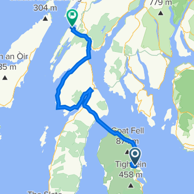
A circular route around the North of Arran following the coaste A 841 and traversing the centre of the island by a minor road (Machrie Moor) and the B 880 (String). Two signicant climbs are the Boguillie Pass, in the north between Sannox and Lochranza, and The String across the centre of the island. Both roads can be busy but drivers are usually very considerate.
The route could be completed in a day, if staying in Brodick, or perhaps two days with an overnight stop in Lochranza.
- -:--
- Durée
- 59,2 km
- Distance
- 489 m
- Montée
- 489 m
- Descente
- ---
- Vit. moyenne
- ---
- Altitude max.

Qualité de l’itinéraire
Types de voies et surfaces le long de l’itinéraire
Types de routes
Route
20,1 km
(34 %)
Route tranquille
4,7 km
(8 %)
surfaces
Pavé
31,4 km
(53 %)
Asphalte
31,4 km
(53 %)
Indéfini
27,8 km
(47 %)
Continuer avec Bikemap
Utilise, modifie ou télécharge cet itinéraire vélo
Tu veux parcourir North Arran ou l’adapter à ton propre voyage ? Voici ce que tu peux faire avec cet itinéraire Bikemap :
Fonctionnalités gratuites
- Enregistre cet itinéraire comme favori ou dans une collection
- Copie et planifie ta propre version de cet itinéraire
- Synchronise ton itinéraire avec Garmin ou Wahoo
Fonctionnalités Premium
Essai gratuit de 3 jours, ou paiement unique. En savoir plus sur Bikemap Premium.
- Navigue sur cet itinéraire sur iOS et Android
- Exporter un fichier GPX / KML de cet itinéraire
- Crée ton impression personnalisée (essaie-la gratuitement)
- Télécharge cet itinéraire pour la navigation hors ligne
Découvre plus de fonctionnalités Premium.
Obtiens Bikemap PremiumDe notre communauté
Isle of Arran : Autres itinéraires populaires qui commencent ici
 arran north loop 8th July 19
- Distance
- 60,4 km
- Montée
- 605 m
- Descente
- 578 m
- Emplacement
- Isle of Arran, Ecosse, Royaume-Uni
 Tour of the Shire - Arran 2014 (Concept)
- Distance
- 90,4 km
- Montée
- 714 m
- Descente
- 714 m
- Emplacement
- Isle of Arran, Ecosse, Royaume-Uni
 LEJO'G 18 Brodick, Isle of Arran to Crinan
- Distance
- 112,3 km
- Montée
- 1 296 m
- Descente
- 1 299 m
- Emplacement
- Isle of Arran, Ecosse, Royaume-Uni
 Arran Loop
- Distance
- 89,1 km
- Montée
- 694 m
- Descente
- 692 m
- Emplacement
- Isle of Arran, Ecosse, Royaume-Uni
 LEJOG Day 10b - Ardrossan - Broddick ferry - Lochranza
- Distance
- 22,8 km
- Montée
- 301 m
- Descente
- 298 m
- Emplacement
- Isle of Arran, Ecosse, Royaume-Uni
 Blackwaterfoot - Brodick Ferry Terminal
- Distance
- 18,6 km
- Montée
- 274 m
- Descente
- 274 m
- Emplacement
- Isle of Arran, Ecosse, Royaume-Uni
 Brodick to Lochranza
- Distance
- 22,3 km
- Montée
- 309 m
- Descente
- 280 m
- Emplacement
- Isle of Arran, Ecosse, Royaume-Uni
 Brodick to Oban
- Distance
- 127,6 km
- Montée
- 1 489 m
- Descente
- 1 443 m
- Emplacement
- Isle of Arran, Ecosse, Royaume-Uni
Ouvre-la dans l’app