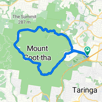
Brisbane River Loop
Un itinéraire vélo au départ de Taringa, State of Queensland, Australie.
Vue d'ensemble
Ă€ propos du circuit
The Brisbane River Loop is popular recreational cycle route that follows the Brisbane River from South Bank to Indooroopilly and back again.
This route is popular on weekends with cyclists of all stripes heading out to get some fresh air and exercise. The majority of the route is on residential back streets, although there are some more busy stretches further out of the city. There is a good mix of flat and hill cycling, and you can also choose the Mini Brisbane River Loop should the full loop prove too challenging.
The full loop is 35-40 km, whereas the mini loop is slightly under 20 km.
- -:--
- Durée
- 38 km
- Distance
- 162 m
- Montée
- 165 m
- Descente
- ---
- Vit. moyenne
- ---
- Altitude max.
Qualité de l’itinéraire
Types de voies et surfaces le long de l’itinéraire
Types de routes
Piste cyclable
13,3 km
(35 %)
Route tranquille
12,9 km
(34 %)
surfaces
Pavé
37,6 km
(99 %)
Asphalte
28,9 km
(76 %)
Béton
8 km
(21 %)
Continuer avec Bikemap
Utilise, modifie ou télécharge cet itinéraire vélo
Tu veux parcourir Brisbane River Loop ou l’adapter à ton propre voyage ? Voici ce que tu peux faire avec cet itinéraire Bikemap :
Fonctionnalités gratuites
- Enregistre cet itinéraire comme favori ou dans une collection
- Copie et planifie ta propre version de cet itinéraire
- Synchronise ton itinéraire avec Garmin ou Wahoo
Fonctionnalités Premium
Essai gratuit de 3 jours, ou paiement unique. En savoir plus sur Bikemap Premium.
- Navigue sur cet itinéraire sur iOS et Android
- Exporter un fichier GPX / KML de cet itinéraire
- Crée ton impression personnalisée (essaie-la gratuitement)
- Télécharge cet itinéraire pour la navigation hors ligne
Découvre plus de fonctionnalités Premium.
Obtiens Bikemap PremiumDe notre communauté
Taringa : Autres itinéraires populaires qui commencent ici
- River Loop Chelmer-Valley
- Distance
- 41,9 km
- Montée
- 188 m
- Descente
- 188 m
- Emplacement
- Taringa, State of Queensland, Australie
- Western Brisbane 67 km River Loop
- Distance
- 67,3 km
- Montée
- 759 m
- Descente
- 758 m
- Emplacement
- Taringa, State of Queensland, Australie
- 28 Ada Street, Toowong to 30 Ada Street, Toowong
- Distance
- 10,9 km
- Montée
- 0 m
- Descente
- 10 m
- Emplacement
- Taringa, State of Queensland, Australie
- 3 figures route
- Distance
- 67,9 km
- Montée
- 449 m
- Descente
- 453 m
- Emplacement
- Taringa, State of Queensland, Australie
- Mt Cootha Loop
- Distance
- 9,6 km
- Montée
- 261 m
- Descente
- 261 m
- Emplacement
- Taringa, State of Queensland, Australie
- The Toowong Gateway Loop
- Distance
- 65,2 km
- Montée
- 5 200 m
- Descente
- 5 200 m
- Emplacement
- Taringa, State of Queensland, Australie
- Mt Cootha finish with breakfast
- Distance
- 5,9 km
- Montée
- 268 m
- Descente
- 272 m
- Emplacement
- Taringa, State of Queensland, Australie
- Toowong, Mt Mee, Samford, Mt Nebo loop
- Distance
- 165,9 km
- Montée
- 1 274 m
- Descente
- 1 271 m
- Emplacement
- Taringa, State of Queensland, Australie
Ouvre-la dans l’app