

New Addington Loop Past Botley Hill and Through Biggin Hill
Un itinéraire vélo au départ de West Wickham, Angleterre, Royaume-Uni.
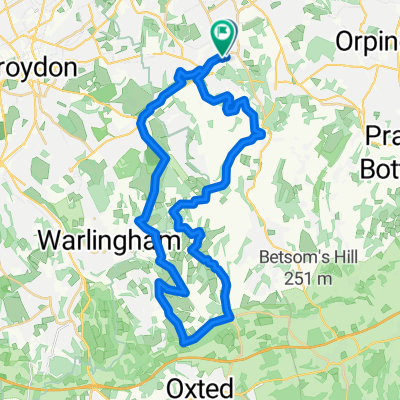
Vue d'ensemble
À propos du circuit
Cet itinéraire est un mélange de route et de hors-piste. Il est définitivement préférable de le faire avec un VTT, même si une grande partie est en bitume. Nous faisons souvent ce parcours en soirée.
Depuis New Addington, il passe par le champ parallèle à Skid Hill Lane, passe devant le White Bear, puis tourne dans High Hill Road, qui est a) raide et b) une route non faite/gravelée. Un rapide droite-gauche te ramène sur une route accidentée et non faite à travers les bois jusqu'à Church Lane. Un peu plus de route te mène à Ledgers Road, et quand cette route tourne à droite, tourne à gauche hors de la route. Le chemin ici commence très marécageux mais remonte jusqu'à Limpsfield Road, où il y a une piste cyclable tout le long jusqu'à Botley Hill Farm.
Après Botley Hill Farm, tourne à gauche au rond-point sur Clarks Lane et profite de la descente jusqu'à ce que tu tournes à gauche sur Chestnut Ave. La partie délicate de cet itinéraire est de trouver le tournant de Chestnut Ave dans les bois à gauche (tu devras soulever ton vélo par-dessus la barrière), surtout la nuit. Redescends à travers les bois (souvent très boueux), sur la prochaine barrière et ensuite descend la route jusqu'en bas de Rag Hill. Un rapide à gauche puis à droite et tu es sur Avenue Road, qui commence très accidentée avant de devenir sérieusement glissante et boueuse près du bas. Finalement, tu sortiras sur The Grove et feras ton chemin à travers Biggin Hill sur la route.
Quand tu atteins Jewels Hill, continue tout droit quand la route tourne à droite et pousse les vélos dans les bois. En haut, tourne à gauche et cela te conduit sur un chemin étroit à travers un champ qui, une fois que tu as traversé Skid Hill Lane, te permet de tourner à droite de nouveau dans le champ qui t'a amené à New Addington au départ.
- -:--
- Durée
- 24,5 km
- Distance
- 257 m
- Montée
- 247 m
- Descente
- ---
- Vit. moyenne
- 263 m
- Altitude max.
Qualité de l’itinéraire
Types de voies et surfaces le long de l’itinéraire
Types de routes
Route tranquille
11 km
(45 %)
Piste cyclable
4,2 km
(17 %)
surfaces
Pavé
7,1 km
(29 %)
Non pavé
4,6 km
(19 %)
Asphalte
7,1 km
(29 %)
Gravier
1,7 km
(7 %)
Continuer avec Bikemap
Utilise, modifie ou télécharge cet itinéraire vélo
Tu veux parcourir New Addington Loop Past Botley Hill and Through Biggin Hill ou l’adapter à ton propre voyage ? Voici ce que tu peux faire avec cet itinéraire Bikemap :
Fonctionnalités gratuites
- Enregistre cet itinéraire comme favori ou dans une collection
- Copie et planifie ta propre version de cet itinéraire
- Synchronise ton itinéraire avec Garmin ou Wahoo
Fonctionnalités Premium
Essai gratuit de 3 jours, ou paiement unique. En savoir plus sur Bikemap Premium.
- Navigue sur cet itinéraire sur iOS et Android
- Exporter un fichier GPX / KML de cet itinéraire
- Crée ton impression personnalisée (essaie-la gratuitement)
- Télécharge cet itinéraire pour la navigation hors ligne
Découvre plus de fonctionnalités Premium.
Obtiens Bikemap PremiumDe notre communauté
West Wickham : Autres itinéraires populaires qui commencent ici
 Addington to Merle Common
- Distance
- 33,5 km
- Montée
- 353 m
- Descente
- 366 m
- Emplacement
- West Wickham, Angleterre, Royaume-Uni
 Addington-Keston Loop
- Distance
- 13,9 km
- Montée
- 147 m
- Descente
- 146 m
- Emplacement
- West Wickham, Angleterre, Royaume-Uni
 test
test- Distance
- 38,4 km
- Montée
- 401 m
- Descente
- 401 m
- Emplacement
- West Wickham, Angleterre, Royaume-Uni
 hayes hayes plan
- Distance
- 31,1 km
- Montée
- 350 m
- Descente
- 352 m
- Emplacement
- West Wickham, Angleterre, Royaume-Uni
 Botley Hill
- Distance
- 30,7 km
- Montée
- 402 m
- Descente
- 400 m
- Emplacement
- West Wickham, Angleterre, Royaume-Uni
 Sutton at Hone route
- Distance
- 50,1 km
- Montée
- 374 m
- Descente
- 374 m
- Emplacement
- West Wickham, Angleterre, Royaume-Uni
 TOUR OF DARWIN COUNTY
- Distance
- 31 km
- Montée
- 308 m
- Descente
- 309 m
- Emplacement
- West Wickham, Angleterre, Royaume-Uni
 New Addington Loop Through Warlingham and Woldingham
- Distance
- 27,5 km
- Montée
- 283 m
- Descente
- 283 m
- Emplacement
- West Wickham, Angleterre, Royaume-Uni
Ouvre-la dans l’app