

York to Filey, Bridlington and Return
Un itinéraire vélo au départ de York, Angleterre, Royaume-Uni.
Vue d'ensemble
À propos du circuit
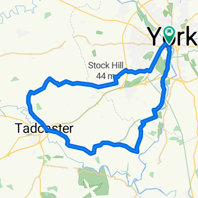
A quiet route to Filey, starting off on the old DVLR railway track to Osbaldwick. On quiet roads to Buttercrambe. At North Grimston, there is a very hard climb, once at the top most of the route from here is comfortable. The route takes you to Filey, then via caost road to Bridlington. It then returns to Wold Newton where it pickesd up the outward route which you may follow back to York. OR you can leave York and turn Right at Wold Nwton and go to Bridlington first. This would be a 47 miles route tdirect to Bridlington
- -:--
- Durée
- 106,8 km
- Distance
- 378 m
- Montée
- 347 m
- Descente
- ---
- Vit. moyenne
- ---
- Altitude max.
Continuer avec Bikemap
Utilise, modifie ou télécharge cet itinéraire vélo
Tu veux parcourir York to Filey, Bridlington and Return ou l’adapter à ton propre voyage ? Voici ce que tu peux faire avec cet itinéraire Bikemap :
Fonctionnalités gratuites
- Enregistre cet itinéraire comme favori ou dans une collection
- Copie et planifie ta propre version de cet itinéraire
- Divise-le en étapes pour créer un tour sur plusieurs jours
- Synchronise ton itinéraire avec Garmin ou Wahoo
Fonctionnalités Premium
Essai gratuit de 3 jours, ou paiement unique. En savoir plus sur Bikemap Premium.
- Navigue sur cet itinéraire sur iOS et Android
- Exporter un fichier GPX / KML de cet itinéraire
- Crée ton impression personnalisée (essaie-la gratuitement)
- Télécharge cet itinéraire pour la navigation hors ligne
Découvre plus de fonctionnalités Premium.
Obtiens Bikemap PremiumDe notre communauté
York : Autres itinéraires populaires qui commencent ici
 Ampleforth (Malton) 2018-05-30
- Distance
- 114,9 km
- Montée
- 353 m
- Descente
- 360 m
- Emplacement
- York, Angleterre, Royaume-Uni
 Barton le willows
- Distance
- 49 km
- Montée
- 141 m
- Descente
- 163 m
- Emplacement
- York, Angleterre, Royaume-Uni
 The Southern Loop
- Distance
- 43,2 km
- Montée
- 72 m
- Descente
- 72 m
- Emplacement
- York, Angleterre, Royaume-Uni
 Tockwith
- Distance
- 54,4 km
- Montée
- 1 529 m
- Descente
- 1 525 m
- Emplacement
- York, Angleterre, Royaume-Uni
 Yorkshire
- Distance
- 243,3 km
- Montée
- 886 m
- Descente
- 784 m
- Emplacement
- York, Angleterre, Royaume-Uni
 York - Westow - York
- Distance
- 64,9 km
- Montée
- 118 m
- Descente
- 114 m
- Emplacement
- York, Angleterre, Royaume-Uni
 37 Monkgate, York to 33 Huntington Road, York
- Distance
- 16,1 km
- Montée
- 6 m
- Descente
- 13 m
- Emplacement
- York, Angleterre, Royaume-Uni
 Beningborough short loop
- Distance
- 29,3 km
- Montée
- 43 m
- Descente
- 44 m
- Emplacement
- York, Angleterre, Royaume-Uni
Ouvre-la dans l’app