

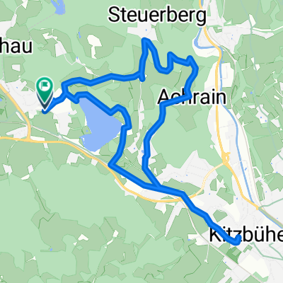
Reith -Kitz - Oberndorf - Reith
Un itinéraire vélo au départ de Reith bei Kitzbühel, Tyrol, Autriche.
Vue d'ensemble
À propos du circuit
gemütliche Runde mit hartem Ende:
Zuerst geht es von Reith nach Kitzbühl auf ebenem Weg. Dort kann man einen kleinen Eindruck von der Stadt bekommen. Dann gehts auf welligem Terrain nach Oberaudorf. Schließlich fährt man von dort wieder über einen längeren Anstieg und eine rasante Abfahrt wieder nach Reith
- -:--
- Durée
- 20,7 km
- Distance
- 278 m
- Montée
- 277 m
- Descente
- ---
- Vit. moyenne
- ---
- Altitude max.
Qualité de l’itinéraire
Types de voies et surfaces le long de l’itinéraire
Types de routes
Route tranquille
8,4 km
(40 %)
Route d'accès
4,1 km
(20 %)
surfaces
Pavé
13,8 km
(66 %)
Non pavé
4,1 km
(20 %)
Asphalte
13,6 km
(65 %)
Gravier
2,2 km
(10 %)
Continuer avec Bikemap
Utilise, modifie ou télécharge cet itinéraire vélo
Tu veux parcourir Reith -Kitz - Oberndorf - Reith ou l’adapter à ton propre voyage ? Voici ce que tu peux faire avec cet itinéraire Bikemap :
Fonctionnalités gratuites
- Enregistre cet itinéraire comme favori ou dans une collection
- Copie et planifie ta propre version de cet itinéraire
- Synchronise ton itinéraire avec Garmin ou Wahoo
Fonctionnalités Premium
Essai gratuit de 3 jours, ou paiement unique. En savoir plus sur Bikemap Premium.
- Navigue sur cet itinéraire sur iOS et Android
- Exporter un fichier GPX / KML de cet itinéraire
- Crée ton impression personnalisée (essaie-la gratuitement)
- Télécharge cet itinéraire pour la navigation hors ligne
Découvre plus de fonctionnalités Premium.
Obtiens Bikemap PremiumDe notre communauté
Reith bei Kitzbühel : Autres itinéraires populaires qui commencent ici
 Rund um den Wilden Kaiser
- Distance
- 85,5 km
- Montée
- 527 m
- Descente
- 541 m
- Emplacement
- Reith bei Kitzbühel, Tyrol, Autriche
 Reith um den Hartkaser
- Distance
- 50,5 km
- Montée
- 438 m
- Descente
- 438 m
- Emplacement
- Reith bei Kitzbühel, Tyrol, Autriche
 Der Weg zum Ochsen
- Distance
- 22,5 km
- Montée
- 755 m
- Descente
- 667 m
- Emplacement
- Reith bei Kitzbühel, Tyrol, Autriche
 Kitzbühel
- Distance
- 9,4 km
- Montée
- 125 m
- Descente
- 124 m
- Emplacement
- Reith bei Kitzbühel, Tyrol, Autriche
 reith bei kitzbühel waidring steinplatte winklmoosalm reith im winkl reith bei kitzbühel
- Distance
- 86,4 km
- Montée
- 1 531 m
- Descente
- 1 527 m
- Emplacement
- Reith bei Kitzbühel, Tyrol, Autriche
 Rund um den Astberg
- Distance
- 18,5 km
- Montée
- 674 m
- Descente
- 676 m
- Emplacement
- Reith bei Kitzbühel, Tyrol, Autriche
 Reith -Kitz - Oberndorf - Reith
- Distance
- 20,7 km
- Montée
- 278 m
- Descente
- 277 m
- Emplacement
- Reith bei Kitzbühel, Tyrol, Autriche
 Schwarzee über St.Johann auf den Harschbichl
- Distance
- 31,2 km
- Montée
- 1 042 m
- Descente
- 1 036 m
- Emplacement
- Reith bei Kitzbühel, Tyrol, Autriche
Ouvre-la dans l’app