

a) 03 PC Ciclovia del Po piacentino (via Po)
Un itinéraire vélo au départ de Castel San Giovanni, Émilie-Romagne, Italie.
Vue d'ensemble
À propos du circuit
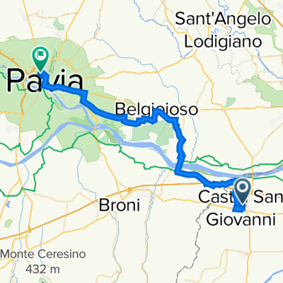
Itinerario corrispondente alla parte piacentina della Ciclovia del Po in sponda destra. E' stata posta la partenza alla stazione di Castel SanGiovanni per evidenziare il servizio treno più bici di Trenitalia. Il percorso giace sul sedime dell'argine maestro del Po, ma è in realtà ottimizzato per un passaggio relativamente efficiente introducendo alcune scorciatoie in prossimità dei meandri più profondi dell fiume. In paricolare sono stati tagliati i tratti comunque pedalalbili su argine maestro a ovest di Piacenza compreso l'area di foce Trebbia e in parte la zona Mortizza a est di Piacenza. Queste diverse letture del percorso possono portare a chilometraggi differenti a seconde delle fonti informazione consultate. La Provincia di Piacenza titolare della gestione della ciclovia indica per la "via Po" una lunghezza di 136 km corrispondenti alla lunghezza dell'argine maestro.
Eng
Route corresponding to the Piacenza part of the Ciclovia del Po River Po Cycle Route Ciclovia del Po on the right bank. The starting point was set at the Castel SanGiovanni railway station to highlight the Trenitalia train plus bike service. The route lies on the grounds of the main bank of the Po, but is actually optimized for a relatively efficient passage by introducing some shortcuts near the deepest meanders of the river. In particular, in the west of Piacenza including the Trebbia estuary area and partly the Mortizza area east of Piacenza some stretches have been cut. These different readings of the route can lead to different mileage depending on the information sources consulted. The Province of Piacenza, owner of the cycle path management, indicates a length of 136 km (Instead of our 92) for the "via Po" corresponding to the length of the main embankment.
- -:--
- Durée
- 91,9 km
- Distance
- 168 m
- Montée
- 199 m
- Descente
- ---
- Vit. moyenne
- 74 m
- Altitude max.

Photos de l’itinéraire
 03 PC Ciclovia del Po piacentino (via Po) »")
 03 PC Ciclovia del Po piacentino (via Po) »")
 03 PC Ciclovia del Po piacentino (via Po) »")
 03 PC Ciclovia del Po piacentino (via Po) »")
Qualité de l’itinéraire
Types de voies et surfaces le long de l’itinéraire
Types de routes
Route tranquille
41,1 km
(45 %)
Route d'accès
24,7 km
(27 %)
surfaces
Pavé
43,8 km
(48 %)
Non pavé
11,4 km
(12 %)
Asphalte
40,1 km
(44 %)
Sol
4,9 km
(5 %)
Continuer avec Bikemap
Utilise, modifie ou télécharge cet itinéraire vélo
Tu veux parcourir a) 03 PC Ciclovia del Po piacentino (via Po) ou l’adapter à ton propre voyage ? Voici ce que tu peux faire avec cet itinéraire Bikemap :
Fonctionnalités gratuites
- Enregistre cet itinéraire comme favori ou dans une collection
- Copie et planifie ta propre version de cet itinéraire
- Divise-le en étapes pour créer un tour sur plusieurs jours
- Synchronise ton itinéraire avec Garmin ou Wahoo
Fonctionnalités Premium
Essai gratuit de 3 jours, ou paiement unique. En savoir plus sur Bikemap Premium.
- Navigue sur cet itinéraire sur iOS et Android
- Exporter un fichier GPX / KML de cet itinéraire
- Crée ton impression personnalisée (essaie-la gratuitement)
- Télécharge cet itinéraire pour la navigation hors ligne
Découvre plus de fonctionnalités Premium.
Obtiens Bikemap PremiumDe notre communauté
Castel San Giovanni : Autres itinéraires populaires qui commencent ici
 I - Gardasee-Mailand-5 - Piacenza-Pavia - 40 km
- Distance
- 40,1 km
- Montée
- 121 m
- Descente
- 108 m
- Emplacement
- Castel San Giovanni, Émilie-Romagne, Italie
 Castel San Giovanni - Ziano - Pianello
- Distance
- 60,9 km
- Montée
- 1 032 m
- Descente
- 1 038 m
- Emplacement
- Castel San Giovanni, Émilie-Romagne, Italie
 CastelSGiovanni - Passo Caldarola (PC)
- Distance
- 70,1 km
- Montée
- 966 m
- Descente
- 966 m
- Emplacement
- Castel San Giovanni, Émilie-Romagne, Italie
 a) 03 PC Ciclovia del Po piacentino (via Po)
- Distance
- 91,9 km
- Montée
- 168 m
- Descente
- 199 m
- Emplacement
- Castel San Giovanni, Émilie-Romagne, Italie
 Grande traversa di pianura in Emilia Romagna
- Distance
- 351,9 km
- Montée
- 303 m
- Descente
- 365 m
- Emplacement
- Castel San Giovanni, Émilie-Romagne, Italie
 Famiglie in bici, Ciclovia dei Fontanili Castel S.Giovanni Sarmato (Pc)
- Distance
- 18,8 km
- Montée
- 104 m
- Descente
- 106 m
- Emplacement
- Castel San Giovanni, Émilie-Romagne, Italie
 giro valli Tidone-Trebbia (lungo)
- Distance
- 125 km
- Montée
- 1 195 m
- Descente
- 1 194 m
- Emplacement
- Castel San Giovanni, Émilie-Romagne, Italie
 EuroVelo 5 - 11 - Castel San Giovanni to Berceto
- Distance
- 159,1 km
- Montée
- 1 176 m
- Descente
- 414 m
- Emplacement
- Castel San Giovanni, Émilie-Romagne, Italie
Ouvre-la dans l’app