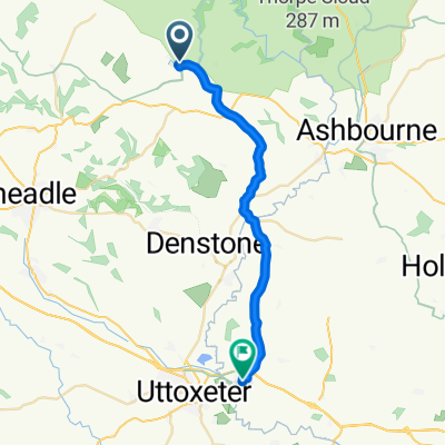
farm on the hill to Home
- 54,4 km
- 802 m
- 896 m
- Mayfield, Inghilterra, Regno Unito

Scopri una mappa con 50 percorsi e sentieri ciclabili vicino a Mayfield, creati dalla nostra community.
Ritratto della regione
Trova il percorso in bici giusto per te a Mayfield, dove abbiamo 50 percorsi ciclabili da esplorare.
1.113 km
Distanza registrata
50
Percorsi ciclabili
2158
Popolazione
Community
Dalla nostra comunità
Percorso ciclabile a Mayfield, Inghilterra, Regno Unito
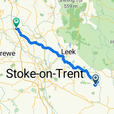
Percorso ciclabile a Mayfield, Inghilterra, Regno Unito
Percorso ciclabile a Mayfield, Inghilterra, Regno Unito
Percorso ciclabile a Mayfield, Inghilterra, Regno Unito