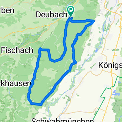
Com’è andare in bici a Diedorf.

Diedorf in bici

Scopri una mappa con 332 percorsi e sentieri ciclabili vicino a Diedorf, creati dalla nostra community.

Ritratto della regione

Scopri Diedorf

Trova il percorso in bici giusto per te a Diedorf, dove abbiamo 332 percorsi ciclabili da esplorare. La maggior parte delle persone va in bici qui nei mesi di Maggio e Luglio.

19.497 km

Distanza registrata

332

Percorsi ciclabili

10.006

Popolazione

Community

Utenti più attivi a Diedorf

Dalla nostra comunità

I migliori percorsi in bici a Diedorf e dintorni

Staudenrundtour nach Bobingen und zurück
Bici da stradaAsfaltato
diedorfbiker
4

Staudenrundtour nach Bobingen und zurück

Percorso ciclabile a Diedorf, Bavaria, Germany

Diedorf-Gesserts-Oberschönefeld-Waldberg-Bobingen-Bergheim-Deuringen-Diedorf
44,1 km
Distanza
306 m
Salita
304 m
Discesa
Waldidyllen
Bicicletta da cittàAsfaltatoNon asfaltato
2

Waldidyllen

Percorso ciclabile a Diedorf, Bavaria, Germany

Früher verbrachten die Fugger und ihre hohen Gäste hier ihre Sommerfrische. Heute sind die „Stauden“ im Süden des Naturparks Augsburg-Westliche Wälder eine der beliebtesten Ausflugsgegenden zum Radeln. Ursprüngliche, stille Mußedörfer liegen eingebettet in den schmalen Wiesentälern einer ansonsten weiten Waldlandschaft. Dorfkultur und Volksfrömmigkeit gelten dort wie eh und je. (Tourbeschreibung unter: thod_er@gmx.de)
53,4 km
Distanza
873 m
Salita
869 m
Discesa
Westliche Wälder
Non asfaltatoGhiaia
2

Westliche Wälder

Percorso ciclabile a Diedorf, Bavaria, Germany

23,2 km
Distanza
291 m
Salita
282 m
Discesa
Diedorf - Angerhütte
Bici da stradaAsfaltato
diedorfbiker
0

Diedorf - Angerhütte

Percorso ciclabile a Diedorf, Bavaria, Germany

<span style="font-size: 8pt;">Diedorf</span> <span style="font-size: 8pt;">Gessertshausen<span>    </span>121</span> <span style="font-size: 8pt;"> </span> <span style="font-size: 8pt;">Margertshausen</span> <span style="font-size: 8pt;">Fischach</span> <span style="font-size: 8pt;">Wollmetshofen</span> <span style="font-size: 8pt;">Langenneufnach</span> <span style="font-size: 8pt;">Walkertshofen</span> <span style="font-size: 8pt;">Reichertshofen</span> <span style="font-size: 8pt;">Mittelneufnach</span> <span style="font-size: 8pt;">Oberneufnach</span> <span style="font-size: 8pt;">Marktwald</span> <span style="font-size: 8pt;"> </span> <span style="font-size: 8pt;">Tussenhausen<span>       </span>88</span> <span style="font-size: 8pt;"> </span> <span style="font-size: 8pt;">Mattsies</span> <span style="font-size: 8pt;"> </span> <span style="font-size: 8pt;">Mindelheim<span>          </span>79</span> <span style="font-size: 8pt;"> </span> <span style="font-size: 8pt;">Apfeltrach</span> <span style="font-size: 8pt;">Dirlewang</span> <span style="font-size: 8pt;">Unteregg</span> <span style="font-size: 8pt;">Oberegg</span> <span style="font-size: 8pt;">Rappen</span> <span style="font-size: 8pt;">Sonderhof</span> <span style="font-size: 8pt;">Neeuried</span> <span style="font-size: 8pt;">Hahnenbühl</span> <span style="font-size: 8pt;">Wolfs</span> <span style="font-size: 8pt;"> </span> <span style="font-size: 8pt;">Obergünzburg<span>      </span>52</span><span style="font-size: 8pt;"></span> <span style="font-size: 8pt;"> </span> <span style="font-size: 8pt;">Immenthal</span> <span style="font-size: 8pt;">Sellthüren</span> <span style="font-size: 8pt;">Eufnach</span> <span style="font-size: 8pt;">Ellenberg</span> <span style="font-size: 8pt;">Wildpoldsried</span> <span style="font-size: 8pt;">Bogenried</span> <span style="font-size: 8pt;"> </span> <span style="font-size: 8pt;">Betzigau<span>                               </span>37</span> <span style="font-size: 8pt;"> </span> <span style="font-size: 8pt;">Mühlstatt</span> <span style="font-size: 8pt;">Haßberg</span> <span style="font-size: 8pt;">Fahls</span> <span style="font-size: 8pt;"> </span> <span style="font-size: 8pt;">Durach<span>                   </span>32</span> <span style="font-size: 8pt;"> </span> <span style="font-size: 8pt;">Seebach</span> <span style="font-size: 8pt;">Sulzberg</span> <span style="font-size: 8pt;">Kenels</span> <span style="font-size: 8pt;">Ottacker</span> <span style="font-size: 8pt;">Rottach</span> <span style="font-size: 8pt;">Humbach</span> <span style="font-size: 8pt;">Greggenhofen</span> <span style="font-size: 8pt;">Rauhenzell</span> <span style="font-size: 8pt;">Altmummen</span> <span style="font-size: 8pt;">Tanne</span> <span style="font-size: 8pt;">Ettensberg</span> <span style="font-size: 8pt;"> </span> <span style="font-size: 8pt;">Gunzesried<span>           </span>4</span> <span style="font-size: 8pt;">Angerhütte</span>  
133,4 km
Distanza
1.026 m
Salita
765 m
Discesa

Scopri più percorsi