
Maidenbower in bici
Scopri una mappa con 146 percorsi e sentieri ciclabili vicino a Maidenbower, creati dalla nostra community.
Ritratto della regione
Scopri Maidenbower
Trova il percorso in bici giusto per te a Maidenbower, dove abbiamo 146 percorsi ciclabili da esplorare. La maggior parte delle persone va in bici qui nei mesi di Luglio e Agosto.
2.760 km
Distanza registrata
146
Percorsi ciclabili
8070
Popolazione
Community
Utenti più attivi a Maidenbower


Dalla nostra comunità
I migliori percorsi in bici a Maidenbower e dintorni

East Grinstead
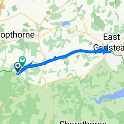
Percorso ciclabile a Maidenbower, Inghilterra, Regno Unito
- 32,8 km
- Distanza
- 267 m
- Salita
- 269 m
- Discesa

ThreeBridgesCircular
Percorso ciclabile a Maidenbower, Inghilterra, Regno Unito
- 14,3 km
- Distanza
- 172 m
- Salita
- 170 m
- Discesa


The Weald
Percorso ciclabile a Maidenbower, Inghilterra, Regno Unito
- 121 km
- Distanza
- 1.448 m
- Salita
- 1.453 m
- Discesa
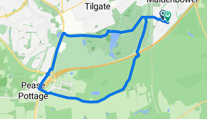
TILGATE WOODS & PEAS POTTAGE
Percorso ciclabile a Maidenbower, Inghilterra, Regno Unito
- 9,8 km
- Distanza
- 100 m
- Salita
- 92 m
- Discesa
Scopri più percorsi
 Sunday experiment
- Distanza
- 54,1 km
- Salita
- 404 m
- Discesa
- 406 m
- Posizione
- Maidenbower, Inghilterra, Regno Unito
 Gare three bridges Redhill
- Distanza
- 22,5 km
- Salita
- 95 m
- Discesa
- 84 m
- Posizione
- Maidenbower, Inghilterra, Regno Unito
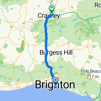
 Crawley to Eastbourne
- Distanza
- 75,8 km
- Salita
- 444 m
- Discesa
- 512 m
- Posizione
- Maidenbower, Inghilterra, Regno Unito
 Little Worth, Crawley Down to Worth Way, Crawley Down
- Distanza
- 16,1 km
- Salita
- 126 m
- Discesa
- 119 m
- Posizione
- Maidenbower, Inghilterra, Regno Unito

Edge520®
Maidenbower Cycling- Distanza
- 7,7 km
- Salita
- 153 m
- Discesa
- 123 m
- Posizione
- Maidenbower, Inghilterra, Regno Unito
 hallans
- Distanza
- 3,7 km
- Salita
- 13 m
- Discesa
- 13 m
- Posizione
- Maidenbower, Inghilterra, Regno Unito
 Six Week Service @ Sydney Street Bikes
- Distanza
- 40 km
- Salita
- 276 m
- Discesa
- 334 m
- Posizione
- Maidenbower, Inghilterra, Regno Unito
 Lengthy bike tour through Crawley
- Distanza
- 39,4 km
- Salita
- 316 m
- Discesa
- 260 m
- Posizione
- Maidenbower, Inghilterra, Regno Unito