


Belek 28km OR
- 28,8 km
- 53 m
- 52 m
- Belek, Antalya, Turchia
Un percorso ciclabile con partenza da Belek, Antalya, Turchia.
Panoramica
90,2 km un circuito in bicicletta
Berke Özücer, Boris Kozlov e Lech hanno aggiunto questo percorso ai segnalibri.
creato 10 anni fa
Punti salienti del percorso
dopo 0 km
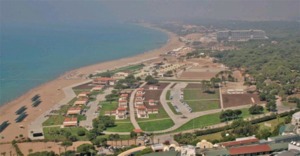
Belek Beach Park
dopo 0 km
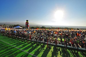
Transition 1 at Belek Beach Park

dopo 2,3 km
After the open water swim and transition in Belek Beach Park the first 10k of the bike course lead you along the golf courses of the world famouse destination Belek to enter a very flat and straight area towards to the town of Serik.

dopo 12,3 km
In Serik the course turns on to the main highway for appoximately 4k before turning off towards the historical places around Aspendos.

dopo 19,3 km
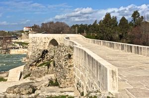
After 18k the course crosses Aspendos bridge, a historical site normally closed for traffic but opened for the bike course of Gloria Ironman 70.3 Turkey.
dopo 19,4 km
The crossing of the bridge will for sure be one of the most scenic and photogenic parts of the bike course.

dopo 27,9 km
From Tasagil, the course starts getting into the backcountry, slowly approaching the hilly terrain of the Köprülü Kanyon National Park and passing authentic backcountry towns.

dopo 28,2 km
AID STATION 1

dopo 29,4 km
Passing authentic back country towns

dopo 32,5 km
From km 30 on, the road leads into a more remote area, becoming more winding and offering spectacular views. This area is already frequently used by bikers, possibly training to become one of the first finishers of Gloria Ironman 70.3 Turkey.

dopo 39,4 km
Until km 40 the valley is mostly flat and wide open.

dopo 44,1 km
The climb starts to reach its top at approximately 220m above sea level, offering spectacular views of the surrounding mountain ranges before descending again into the beautiful and quiet area of Köprülü Kanyon, passing by rushing waterfalls, crystal clear streams and old pine forests.

dopo 44,9 km
AID STATION 2

dopo 44,9 km
Top of the climb.

dopo 46,7 km
Köprülü Canyon

dopo 48,5 km
Turning Point

dopo 49,1 km
After nearly 50k, the course approaches the turning point in a last uphill section.

dopo 51 km
Köprülü Canyon

dopo 52 km
WATERSTATION

dopo 64,3 km
After the turn around point, the course leads back the same way for approximately 17k before entering a less remote but not less beautiful area of Orange orchards and wide river beds.

dopo 65,2 km
After the turn around point, the course leads back the same way for approximately 17k before entering a less remote but not less beautiful area of Orange orchards and wide river beds.

dopo 66,7 km
At km 70, a dam leads across the river.

dopo 67 km
AIDSTATION 3

dopo 68,1 km
Moving forward on the other side of the river, the views of ancient remains such as aqueducts make it clear that the track is approaching the Aspendos area again.

dopo 69,5 km
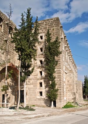
Only some kilometres later, the most historical sight of this area itself comes into view. The Aspendos amphitheatre has seen a lot in the last 2000 years since it was built under the roman Marc Aurel, but it has certainly never seen an Ironman 70.3 race passing just in front of it´s walls.
dopo 69,6 km
Only some kilometres later, the most historical sight of this area itself comes into view. The Aspendos amphitheatre has seen a lot in the last 2000 years since it was built under the roman Marc Aurel, but it has certainly never seen an Ironman 70.3 race passing just in front of it´s walls.

dopo 88,7 km
Gloria Sports Arena
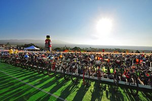
dopo 88,8 km
Transition 2 at Gloria Sports Arena
Continua con Bikemap
Vuoi percorrere Ironman 70.3 Antalya Bike Course o personalizzarlo per il tuo viaggio? Ecco cosa puoi fare con questo percorso su Bikemap:
Prova gratuita di 3 giorni o pagamento una tantum. Scopri di più su Bikemap Premium.
Scopri altre funzionalità Premium.
Ottieni Bikemap PremiumDalla nostra community


Aprila nell’app