Ferreira do Alentejo na rowerze
Odkrywaj mapę z 29 trasami rowerowymi i szlakami w pobliżu Ferreira do Alentejo, stworzonymi przez naszą społeczność.
Portret regionu
Poznaj Ferreira do Alentejo
Znajdź odpowiednią trasę rowerową dla siebie w Ferreira do Alentejo – mamy tam 29 tras do odkrycia.
1941 km
Zarejestrowany dystans
29
Trasy rowerowe
4689
Populacja
Starannie wybrane trasy
Odkryj Ferreira do Alentejo dzięki tym kolekcjom
Wycieczka
Od naszej społeczności
Najlepsze trasy rowerowe w Ferreira do Alentejo i okolicach
Ferreira - Barragem Pisão - Ferreira
Trasa rowerowa w Ferreira do Alentejo, Beja, Portugalia
- 33,1 km
- Dystans
- 226 m
- Przewyższenia
- 230 m
- Spadek
Safari fotográfico 2014
Trasa rowerowa w Ferreira do Alentejo, Beja, Portugalia
- 10,7 km
- Dystans
- 126 m
- Przewyższenia
- 126 m
- Spadek
Safari Fotográfico Serra do Paço
Trasa rowerowa w Ferreira do Alentejo, Beja, Portugalia
- 34,6 km
- Dystans
- 383 m
- Przewyższenia
- 345 m
- Spadek
Ferreira do Alentejo Cycling
Trasa rowerowa w Ferreira do Alentejo, Beja, Portugalia
- 44,5 km
- Dystans
- 511 m
- Przewyższenia
- 511 m
- Spadek
Odkryj więcej tras
 Ferreira do Alentejo - Setubal
- Dystans
- 92 km
- Przewyższenia
- 220 m
- Spadek
- 348 m
- Lokalizacja
- Ferreira do Alentejo, Beja, Portugalia
 Alfundão-Grândola-Santiago do Cacém-Sonega-Sines
- Dystans
- 117,7 km
- Przewyższenia
- 450 m
- Spadek
- 534 m
- Lokalizacja
- Ferreira do Alentejo, Beja, Portugalia
 De Rua de Nossa Senhora 25, Beja a Rua de Nossa Senhora 33, Beja
- Dystans
- 9,7 km
- Przewyższenia
- 51 m
- Spadek
- 44 m
- Lokalizacja
- Ferreira do Alentejo, Beja, Portugalia
 borabora
- Dystans
- 22,9 km
- Przewyższenia
- 227 m
- Spadek
- 55 m
- Lokalizacja
- Ferreira do Alentejo, Beja, Portugalia
 Etapa 3 Tour Genesse 2013
- Dystans
- 195,4 km
- Przewyższenia
- 846 m
- Spadek
- 960 m
- Lokalizacja
- Ferreira do Alentejo, Beja, Portugalia
 Rua 1º de Maio 25, Ferreira do Alentejo to Avenida Gago Coutinho 6, Ferreira do Alentejo
- Dystans
- 23,9 km
- Przewyższenia
- 266 m
- Spadek
- 270 m
- Lokalizacja
- Ferreira do Alentejo, Beja, Portugalia
 Bln - P 41
- Dystans
- 86,2 km
- Przewyższenia
- 398 m
- Spadek
- 518 m
- Lokalizacja
- Ferreira do Alentejo, Beja, Portugalia
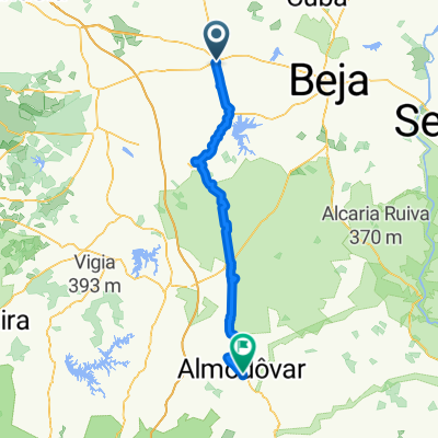
 Ferreira do Alentejo - Almodôvar
- Dystans
- 76,8 km
- Przewyższenia
- 688 m
- Spadek
- 551 m
- Lokalizacja
- Ferreira do Alentejo, Beja, Portugalia


