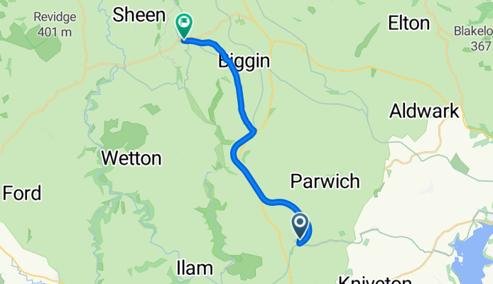
Ashbourne na rowerze
Odkrywaj mapę z 141 trasami rowerowymi i szlakami w pobliżu Ashbourne, stworzonymi przez naszą społeczność.
Portret regionu
Poznaj Ashbourne
Znajdź odpowiednią trasę rowerową dla siebie w Ashbourne – mamy tam 141 tras do odkrycia. Większość osób wybiera się tutaj na rower w miesiącach Lipiec i Październik.
11 046 km
Zarejestrowany dystans
141
Trasy rowerowe
5132
Populacja
Wspólnota
Najaktywniejsi użytkownicy w Ashbourne
Starannie wybrane trasy
Odkryj Ashbourne dzięki tym kolekcjom
- Wycieczka
Od naszej społeczności
Najlepsze trasy rowerowe w Ashbourne i okolicach
The Green to Church Street
Trasa rowerowa w Ashbourne, Anglia, Zjednoczone Królestwo Wielkiej Brytanii
- 12,5 km
- Dystans
- 182 m
- Przewyższenia
- 172 m
- Spadek
Trissington circle
Trasa rowerowa w Ashbourne, Anglia, Zjednoczone Królestwo Wielkiej Brytanii
- 28 km
- Dystans
- 311 m
- Przewyższenia
- 305 m
- Spadek
Route 10 Carsington Water circular
Trasa rowerowa w Ashbourne, Anglia, Zjednoczone Królestwo Wielkiej Brytanii
- 43,6 km
- Dystans
- 513 m
- Przewyższenia
- 514 m
- Spadek
C38.5 WPC
Trasa rowerowa w Ashbourne, Anglia, Zjednoczone Królestwo Wielkiej Brytanii
- 62,3 km
- Dystans
- 355 m
- Przewyższenia
- 357 m
- Spadek
Odkryj więcej tras
 Tissington Trail
- Dystans
- 39,8 km
- Przewyższenia
- 518 m
- Spadek
- 486 m
- Lokalizacja
- Ashbourne, Anglia, Zjednoczone Królestwo Wielkiej Brytanii
 tissington trail to high peak trail
- Dystans
- 12,9 km
- Przewyższenia
- 219 m
- Spadek
- 159 m
- Lokalizacja
- Ashbourne, Anglia, Zjednoczone Królestwo Wielkiej Brytanii
 Ashbourne - Alstonefield loop
- Dystans
- 26,1 km
- Przewyższenia
- 486 m
- Spadek
- 485 m
- Lokalizacja
- Ashbourne, Anglia, Zjednoczone Królestwo Wielkiej Brytanii
 ride in the peak district
- Dystans
- 50,1 km
- Przewyższenia
- 723 m
- Spadek
- 723 m
- Lokalizacja
- Ashbourne, Anglia, Zjednoczone Królestwo Wielkiej Brytanii
 Flashy Manifold Trail
- Dystans
- 77,5 km
- Przewyższenia
- 1186 m
- Spadek
- 1187 m
- Lokalizacja
- Ashbourne, Anglia, Zjednoczone Królestwo Wielkiej Brytanii
 The Lanes 10-04-20
- Dystans
- 32,5 km
- Przewyższenia
- 284 m
- Spadek
- 287 m
- Lokalizacja
- Ashbourne, Anglia, Zjednoczone Królestwo Wielkiej Brytanii
 Tissington Trail (one way)
- Dystans
- 27,2 km
- Przewyższenia
- 347 m
- Spadek
- 90 m
- Lokalizacja
- Ashbourne, Anglia, Zjednoczone Królestwo Wielkiej Brytanii
 ashbourne loop
- Dystans
- 106,5 km
- Przewyższenia
- 1028 m
- Spadek
- 1029 m
- Lokalizacja
- Ashbourne, Anglia, Zjednoczone Królestwo Wielkiej Brytanii


