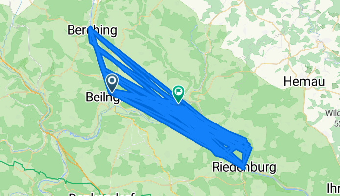
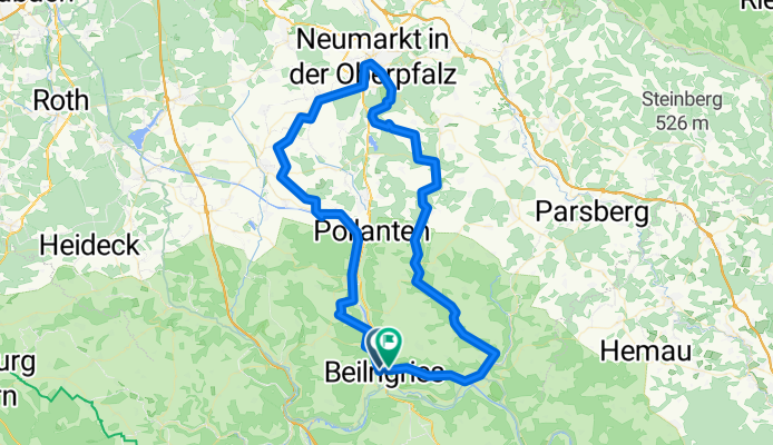
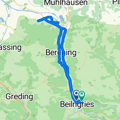
Jak może wyglądać jazda na rowerze w Berching.
Jak może wyglądać jazda na rowerze w Dietfurt.

Jednodniowa wycieczka rowerowa z Berching do Dietfurt

Dostosuj własną trasę na podstawie naszego szablonu lub zobacz, jak nasza społeczność najchętniej jeździ z Berching do Dietfurt.

Szablon trasy

Z Berching do Dietfurt

1:30 h
Czas
22,6 km
Dystans
107 m
Przewyższenia
130 m
Spadek
15,1 km/h
Śr. Prędkość
422 m
Maks. wysokość

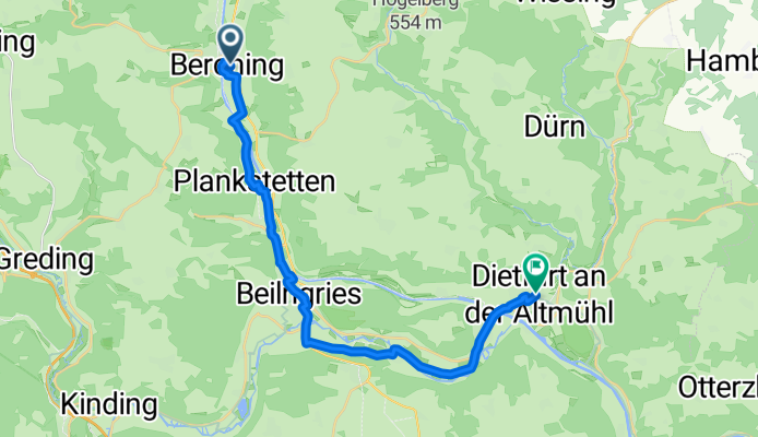
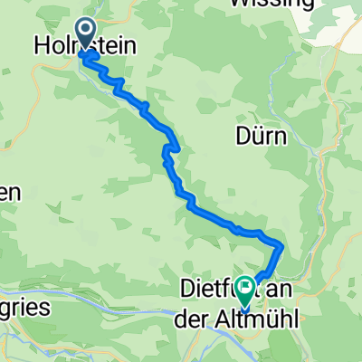
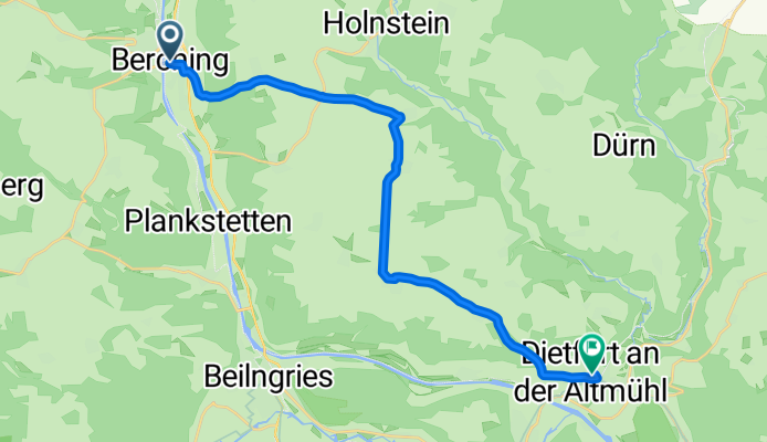
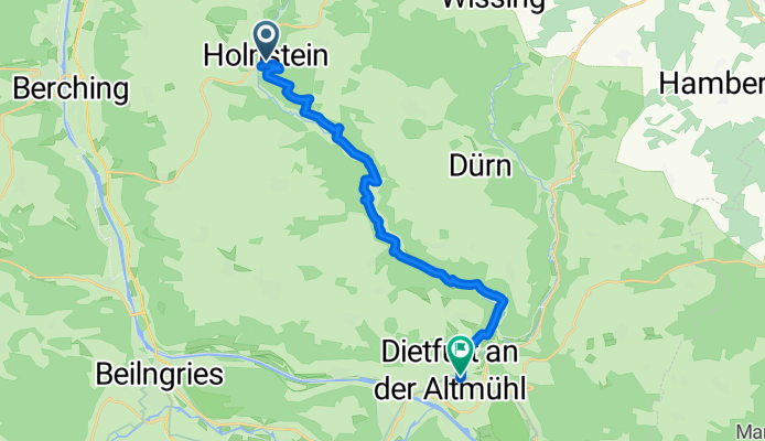
Roll out from Berching’s postcard-pretty old town, still wrapped in its medieval wall and towers, and head southeast through the Altmühl/Canal valley. It’s about 23 km with gentle ups and downs (around 100 m of climbing) and a slight net drop into Dietfurt, so it feels easygoing.

The ride mixes plenty of farm tracks and towpath-style gravel with quiet country roads. Roughly three quarters is paved, but expect long, smooth gravel stretches—wider tires are a plus. You’ll pass meadows, locks on the Main–Danube Canal, and sleepy villages where a beer garden stop is hard to resist.

Roll into Dietfurt, the “Stadt der sieben Täler” (City of Seven Valleys), also famous for its quirky “Bavarian China” carnival. Both towns sit on classic cycling territory, so signage is usually friendly and navigation straightforward, even without dedicated cycleways.

Tip: there’s little shade in parts along the water—sunblock and a spare bottle help on warm days.

Wspólnota

Najlepsi użytkownicy w tym regionie

Od naszej społeczności

Najlepsze trasy rowerowe z Berching do Dietfurt

0

04.10.2011 - Radtour - Beilngries-Berching-Dietfurt--Riedenburg-Dietfurt-Beilngries

Trasa rowerowa w Berching, Bawaria, Niemcy

855,6 km
Dystans
1511 m
Przewyższenia
1522 m
Spadek
0

dba2009 Tag3 Beilngries-Neumarkt-Beilngries

Trasa rowerowa w Berching, Bawaria, Niemcy

dba Radtour 2009 Tag3 Altmühl
91,3 km
Dystans
531 m
Przewyższenia
528 m
Spadek
0

kanal

Trasa rowerowa w Berching, Bawaria, Niemcy

17,4 km
Dystans
199 m
Przewyższenia
217 m
Spadek
0

dba2009 Tag2 Beingries-Eichstätt-Beilngries

Trasa rowerowa w Berching, Bawaria, Niemcy

dba Radtour 2009 Tag2 Altmühl
110,5 km
Dystans
441 m
Przewyższenia
443 m
Spadek
1

Beilngries/GluckWw

Trasa rowerowa w Berching, Bawaria, Niemcy

Rundkurs Main-Donau-Kanal
39,3 km
Dystans
865 m
Przewyższenia
916 m
Spadek
0

Beilngries-Dietfurt

Trasa rowerowa w Berching, Bawaria, Niemcy

14,7 km
Dystans
58 m
Przewyższenia
67 m
Spadek
0

Holnstein-Dietfurt

Trasa rowerowa w Berching, Bawaria, Niemcy

15,8 km
Dystans
384 m
Przewyższenia
447 m
Spadek
0

Uferpromenade 1, Berching nach Hauptstraße 9, Beilngries

Trasa rowerowa w Berching, Bawaria, Niemcy

10,2 km
Dystans
50 m
Przewyższenia
62 m
Spadek
0

Mühlbach an der Altmühl nach Kelheim Tag 5

Trasa rowerowa w Riedenburg, Bawaria, Niemcy

58,7 km
Dystans
257 m
Przewyższenia
242 m
Spadek
Beilngries - Weltenburg - Neustadt a.d.Donau  - zurück
Rower szosowy
0

Beilngries - Weltenburg - Neustadt a.d.Donau - zurück

Trasa rowerowa w Berching, Bawaria, Niemcy

92,8 km
Dystans
530 m
Przewyższenia
531 m
Spadek
0

Pettenkoferplatz 1, Berching nach Poststraße 2, Beilngries

Trasa rowerowa w Berching, Bawaria, Niemcy

12,4 km
Dystans
440 m
Przewyższenia
452 m
Spadek
0

Am Stillbach 6, Berching nach Marktplatz 7, Breitenbrunn

Trasa rowerowa w Berching, Bawaria, Niemcy

16,6 km
Dystans
242 m
Przewyższenia
245 m
Spadek

Odkryj więcej tras