
Jednodniowa wycieczka rowerowa z Saint-Jean-Pied-de-Port do Pampeluna
Dostosuj własną trasę na podstawie naszego szablonu lub zobacz, jak nasza społeczność najchętniej jeździ z Saint-Jean-Pied-de-Port do Pampeluna.
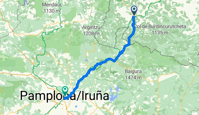
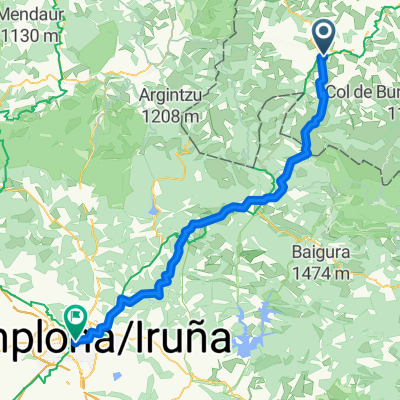
Szablon trasy
Z Saint-Jean-Pied-de-Port do Pampeluna

- 8 h 24 min
- Czas
- 92,5 km
- Dystans
- 4453 m
- Przewyższenia
- 4164 m
- Spadek
- 11 km/h
- Śr. Prędkość
- 1053 m
- Maks. wysokość
This ride takes you from the historic gateway of the Camino de Santiago, Saint-Jean-Pied-de-Port in France, deep into the heart of Spain at Pamplona. Get ready for a real adventure: it’s nearly 92 km of rolling countryside, with a whopping 4,450 m of climbing, so your legs (and brakes!) will be busy. You’ll be riding mostly on quiet country roads and tracks, surrounded by the lush hills of the Pyrenees.
Saint-Jean-Pied-de-Port is known for its medieval charm and as a rite-of-passage starting point for pilgrims, while Pamplona is famous for its vibrant Old Town and, of course, the running of the bulls. Along the way, expect some remote stretches—perfect for soaking up mountain views and spotting the odd flock of sheep or wild ponies. Surfaces can vary and there’s a lot of missing data, so a gravel or adventure bike is your friend. Bring snacks, layers, and your sense of adventure—this cross-border journey will leave you with some epic memories!
Wspólnota
Najlepsi użytkownicy w tym regionie


Od naszej społeczności
Najlepsze trasy rowerowe z Saint-Jean-Pied-de-Port do Pampeluna

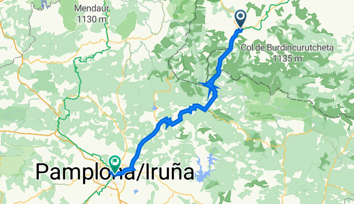
18 Tag Saint-jean-Pied-de-Port -Pamplona
Trasa rowerowa w Saint-Jean-Pied-de-Port, Nouvelle-Aquitaine, Francja
- 80,8 km
- Dystans
- 1174 m
- Przewyższenia
- 882 m
- Spadek

Camino 1 zi
Trasa rowerowa w Saint-Jean-Pied-de-Port, Nouvelle-Aquitaine, Francja
- 73,7 km
- Dystans
- 1230 m
- Przewyższenia
- 950 m
- Spadek

19 Pyrineen
Trasa rowerowa w Saint-Jean-Pied-de-Port, Nouvelle-Aquitaine, Francja
- 72,7 km
- Dystans
- 1079 m
- Przewyższenia
- 840 m
- Spadek

7º Etapa 2017 Saint jean Pied de Port - Panplona
Trasa rowerowa w Saint-Jean-Pied-de-Port, Nouvelle-Aquitaine, Francja
- 75,3 km
- Dystans
- 1151 m
- Przewyższenia
- 857 m
- Spadek
SAINT JEAN - PAMPLONA . 1° tappa camino
Trasa rowerowa w Saint-Jean-Pied-de-Port, Nouvelle-Aquitaine, Francja
- 70,9 km
- Dystans
- 1536 m
- Przewyższenia
- 1246 m
- Spadek

Jak40
Trasa rowerowa w Saint-Jean-Pied-de-Port, Nouvelle-Aquitaine, Francja
- 72 km
- Dystans
- 1166 m
- Przewyższenia
- 904 m
- Spadek

Saint Jean Pied de Port-Pamplona
Trasa rowerowa w Saint-Jean-Pied-de-Port, Nouvelle-Aquitaine, Francja
- 74,6 km
- Dystans
- 1682 m
- Przewyższenia
- 1393 m
- Spadek
St Jean - Pamplona
Trasa rowerowa w Saint-Jean-Pied-de-Port, Nouvelle-Aquitaine, Francja
- 74,6 km
- Dystans
- 1675 m
- Przewyższenia
- 1385 m
- Spadek
Tag 7
Trasa rowerowa w Saint-Jean-Pied-de-Port, Nouvelle-Aquitaine, Francja
- 94 km
- Dystans
- 1384 m
- Przewyższenia
- 1092 m
- Spadek

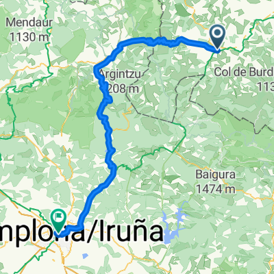
Arneguy - Pampelune
Trasa rowerowa w Saint-Jean-Pied-de-Port, Nouvelle-Aquitaine, Francja
- 66,5 km
- Dystans
- 1039 m
- Przewyższenia
- 827 m
- Spadek

jakob_1
Trasa rowerowa w Saint-Jean-Pied-de-Port, Nouvelle-Aquitaine, Francja
- 76,3 km
- Dystans
- 3192 m
- Przewyższenia
- 2908 m
- Spadek

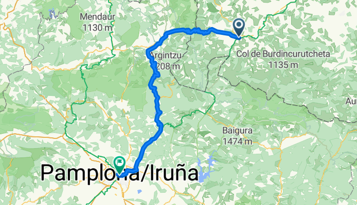
St JPP Pamplona
Trasa rowerowa w Saint-Jean-Pied-de-Port, Nouvelle-Aquitaine, Francja
- 71,8 km
- Dystans
- 1689 m
- Przewyższenia
- 1416 m
- Spadek
Odkryj więcej tras
 SAINT JEAN - PAMPLONA . 1° tappa camino
- Dystans
- 70,9 km
- Przewyższenia
- 1536 m
- Spadek
- 1246 m
- Lokalizacja
- Saint-Jean-Pied-de-Port, Nouvelle-Aquitaine, Francja
 Jak40
Jak40- Dystans
- 72 km
- Przewyższenia
- 1166 m
- Spadek
- 904 m
- Lokalizacja
- Saint-Jean-Pied-de-Port, Nouvelle-Aquitaine, Francja
 Saint Jean Pied de Port-Pamplona
- Dystans
- 74,6 km
- Przewyższenia
- 1682 m
- Spadek
- 1393 m
- Lokalizacja
- Saint-Jean-Pied-de-Port, Nouvelle-Aquitaine, Francja
 St Jean - Pamplona
- Dystans
- 74,6 km
- Przewyższenia
- 1675 m
- Spadek
- 1385 m
- Lokalizacja
- Saint-Jean-Pied-de-Port, Nouvelle-Aquitaine, Francja
 Tag 7
Tag 7- Dystans
- 94 km
- Przewyższenia
- 1384 m
- Spadek
- 1092 m
- Lokalizacja
- Saint-Jean-Pied-de-Port, Nouvelle-Aquitaine, Francja
 Arneguy - Pampelune
- Dystans
- 66,5 km
- Przewyższenia
- 1039 m
- Spadek
- 827 m
- Lokalizacja
- Saint-Jean-Pied-de-Port, Nouvelle-Aquitaine, Francja
 jakob_1
- Dystans
- 76,3 km
- Przewyższenia
- 3192 m
- Spadek
- 2908 m
- Lokalizacja
- Saint-Jean-Pied-de-Port, Nouvelle-Aquitaine, Francja
 St JPP Pamplona
- Dystans
- 71,8 km
- Przewyższenia
- 1689 m
- Spadek
- 1416 m
- Lokalizacja
- Saint-Jean-Pied-de-Port, Nouvelle-Aquitaine, Francja
Trasy z Saint-Jean-Pied-de-Port
Jednodniowa wycieczka rowerowa od
Z Saint-Jean-Pied-de-Port do Laruns
Jednodniowa wycieczka rowerowa od
Z Saint-Jean-Pied-de-Port do Saint-Jean-de-Luz