
Jednodniowa wycieczka rowerowa z Guillestre do Huez
Dostosuj własną trasę na podstawie naszego szablonu lub zobacz, jak nasza społeczność najchętniej jeździ z Guillestre do Huez.
Szablon trasy
Z Guillestre do Huez
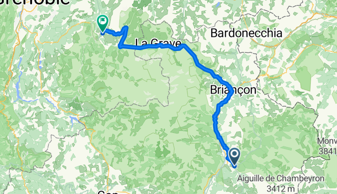
- 11 h 30 min
- Czas
- 126,9 km
- Dystans
- 5051 m
- Przewyższenia
- 4554 m
- Spadek
- 11 km/h
- Śr. Prędkość
- 2061 m
- Maks. wysokość
Get ready for an epic cycling adventure through the heart of the French Alps! This route kicks off in Guillestre, a charming town nestled at the confluence of the Guil and Durance rivers, and famous as a gateway to the legendary mountain passes of the Alps. The first part of your ride will feature stunning alpine views and serene roads as you climb deep into the mountains on a mix of asphalt and gravel.
This is no easy spin—the journey to Huez covers about 127 km and packs in over 5000 meters of climbing! Expect to ride mostly on quiet roads and the occasional track or path, winding your way through dramatic scenery and tiny mountain villages. Some sections are unpaved, so a gravel or robust road bike is recommended.
Your ride finishes in Huez, home to the legendary Alpe d’Huez climb—iconic in Tour de France history for its 21 hairpin bends and breathtaking finish. This route truly offers a taste of classic alpine riding, epic ascents, and incredible views. Be sure to fuel up and take plenty of photos along the way!
Wspólnota
Najlepsi użytkownicy w tym regionie


Od naszej społeczności
Najlepsze trasy rowerowe z Guillestre do Huez

Guillestre - L'Alpe d'Huez
Trasa rowerowa w Guillestre, Prowansja-Alpy-Lazurowe Wybrzeże, Francja
- 244,2 km
- Dystans
- 6120 m
- Przewyższenia
- 5350 m
- Spadek

Dia 3: Guillestre - Le Bourg d'Oisans
Trasa rowerowa w Guillestre, Prowansja-Alpy-Lazurowe Wybrzeże, Francja
- 111,2 km
- Dystans
- 1581 m
- Przewyższenia
- 1859 m
- Spadek

LD-É6
Trasa rowerowa w Guillestre, Prowansja-Alpy-Lazurowe Wybrzeże, Francja
- 102,7 km
- Dystans
- 1341 m
- Przewyższenia
- 1621 m
- Spadek

07-21 Guillestre - Le Bourg-d'Oisans
Trasa rowerowa w Guillestre, Prowansja-Alpy-Lazurowe Wybrzeże, Francja
- 120,3 km
- Dystans
- 1887 m
- Przewyższenia
- 2208 m
- Spadek

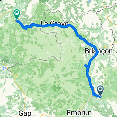
Ville-Vieille - Bourg d'Oisans
Trasa rowerowa w Guillestre, Prowansja-Alpy-Lazurowe Wybrzeże, Francja
- 107,4 km
- Dystans
- 1796 m
- Przewyższenia
- 2458 m
- Spadek

guillestre 3
Trasa rowerowa w Guillestre, Prowansja-Alpy-Lazurowe Wybrzeże, Francja
- 112,4 km
- Dystans
- 1665 m
- Przewyższenia
- 2003 m
- Spadek

fyuukg.ujg.k
Trasa rowerowa w Guillestre, Prowansja-Alpy-Lazurowe Wybrzeże, Francja
- 211,8 km
- Dystans
- 5445 m
- Przewyższenia
- 4617 m
- Spadek

Dia 3: Guillestre - Lautaret - Borg d'Osains
Trasa rowerowa w Guillestre, Prowansja-Alpy-Lazurowe Wybrzeże, Francja
- 101,2 km
- Dystans
- 1408 m
- Przewyższenia
- 1706 m
- Spadek

Europa Tour 2k13 14 Guillestre - Oz
Trasa rowerowa w Guillestre, Prowansja-Alpy-Lazurowe Wybrzeże, Francja
- 190,5 km
- Dystans
- 4134 m
- Przewyższenia
- 4285 m
- Spadek

Etapa 1 Alpes
Trasa rowerowa w Guillestre, Prowansja-Alpy-Lazurowe Wybrzeże, Francja
- 216,9 km
- Dystans
- 5058 m
- Przewyższenia
- 4292 m
- Spadek

Dia 3: Guillestre Galibier Borg d'Osains
Trasa rowerowa w Guillestre, Prowansja-Alpy-Lazurowe Wybrzeże, Francja
- 118,3 km
- Dystans
- 1889 m
- Przewyższenia
- 2190 m
- Spadek

tour of alps 3
Trasa rowerowa w Guillestre, Prowansja-Alpy-Lazurowe Wybrzeże, Francja
- 695,4 km
- Dystans
- 14 395 m
- Przewyższenia
- 13 355 m
- Spadek
Odkryj więcej tras
 Ville-Vieille - Bourg d'Oisans
- Dystans
- 107,4 km
- Przewyższenia
- 1796 m
- Spadek
- 2458 m
- Lokalizacja
- Guillestre, Prowansja-Alpy-Lazurowe Wybrzeże, Francja
 guillestre 3
- Dystans
- 112,4 km
- Przewyższenia
- 1665 m
- Spadek
- 2003 m
- Lokalizacja
- Guillestre, Prowansja-Alpy-Lazurowe Wybrzeże, Francja
 fyuukg.ujg.k
- Dystans
- 211,8 km
- Przewyższenia
- 5445 m
- Spadek
- 4617 m
- Lokalizacja
- Guillestre, Prowansja-Alpy-Lazurowe Wybrzeże, Francja
 Dia 3: Guillestre - Lautaret - Borg d'Osains
- Dystans
- 101,2 km
- Przewyższenia
- 1408 m
- Spadek
- 1706 m
- Lokalizacja
- Guillestre, Prowansja-Alpy-Lazurowe Wybrzeże, Francja
 Europa Tour 2k13 14 Guillestre - Oz
- Dystans
- 190,5 km
- Przewyższenia
- 4134 m
- Spadek
- 4285 m
- Lokalizacja
- Guillestre, Prowansja-Alpy-Lazurowe Wybrzeże, Francja
 Etapa 1 Alpes
- Dystans
- 216,9 km
- Przewyższenia
- 5058 m
- Spadek
- 4292 m
- Lokalizacja
- Guillestre, Prowansja-Alpy-Lazurowe Wybrzeże, Francja
 Dia 3: Guillestre Galibier Borg d'Osains
- Dystans
- 118,3 km
- Przewyższenia
- 1889 m
- Spadek
- 2190 m
- Lokalizacja
- Guillestre, Prowansja-Alpy-Lazurowe Wybrzeże, Francja
 tour of alps 3
- Dystans
- 695,4 km
- Przewyższenia
- 14 395 m
- Spadek
- 13 355 m
- Lokalizacja
- Guillestre, Prowansja-Alpy-Lazurowe Wybrzeże, Francja
Trasy z Guillestre
Jednodniowa wycieczka rowerowa od
Z Guillestre do Jausiers
Jednodniowa wycieczka rowerowa od
Z Guillestre do Barcelonnette
Trasy do Huez
Jednodniowa wycieczka rowerowa od
Z Les Deux Alpes do Huez
Jednodniowa wycieczka rowerowa od
Z Gap do Huez