


Route des Grandes Alpes 2010 - stage 7
- 86,4 km
- 1258 m
- 1900 m
- Barcelonnette, Prowansja-Alpy-Lazurowe Wybrzeże, Francja

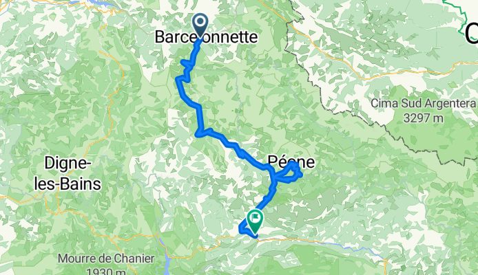
Dostosuj własną trasę na podstawie naszego szablonu lub zobacz, jak nasza społeczność najchętniej jeździ z Barcelonnette do Puget-Théniers.
Szablon trasy

Set off from the charming alpine town of Barcelonnette, nestled in the heart of the Ubaye Valley and famous for its colorful Mexican-inspired architecture. This route is a real adventure—just over 106 km of diverse riding that will take you deep into the southern Alps, all the way to Puget-Théniers, a lovely village gateway to the Var valley.
The route isn’t for the faint of heart, with some serious climbing (almost 5,900 meters of ascent!) and a max elevation reaching over 2,300 meters. Prepare for epic mountain views, crisp alpine air, and some thrilling descents (over 6,600 meters down!). You'll encounter a mix of paved and unpaved surfaces; most are smooth, but there are some gravelly stretches to keep things interesting, and you'll be hopping between quiet backroads, mountain tracks, and the occasional busy section.
Barcelonnette’s festive spirit will be a fond memory as you roll into picturesque Puget-Théniers, a classic Provence town with narrow streets and a relaxed vibe. Bring snacks, layers, and your sense of adventure—this ride is pure Alpes-de-Haute-Provence magic!
Wspólnota
Od naszej społeczności
Trasa rowerowa w Barcelonnette, Prowansja-Alpy-Lazurowe Wybrzeże, Francja
Trasa rowerowa w Barcelonnette, Prowansja-Alpy-Lazurowe Wybrzeże, Francja
Trasa rowerowa w Barcelonnette, Prowansja-Alpy-Lazurowe Wybrzeże, Francja
Trasa rowerowa w Barcelonnette, Prowansja-Alpy-Lazurowe Wybrzeże, Francja
Trasa rowerowa w Barcelonnette, Prowansja-Alpy-Lazurowe Wybrzeże, Francja
Trasa rowerowa w Barcelonnette, Prowansja-Alpy-Lazurowe Wybrzeże, Francja
Trasa rowerowa w Barcelonnette, Prowansja-Alpy-Lazurowe Wybrzeże, Francja
Trasa rowerowa w Barcelonnette, Prowansja-Alpy-Lazurowe Wybrzeże, Francja
Trasa rowerowa w Barcelonnette, Prowansja-Alpy-Lazurowe Wybrzeże, Francja
Trasa rowerowa w Barcelonnette, Prowansja-Alpy-Lazurowe Wybrzeże, Francja
Trasa rowerowa w Barcelonnette, Prowansja-Alpy-Lazurowe Wybrzeże, Francja
Trasa rowerowa w Barcelonnette, Prowansja-Alpy-Lazurowe Wybrzeże, Francja
Jednodniowa wycieczka rowerowa od
Jednodniowa wycieczka rowerowa od
Rowerowa od


