
Szybka przejażdżka rowerowa z San Francisco do Daly City
Dostosuj własną trasę na podstawie naszego szablonu lub zobacz, jak nasza społeczność najchętniej jeździ z San Francisco do Daly City.
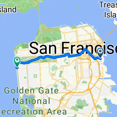
Szablon trasy
Z San Francisco do Daly City
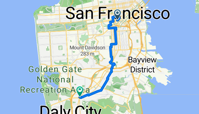
- 48 min
- Czas
- 13,8 km
- Dystans
- 240 m
- Przewyższenia
- 139 m
- Spadek
- 17,2 km/h
- Śr. Prędkość
- 127 m
- Maks. wysokość
This ride takes you from the vibrant streets of San Francisco down to Daly City, cruising just under 14 km—with a good bit of climbing along the way! You'll start amidst San Francisco’s iconic hills and unique neighborhoods (maybe grab a coffee to fuel up). The route is mostly on quiet roads and has a decent chunk of dedicated cycleway, so you can ride without too much traffic stress. Expect a smooth roll on asphalt almost the whole way, though about half the surfaces aren’t specified—so be ready for a little variety.
As you head south, you’ll catch great glimpses of the city skyline and, on a clear day, maybe even the Pacific. Daly City is often called the “Gateway to the Peninsula,” marking your transition into a more suburban vibe. If you like a mix of urban energy and chill roads, this route is a solid pick!
Wspólnota
Najlepsi użytkownicy w tym regionie


Od naszej społeczności
Najlepsze trasy rowerowe z San Francisco do Daly City


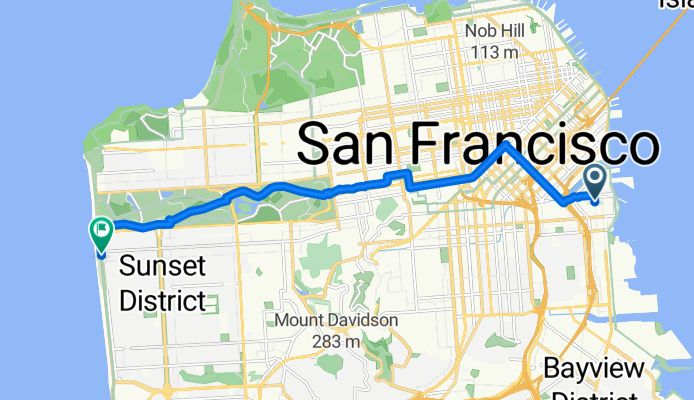
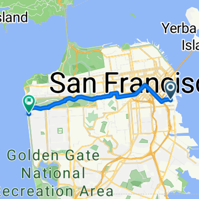
Market Street, San Francisco to 48th Avenue 2499, San Francisco
Trasa rowerowa w San Francisco, Kalifornia, USA
- 12,2 km
- Dystans
- 55 m
- Przewyższenia
- 80 m
- Spadek

754 Kirkham St, San Francisco to 731 Huron Ave, San Francisco
Trasa rowerowa w San Francisco, Kalifornia, USA
- 9,1 km
- Dystans
- 146 m
- Przewyższenia
- 152 m
- Spadek

1770 Post St, San Francisco to 214 Edinburgh St, San Francisco
Trasa rowerowa w San Francisco, Kalifornia, USA
- 9,2 km
- Dystans
- 128 m
- Przewyższenia
- 86 m
- Spadek

Mission to the Wiggle to Golden Gate Park to Ocean Beach
Trasa rowerowa w San Francisco, Kalifornia, USA
- 11,7 km
- Dystans
- 125 m
- Przewyższenia
- 118 m
- Spadek

Leisurely Ride From Panhandle To Sloat
Trasa rowerowa w San Francisco, Kalifornia, USA
- 10,2 km
- Dystans
- 37 m
- Przewyższenia
- 113 m
- Spadek

home the long way
Trasa rowerowa w San Francisco, Kalifornia, USA
- 19,2 km
- Dystans
- 237 m
- Przewyższenia
- 162 m
- Spadek

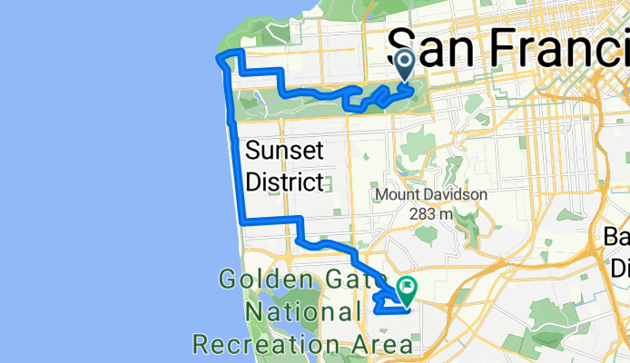
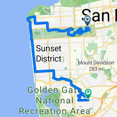
Mission to San Bruno Mountain
Trasa rowerowa w San Francisco, Kalifornia, USA
- 10,7 km
- Dystans
- 273 m
- Przewyższenia
- 76 m
- Spadek
Gene Friend Way to La Playa Street
Trasa rowerowa w San Francisco, Kalifornia, USA
- 14,1 km
- Dystans
- 146 m
- Przewyższenia
- 98 m
- Spadek

Embarcadero to Chestnut to SFSU to Daly City Bart
Trasa rowerowa w San Francisco, Kalifornia, USA
- 21,6 km
- Dystans
- 268 m
- Przewyższenia
- 220 m
- Spadek
home to Ocean beach
Trasa rowerowa w San Francisco, Kalifornia, USA
- 13,3 km
- Dystans
- 137 m
- Przewyższenia
- 129 m
- Spadek

NDeL: Lake Merced Run
Trasa rowerowa w San Francisco, Kalifornia, USA
- 7,8 km
- Dystans
- 62 m
- Przewyższenia
- 109 m
- Spadek
San Francisco - Daly City
Trasa rowerowa w San Francisco, Kalifornia, USA
- 20,1 km
- Dystans
- 129 m
- Przewyższenia
- 114 m
- Spadek
Odkryj więcej tras
 Leisurely Ride From Panhandle To Sloat
- Dystans
- 10,2 km
- Przewyższenia
- 37 m
- Spadek
- 113 m
- Lokalizacja
- San Francisco, Kalifornia, USA
 home the long way
- Dystans
- 19,2 km
- Przewyższenia
- 237 m
- Spadek
- 162 m
- Lokalizacja
- San Francisco, Kalifornia, USA
 Mission to San Bruno Mountain
- Dystans
- 10,7 km
- Przewyższenia
- 273 m
- Spadek
- 76 m
- Lokalizacja
- San Francisco, Kalifornia, USA
 Gene Friend Way to La Playa Street
- Dystans
- 14,1 km
- Przewyższenia
- 146 m
- Spadek
- 98 m
- Lokalizacja
- San Francisco, Kalifornia, USA
 Embarcadero to Chestnut to SFSU to Daly City Bart
- Dystans
- 21,6 km
- Przewyższenia
- 268 m
- Spadek
- 220 m
- Lokalizacja
- San Francisco, Kalifornia, USA
 home to Ocean beach
- Dystans
- 13,3 km
- Przewyższenia
- 137 m
- Spadek
- 129 m
- Lokalizacja
- San Francisco, Kalifornia, USA
 NDeL: Lake Merced Run
- Dystans
- 7,8 km
- Przewyższenia
- 62 m
- Spadek
- 109 m
- Lokalizacja
- San Francisco, Kalifornia, USA
 San Francisco - Daly City
- Dystans
- 20,1 km
- Przewyższenia
- 129 m
- Spadek
- 114 m
- Lokalizacja
- San Francisco, Kalifornia, USA
Trasy z San Francisco
Jednodniowa wycieczka rowerowa od
Z San Francisco do Tiburon
Szybka przejażdżka rowerowa od
Z San Francisco do Sausalito