
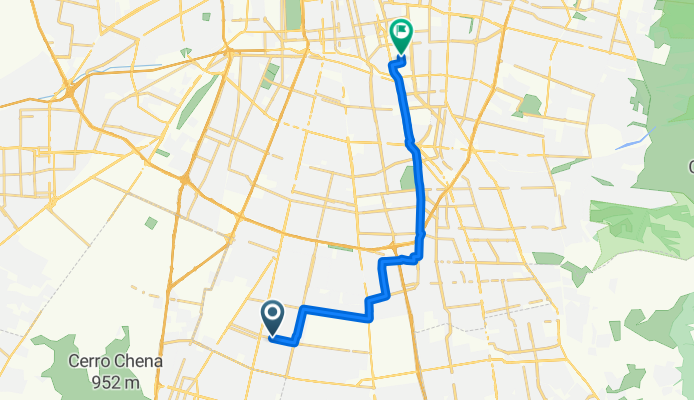
Jednodniowa wycieczka rowerowa z La Pintana do Santiago de Chile
Dostosuj własną trasę na podstawie naszego szablonu lub zobacz, jak nasza społeczność najchętniej jeździ z La Pintana do Santiago de Chile.
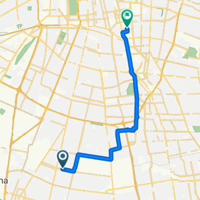
Szablon trasy
Z La Pintana do Santiago de Chile

- 1 h 11 min
- Czas
- 21,2 km
- Dystans
- 35 m
- Przewyższenia
- 110 m
- Spadek
- 17,9 km/h
- Śr. Prędkość
- 653 m
- Maks. wysokość
Hop on your bike and roll out from La Pintana, a bustling commune with strong local character in southern Santiago. The route takes you north into the heart of Santiago, covering just over 21 kilometers—perfect for a solid ride, but not too daunting. Most of your journey will be on paved paths and dedicated cycleways (over half the ride!), so you can expect a pretty smooth and safe experience.
The ride is mostly flat, with just a gentle climb here and there, followed by a relaxed descent as you near the city center. You’ll weave through quieter streets for much of the way, avoiding heavy traffic. As you arrive in Santiago, the country’s vibrant capital, you'll find yourself among a mix of historic architecture, bustling plazas, and plenty of spots to reward yourself with a coffee or snack.
This ride is ideal for those looking to move between neighborhoods, explore the urban landscape, or simply enjoy an accessible, city-spanning bike trip.
Wspólnota
Najlepsi użytkownicy w tym regionie


Od naszej społeczności
Najlepsze trasy rowerowe z La Pintana do Santiago de Chile

recorrido para la pega
Trasa rowerowa w La Pintana, Region Metropolitalny, Chile
- 15,1 km
- Dystans
- 52 m
- Przewyższenia
- 51 m
- Spadek

Ruta a Sendero Peatonal Atacameño, Recoleta
Trasa rowerowa w La Pintana, Region Metropolitalny, Chile
- 16,4 km
- Dystans
- 309 m
- Przewyższenia
- 100 m
- Spadek

De Poiguano 10925, La Pintana a PA150-Parada 4 / Hospital Sn. Borja Arriarán, Santiago
Trasa rowerowa w La Pintana, Region Metropolitalny, Chile
- 12,9 km
- Dystans
- 330 m
- Przewyższenia
- 408 m
- Spadek

Ruta a Til Til 2569, Macul
Trasa rowerowa w La Pintana, Region Metropolitalny, Chile
- 16,8 km
- Dystans
- 54 m
- Przewyższenia
- 106 m
- Spadek

De Las Pataguas 13189, La Pintana a José Ananías 383, Macul
Trasa rowerowa w La Pintana, Region Metropolitalny, Chile
- 16,8 km
- Dystans
- 101 m
- Przewyższenia
- 630 m
- Spadek

Ruta desde Las Pataguas 13189, La Pintana
Trasa rowerowa w La Pintana, Region Metropolitalny, Chile
- 15,6 km
- Dystans
- 48 m
- Przewyższenia
- 127 m
- Spadek

Ruta desde Las Pataguas 13189, La Pintana
Trasa rowerowa w La Pintana, Region Metropolitalny, Chile
- 15,6 km
- Dystans
- 57 m
- Przewyższenia
- 137 m
- Spadek
Paseo lento
Trasa rowerowa w La Pintana, Region Metropolitalny, Chile
- 16,8 km
- Dystans
- 80 m
- Przewyższenia
- 131 m
- Spadek

De Pasaje Pedro Lagos 9208, San Ramón a Fuenzalida Urrejola 1120, La Cisterna Región Metropolitana
Trasa rowerowa w La Pintana, Region Metropolitalny, Chile
- 4,5 km
- Dystans
- 34 m
- Przewyższenia
- 53 m
- Spadek

Ruta desde Las Pataguas 13189, La Pintana
Trasa rowerowa w La Pintana, Region Metropolitalny, Chile
- 15,6 km
- Dystans
- 29 m
- Przewyższenia
- 106 m
- Spadek

Ruta desde Gabriela Poniente 1113, La Pintana
Trasa rowerowa w La Pintana, Region Metropolitalny, Chile
- 15,6 km
- Dystans
- 63 m
- Przewyższenia
- 138 m
- Spadek

Ruta desde Las Pataguas 13189, La Pintana
Trasa rowerowa w La Pintana, Region Metropolitalny, Chile
- 15,7 km
- Dystans
- 68 m
- Przewyższenia
- 144 m
- Spadek
Odkryj więcej tras
 De Las Pataguas 13189, La Pintana a José Ananías 383, Macul
- Dystans
- 16,8 km
- Przewyższenia
- 101 m
- Spadek
- 630 m
- Lokalizacja
- La Pintana, Region Metropolitalny, Chile
 Ruta desde Las Pataguas 13189, La Pintana
- Dystans
- 15,6 km
- Przewyższenia
- 48 m
- Spadek
- 127 m
- Lokalizacja
- La Pintana, Region Metropolitalny, Chile
 Ruta desde Las Pataguas 13189, La Pintana
- Dystans
- 15,6 km
- Przewyższenia
- 57 m
- Spadek
- 137 m
- Lokalizacja
- La Pintana, Region Metropolitalny, Chile
 Paseo lento
- Dystans
- 16,8 km
- Przewyższenia
- 80 m
- Spadek
- 131 m
- Lokalizacja
- La Pintana, Region Metropolitalny, Chile
 De Pasaje Pedro Lagos 9208, San Ramón a Fuenzalida Urrejola 1120, La Cisterna Región Metropolitana
- Dystans
- 4,5 km
- Przewyższenia
- 34 m
- Spadek
- 53 m
- Lokalizacja
- La Pintana, Region Metropolitalny, Chile
 Ruta desde Las Pataguas 13189, La Pintana
- Dystans
- 15,6 km
- Przewyższenia
- 29 m
- Spadek
- 106 m
- Lokalizacja
- La Pintana, Region Metropolitalny, Chile
 Ruta desde Gabriela Poniente 1113, La Pintana
- Dystans
- 15,6 km
- Przewyższenia
- 63 m
- Spadek
- 138 m
- Lokalizacja
- La Pintana, Region Metropolitalny, Chile
 Ruta desde Las Pataguas 13189, La Pintana
- Dystans
- 15,7 km
- Przewyższenia
- 68 m
- Spadek
- 144 m
- Lokalizacja
- La Pintana, Region Metropolitalny, Chile
Trasy z La Pintana
Jednodniowa wycieczka rowerowa od
Z La Pintana do Lo Prado
Jednodniowa wycieczka rowerowa od
Z La Pintana do Villa Presidente Frei
Rowerowa od
Z La Pintana do Puente Alto
Rowerowa od
Z La Pintana do San Bernardo
Trasy do Santiago de Chile
Jednodniowa wycieczka rowerowa od
Z San Bernardo do Santiago de Chile
Jednodniowa wycieczka rowerowa od
Z Chicureo do Santiago de Chile
Rowerowa od
Z Lo Prado do Santiago de Chile
Rowerowa od
Z Villa Presidente Frei do Santiago de Chile