Home to SB Clinic at Eddy Street
- 9,4 km
- 44 m
- 86 m
- Gulivoire Park, Indiana, USA
Trasa rowerowa rozpoczynająca się w Gulivoire Park, Indiana, USA.
Przegląd
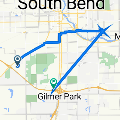
this was a very pleasant route from the intersection of Kern Road and Miami on the south side of South Bend all the way up to Roseland and Notre Dame, and then back. almost all of the ride was on paved multi-use trails, particularly the East Bank Trail along the St Joseph River. I haven't written around South Bend much in quite a long time and I was very impressed with the quality of the trail system! It was delightful. I recommend this route from Miami and Kern up to the river path via the Twickenham Road bridge. It is through residential neighborhoods, but on wide roads that are not heavily trafficked and are a lot of fun to bike on.
At the time of this writing, April 2026, York Road is under construction at an underpass just south of Sutherland Road. but it is often possible to bypass the construction area using the sidewalk. I suggest doing this rather than biking on Jackson Road, which is very narrow and is the designated detour route.
utworzono 1 miesiąc temu temu
Jakość trasy
Droga rowerowa
18,4 km
45 %
Droga
8,6 km
21 %
Utwardzona
16 km
(39 %)
Asfalt
8,6 km
21 %
Beton
4,5 km
11 %
Kontynuuj z Bikemap
Chcesz przejechać trasę Miami Circle to Roseland and Notre Dame lub dostosować ją do swojej wycieczki? Oto, co możesz zrobić z tą trasą na Bikemap:
3 dni bezpłatnej wersji próbnej lub jednorazowa opłata. Dowiedz się więcej o Bikemap Premium.
Odkryj więcej funkcji Premium.
Uzyskaj Bikemap PremiumOd naszej społeczności
Otwórz ją w aplikacji