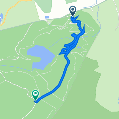
Bike Centre to Somewhere Else
Trasa rowerowa rozpoczynająca się w Llandegla, Walia, Zjednoczone Królestwo Wielkiej Brytanii.
Przegląd
O tej trasie
- -:--
- Czas
- 16,6 km
- Dystans
- 420 m
- Przewyższenia
- 499 m
- Spadek
- ---
- Śr. Prędkość
- ---
- Maks. wysokość
Jakość trasy
Typy dróg i nawierzchnie na trasie
Typy dróg
Ścieżka
5,2 km
(31 %)
Spokojna droga
4,6 km
(28 %)
Powierzchnie
Utwardzona
1,7 km
(10 %)
Nieutwardzona
0,5 km
(3 %)
Asfalt
1,7 km
(10 %)
Nieutwardzony (nieokreślony)
0,4 km
(2 %)
Najważniejsze punkty trasy
Punkty zainteresowania na trasie
Interesujące miejsce po 3,2 km
Waymarker should be for offas dyke. Should have an acorn on? Might not though ;-)
Interesujące miejsce po 5,2 km
Go through the garden, turn right onto road. Then after houses bear left into field and follow path
Interesujące miejsce po 6,1 km
Walk down grass verge, path crosses main road and goes up between houses.
Interesujące miejsce po 6,9 km
Jim & Claires old house - say hello.
Interesujące miejsce po 6,9 km
follow wall of churchyard, go down path in between church and old vicarage past water works. Don't keep on the tarmac road
Interesujące miejsce po 8,4 km
Cross tarmac road onto gravel drive
Interesujące miejsce po 9,4 km
Go over stile into field, just look for next sile. Goes up quite steep through fields
Interesujące miejsce po 10,8 km
Bear right of tarmac road, but go to the left of the trees over stile towards the big mast. Dont go to the right of the trees towards the fisheries.
Interesujące miejsce po 11,6 km
Steep Grass bank
Interesujące miejsce po 11,7 km
At top of grass bank, bear right and go over stile
Interesujące miejsce po 12,2 km
Tree & Steps
Interesujące miejsce po 12,4 km
The old piggeries
Interesujące miejsce po 15,1 km
The Raven
Interesujące miejsce po 15,6 km
The Chapel - Jim & Claires other old house.
Kontynuuj z Bikemap
Użyj, edytuj lub pobierz tę trasę rowerową
Chcesz przejechać trasę Bike Centre to Somewhere Else lub dostosować ją do swojej wycieczki? Oto, co możesz zrobić z tą trasą na Bikemap:
Darmowe funkcje
- Zapisz tę trasę jako ulubioną lub w kolekcji
- Skopiuj i zaplanuj swoją wersję tej trasy
- Synchronizuj swoją trasę z Garminem lub Wahoo
Funkcje Premium
3 dni bezpłatnej wersji próbnej lub jednorazowa opłata. Dowiedz się więcej o Bikemap Premium.
- Nawiguj po tej trasie na iOS i Androidzie
- Eksportuj plik GPX / KML tej trasy
- Stwórz swój własny wydruk (wypróbuj za darmo)
- Pobierz tę trasę do nawigacji offline
Odkryj więcej funkcji Premium.
Uzyskaj Bikemap PremiumOd naszej społeczności
Llandegla: Inne popularne trasy rozpoczynające się tutaj
- Coed LLandegla Black
- Dystans
- 19,8 km
- Przewyższenia
- 372 m
- Spadek
- 380 m
- Lokalizacja
- Llandegla, Walia, Zjednoczone Królestwo Wielkiej Brytanii
- UK - Llandegla forest (red route)
- Dystans
- 17,3 km
- Przewyższenia
- 310 m
- Spadek
- 302 m
- Lokalizacja
- Llandegla, Walia, Zjednoczone Królestwo Wielkiej Brytanii
- UK - COED LLANDEGLA FOREST (niebieska)
- Dystans
- 11,5 km
- Przewyższenia
- 196 m
- Spadek
- 187 m
- Lokalizacja
- Llandegla, Walia, Zjednoczone Królestwo Wielkiej Brytanii
- Bike Centre to Somewhere Else
- Dystans
- 16,6 km
- Przewyższenia
- 420 m
- Spadek
- 499 m
- Lokalizacja
- Llandegla, Walia, Zjednoczone Królestwo Wielkiej Brytanii
- Llandegla 3 Peaks
- Dystans
- 42,8 km
- Przewyższenia
- 895 m
- Spadek
- 897 m
- Lokalizacja
- Llandegla, Walia, Zjednoczone Królestwo Wielkiej Brytanii
- Llandegla Chester
- Dystans
- 30,6 km
- Przewyższenia
- 265 m
- Spadek
- 512 m
- Lokalizacja
- Llandegla, Walia, Zjednoczone Królestwo Wielkiej Brytanii
- Llandegla - Black Route
- Dystans
- 19,1 km
- Przewyższenia
- 363 m
- Spadek
- 363 m
- Lokalizacja
- Llandegla, Walia, Zjednoczone Królestwo Wielkiej Brytanii
- Mark Lloyd Mini Mega
- Dystans
- 131,1 km
- Przewyższenia
- 1301 m
- Spadek
- 1301 m
- Lokalizacja
- Llandegla, Walia, Zjednoczone Królestwo Wielkiej Brytanii
Otwórz ją w aplikacji