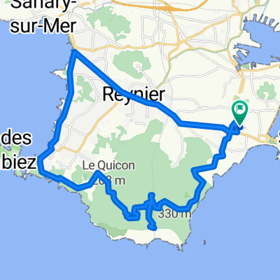
- 114,2 km
- 1294 m
- 1293 m
- La Seyne-sur-Mer, Prowansja-Alpy-Lazurowe Wybrzeże, Francja
Cogolin - Collobrières - CHCV La Valette et Cavalaire - 27 Janvier 19.
Trasa rowerowa rozpoczynająca się w La Seyne-sur-Mer, Prowansja-Alpy-Lazurowe Wybrzeże, Francja.
Przegląd
O tej trasie
La Seyne-Sablettes - Port - Pyro – Toulon – La Valette © ( CHCV ) - Hyères – Pont du Gapeau – Mauvanne – ścieżka – La Londe – La Verrerie – Le Lavandou - Aiguebelle – Cavalière – Pramousquier – Ch. du Plageron – ścieżka « Gravel » ( stary V.F. pociąg z pinii ) - Canadel - Le Rayol – tunel du Dattier – Cavalaire © ( CHCV ) – Pardigon – La Croix-Valmer – Domaine Tropez – La Mort du Luc – Cogolin – Pont de la Giscle – Col du Périer ( 350 m ) – Capelude – Col de Taillude ( 411 m ) - Col du Boulin – Collobrières – Pierrefeu - Cuers – Crémorin – Les Bancaous – Solliès-Pont ( cmentarz ) – la Farlède – La Valette-Nord – Bar des Chênes ( 210 m ) – Les Moulins – Le Jonquet - Lagoubran - Pyro – La Seyne-Port – Corniche de Tamaris – La Seyne / Sablettes.
- -:--
- Czas
- 170,4 km
- Dystans
- 865 m
- Przewyższenia
- 865 m
- Spadek
- ---
- Śr. Prędkość
- ---
- Maks. wysokość
utworzono 7 lat temu temu
Jakość trasy
Typy dróg i nawierzchnie na trasie
Typy dróg
Droga
46 km
27 %
Spokojna droga
27,3 km
16 %
Powierzchnie
Utwardzona
117,6 km
(69 %)
Nieutwardzona
1,7 km
(1 %)
Asfalt
115,9 km
68 %
Beton
1,7 km
1 %
Kontynuuj z Bikemap
Użyj, edytuj lub pobierz tę trasę rowerową
Chcesz przejechać trasę Cogolin - Collobrières - CHCV La Valette et Cavalaire - 27 Janvier 19. lub dostosować ją do swojej wycieczki? Oto, co możesz zrobić z tą trasą na Bikemap:
Darmowe funkcje
- Zapisz tę trasę jako ulubioną lub w kolekcji
- Skopiuj i zaplanuj swoją wersję tej trasy
- Podziel trasę na etapy, aby utworzyć kilkudniową wycieczkę
- Synchronizuj swoją trasę z Garminem lub Wahoo
Funkcje Premium
3 dni bezpłatnej wersji próbnej lub jednorazowa opłata. Dowiedz się więcej o Bikemap Premium.
- Nawiguj po tej trasie na iOS i Androidzie
- Eksportuj plik GPX / KML tej trasy
- Stwórz swój własny wydruk (wypróbuj za darmo)
- Pobierz tę trasę do nawigacji offline
Odkryj więcej funkcji Premium.
Uzyskaj Bikemap PremiumOd naszej społeczności
La Seyne-sur-Mer: Inne popularne trasy rozpoczynające się tutaj
- Crêtes de Cassis - N.D. du Mai - 6 Mai 18
- Espigoulier - Marseille - Gineste - 30 Novembre 21.
- 192,7 km
- 2561 m
- 2561 m
- La Seyne-sur-Mer, Prowansja-Alpy-Lazurowe Wybrzeże, Francja
- Hyères - La Navarre - Pierrefeu - CHCV La Moutonne - 13 Déc. 15
- 96,4 km
- 406 m
- 406 m
- La Seyne-sur-Mer, Prowansja-Alpy-Lazurowe Wybrzeże, Francja
- Cogolin - Collobrières - CHCV La Valette et Cavalaire - 27 Janvier 19.
- 170,4 km
- 865 m
- 865 m
- La Seyne-sur-Mer, Prowansja-Alpy-Lazurowe Wybrzeże, Francja
- Crêtes de Cassis - Roquefort - Le Camp - 27 Janvier 22.
- 114,6 km
- 1499 m
- 1541 m
- La Seyne-sur-Mer, Prowansja-Alpy-Lazurowe Wybrzeże, Francja
- N.D. du Mai - Le Brusc - 10 Avril 17
- 27,1 km
- 435 m
- 433 m
- La Seyne-sur-Mer, Prowansja-Alpy-Lazurowe Wybrzeże, Francja
- La Ciotat - Bois-Soleil - 19 Mai 20_Y.P.
- 89,2 km
- 743 m
- 743 m
- La Seyne-sur-Mer, Prowansja-Alpy-Lazurowe Wybrzeże, Francja
- Tour de Six Fours
- 38,1 km
- 323 m
- 323 m
- La Seyne-sur-Mer, Prowansja-Alpy-Lazurowe Wybrzeże, Francja
Otwórz ją w aplikacji