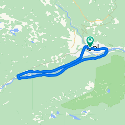
Einarsetrunden 14km
- 13,8 km
- 256 m
- 261 m
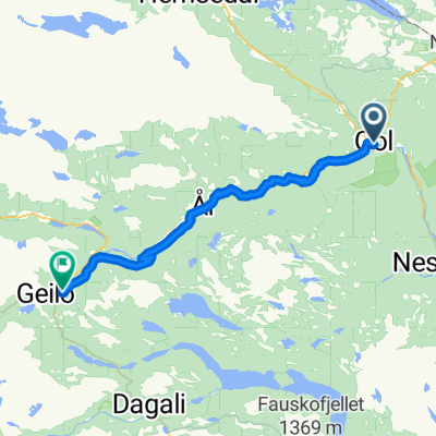
- Gol, Buskerud fylke, Norwegia
Trasa rowerowa rozpoczynająca się w Gol, Buskerud fylke, Norwegia.
Przegląd
Ta wycieczka prowadzi przez różne rodzinne atrakcje na Golsfjellet.
Opis zaczyna się od Oset Høyfjellshotell, ale ponieważ jest to trasa okrężna, możesz rozpocząć gdziekolwiek na trasie.
Podążaj drogą z Oset mijając Ørterstølen aż do Bjørnelia. Kontynuuj pod górę i na południe w kierunku Kamben. Skręć w prawo i jedź Kambegutu mijając chatek Czerwonego Krzyża, a następnie ścieżką/drogą szutrową do Storefjell.
W Storefjell są możliwości jazdy konnej i kąpieli. Jeśli jesteś głodny, możesz zjeść tam obiad.
Zjedź drogą ze Storefjell i na drugim skrzyżowaniu skręć w lewo. Ta droga prowadzi z powrotem do Kamben. Stamtąd zjedź dalej aż do Fjellheimveien (głównej drogi na Golsfjellet). Skręć w lewo i wróć do Oset.
Po dotarciu do Oset możesz odwiedzić Farmę Dziecięcą, skorzystać z placów zabaw lub popływać w basenie.
Oset jest również niedaleko jeziora Tisleifjorden, gdzie znajdziesz dobre miejsca do pływania oraz wypożyczalnię łodzi wiosłowych i kajaków.
utworzono 15 lat temu temu
Jakość trasy
Spokojna droga
11 km
(83 %)
Droga dojazdowa
1,7 km
(13 %)
Nieutwardzona
11,5 km
(87 %)
Żwir
9,8 km
(74 %)
Luźny żwir
1,7 km
(13 %)
Niezdefiniowany
1,7 km
(13 %)
Kontynuuj z Bikemap
Chcesz przejechać trasę Family round trip - Golsfjellet lub dostosować ją do swojej wycieczki? Oto, co możesz zrobić z tą trasą na Bikemap:
3 dni bezpłatnej wersji próbnej lub jednorazowa opłata. Dowiedz się więcej o Bikemap Premium.
Odkryj więcej funkcji Premium.
Uzyskaj Bikemap PremiumOd naszej społeczności
Otwórz ją w aplikacji