
Lands End to John O'Groats
A collection of 24 cycling routes, created by hrgarthwaite.
- 24
- Routes
- -:--
- Duration
- 1,622.5 km
- Distance
- ---
- Avg. speed
- 10,657 m
- Ascent
- 10,740 m
- Descent
About this collection
Lands End - John O'Groats by Tandem 2017
Created by

Lands End to Truro - LEJOG day 1
Cycling route in Sennen, England, United Kingdom
- 65.6 km
- Distance
- 507 m
- Ascent
- 551 m
- Descent

Truro to St Cleer - LEJOG day 2
Cycling route in Truro, England, United Kingdom
- 58 km
- Distance
- 656 m
- Ascent
- 497 m
- Descent

St Cleer to Okehampton - LEJOG day 3
Cycling route in Liskeard, England, United Kingdom
- 53.9 km
- Distance
- 635 m
- Ascent
- 663 m
- Descent

Okehampton to Oakford LEJOG day 4
Cycling route in Okehampton, England, United Kingdom
- 65.4 km
- Distance
- 596 m
- Ascent
- 572 m
- Descent

Oakford to Wedmore LEJOG day 5
Cycling route in Tiverton, England, United Kingdom
- 74.7 km
- Distance
- 481 m
- Ascent
- 635 m
- Descent

Wedmore to Marshfield LEJOG day 6
Cycling route in Wedmore, England, United Kingdom
- 64.6 km
- Distance
- 666 m
- Ascent
- 513 m
- Descent

Marshfield to Coleford LEJOG day 7
Cycling route in Marshfield, England, United Kingdom
- 60.5 km
- Distance
- 460 m
- Ascent
- 472 m
- Descent

Coleford to Ludlow LEJOG day 8
Cycling route in Coleford, England, United Kingdom
- 82.1 km
- Distance
- 448 m
- Ascent
- 504 m
- Descent

Ludlow to Tibberton LEJOG day 9
Cycling route in Ludlow, England, United Kingdom
- 63.2 km
- Distance
- 328 m
- Ascent
- 383 m
- Descent

Tibberton to Mere LEJOG day 10
Cycling route in Chetwynd, England, United Kingdom
- 89.9 km
- Distance
- 149 m
- Ascent
- 140 m
- Descent

Mere to Bilsborrow LEJOG day 11
Cycling route in Mere, England, United Kingdom
- 81.3 km
- Distance
- 221 m
- Ascent
- 274 m
- Descent
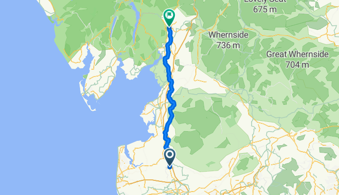
Bilsbarrow to Kendal LEJOG day 12
Cycling route in Catterall, England, United Kingdom
- 66.5 km
- Distance
- 373 m
- Ascent
- 344 m
- Descent
All routes on the map
You can open and navigate all the routes in the Bikemap app for iOS and Android or continue on web to see all details and routes on the map.