
Tangke mit dem Fahrrad
Entdecke eine Karte mit 40 Radrouten und Radwegen rund um Tangke, erstellt von unserer Community.
Regionenporträt
Lerne Tangke kennen
Finde die richtige Fahrradroute in Tangke, wo wir 40 Fahrradrouten für dich zum Erkunden haben.
841 km
Aufgezeichnete Strecken
40
Fahrradrouten
3.537
Einwohner
Community
Die aktivsten Nutzer in Tangke


Von unserer Community
Die besten Fahrradrouten in und um Tangke


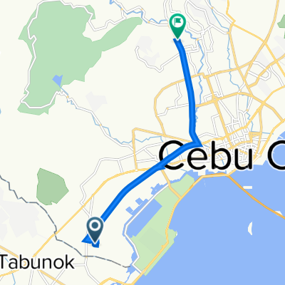
L. Gabuya Street, Cebu City to Unnamed Road, San Fernando
Fahrradtour in Tangke, Western Visayas, Philippinen
- 35,5 km
- Distanz
- 701 m
- Aufstieg
- 438 m
- Abstieg


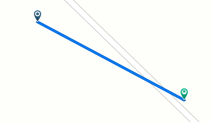
Cebu South Road 106, Cebu City to Katipunan Street 584, Cebu City
Fahrradtour in Tangke, Western Visayas, Philippinen
- 3,7 km
- Distanz
- 36 m
- Aufstieg
- 34 m
- Abstieg

Mehr Routen entdecken
 Rafael Rabaya Road 516, Talisay to Galaxy Street, Talisay
- Distanz
- 25,5 km
- Aufstieg
- 291 m
- Abstieg
- 295 m
- Standort
- Tangke, Western Visayas, Philippinen
 7V95+HJM, Cebu City to V Rama Avenue 1377, Cebu City
- Distanz
- 8,6 km
- Aufstieg
- 53 m
- Abstieg
- 12 m
- Standort
- Tangke, Western Visayas, Philippinen
 CCLEX
CCLEX- Distanz
- 17,2 km
- Aufstieg
- 94 m
- Abstieg
- 94 m
- Standort
- Tangke, Western Visayas, Philippinen
 2nd day
- Distanz
- 19,6 km
- Aufstieg
- 124 m
- Abstieg
- 124 m
- Standort
- Tangke, Western Visayas, Philippinen
 Central Cebu Loop
- Distanz
- 155,5 km
- Aufstieg
- 1.264 m
- Abstieg
- 1.265 m
- Standort
- Tangke, Western Visayas, Philippinen
 Recorded via Apple Watch - 13/08/2021, 6:56 AM
- Distanz
- 13,3 km
- Aufstieg
- 0 m
- Abstieg
- 0 m
- Standort
- Tangke, Western Visayas, Philippinen
 SRP Cevu
- Distanz
- 4,8 km
- Aufstieg
- 264 m
- Abstieg
- 292 m
- Standort
- Tangke, Western Visayas, Philippinen
 Cogon Pardo, Cebu City to Cogon Pardo, Cebu City
- Distanz
- 15,4 km
- Aufstieg
- 10 m
- Abstieg
- 15 m
- Standort
- Tangke, Western Visayas, Philippinen