
Shizuoka mit dem Fahrrad
Entdecke eine Karte mit 75 Radrouten und Radwegen rund um Shizuoka, erstellt von unserer Community.
Regionenporträt
Lerne Shizuoka kennen
Finde die richtige Fahrradroute in Shizuoka, wo wir 75 Fahrradrouten für dich zum Erkunden haben.
8.022 km
Aufgezeichnete Strecken
75
Fahrradrouten
701.561
Einwohner
Community
Die aktivsten Nutzer in Shizuoka


Von unserer Community
Die besten Fahrradrouten in und um Shizuoka
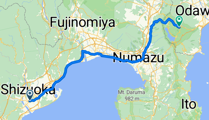
Шидзуока Хаконе 1
Fahrradtour in Shizuoka, Präfektur Shizuoka, Japan
- 97,7 km
- Distanz
- 1.795 m
- Aufstieg
- 1.198 m
- Abstieg

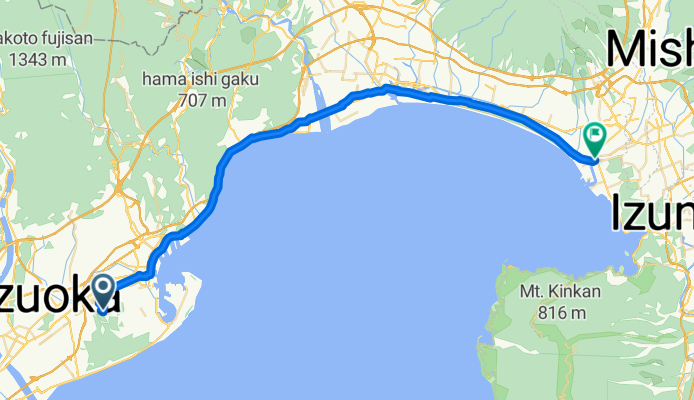
SHIZUOKA - LAC HAMANA
Fahrradtour in Shizuoka, Präfektur Shizuoka, Japan
- 95,3 km
- Distanz
- 366 m
- Aufstieg
- 391 m
- Abstieg
1_6_Shizuoka_Numadu_50km_160m
Fahrradtour in Shizuoka, Präfektur Shizuoka, Japan
- 49,7 km
- Distanz
- 73 m
- Aufstieg
- 168 m
- Abstieg

CJ04 清水~浜松(2016)
Fahrradtour in Shizuoka, Präfektur Shizuoka, Japan
- 106,7 km
- Distanz
- 371 m
- Aufstieg
- 366 m
- Abstieg
Mehr Routen entdecken
 Day 605
- Distanz
- 62,3 km
- Aufstieg
- 137 m
- Abstieg
- 163 m
- Standort
- Shizuoka, Präfektur Shizuoka, Japan
 2016Tour-Shizuoka-Hamamatsu
- Distanz
- 87,4 km
- Aufstieg
- 432 m
- Abstieg
- 494 m
- Standort
- Shizuoka, Präfektur Shizuoka, Japan
 3: Shizuoka to Hamamatsu
- Distanz
- 81,6 km
- Aufstieg
- 419 m
- Abstieg
- 428 m
- Standort
- Shizuoka, Präfektur Shizuoka, Japan
 05 Shizuoka to Omaezaki
- Distanz
- 53,1 km
- Aufstieg
- 449 m
- Abstieg
- 560 m
- Standort
- Shizuoka, Präfektur Shizuoka, Japan
 Tokyo Osaka Kyoto
- Distanz
- 618,6 km
- Aufstieg
- 739 m
- Abstieg
- 792 m
- Standort
- Shizuoka, Präfektur Shizuoka, Japan
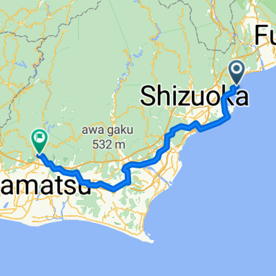 Shizuoka - Hamakita
- Distanz
- 101,2 km
- Aufstieg
- 194 m
- Abstieg
- 220 m
- Standort
- Shizuoka, Präfektur Shizuoka, Japan
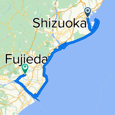 太平洋岸自転車道(清水ー藤枝)
- Distanz
- 70,8 km
- Aufstieg
- 146 m
- Abstieg
- 119 m
- Standort
- Shizuoka, Präfektur Shizuoka, Japan
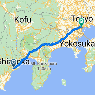 Shizuoka-Tokyo
- Distanz
- 178,4 km
- Aufstieg
- 1.136 m
- Abstieg
- 1.174 m
- Standort
- Shizuoka, Präfektur Shizuoka, Japan