
Kumamoto mit dem Fahrrad
Entdecke eine Karte mit 68 Radrouten und Radwegen rund um Kumamoto, erstellt von unserer Community.
Regionenporträt
Lerne Kumamoto kennen
Finde die richtige Fahrradroute in Kumamoto, wo wir 68 Fahrradrouten für dich zum Erkunden haben. Die meisten Leute fahren hier in den Monaten Mai und September Fahrrad.
4.137 km
Aufgezeichnete Strecken
68
Fahrradrouten
680.423
Einwohner


Handverlesene Routen
Entdecke Kumamoto durch diese Sammlungen
Tour
Von unserer Community
Die besten Fahrradrouten in und um Kumamoto
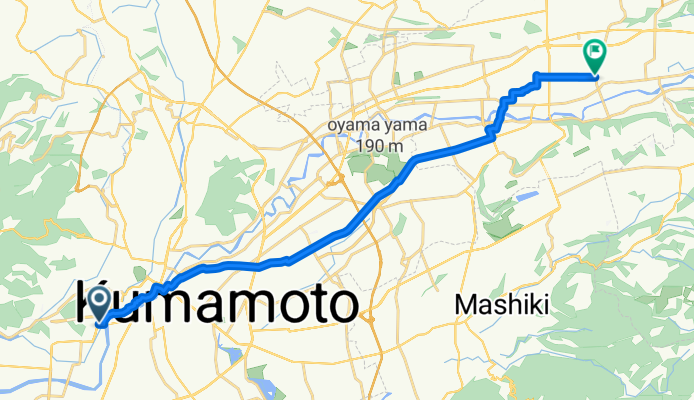
Kasuga 3-Chōme, Kumamoto to Jinnai, Ozu
Fahrradtour in Kumamoto, Präfektur Kumamoto, Japan
- 22,3 km
- Distanz
- 170 m
- Aufstieg
- 80 m
- Abstieg

kyushu day4
Fahrradtour in Kumamoto, Präfektur Kumamoto, Japan
- 54,4 km
- Distanz
- 125 m
- Aufstieg
- 138 m
- Abstieg

Mehr Routen entdecken
 Day 524
- Distanz
- 38,5 km
- Aufstieg
- 478 m
- Abstieg
- 100 m
- Standort
- Kumamoto, Präfektur Kumamoto, Japan
 西区在住・赤星俊光選手推薦コース
- Distanz
- 36,6 km
- Aufstieg
- 0 m
- Abstieg
- 0 m
- Standort
- Kumamoto, Präfektur Kumamoto, Japan
 千原台高校自転車競技部推薦コース
- Distanz
- 24 km
- Aufstieg
- 0 m
- Abstieg
- 0 m
- Standort
- Kumamoto, Präfektur Kumamoto, Japan
 Kumamoto to Kagoshima
- Distanz
- 224,6 km
- Aufstieg
- 4.275 m
- Abstieg
- 4.275 m
- Standort
- Kumamoto, Präfektur Kumamoto, Japan
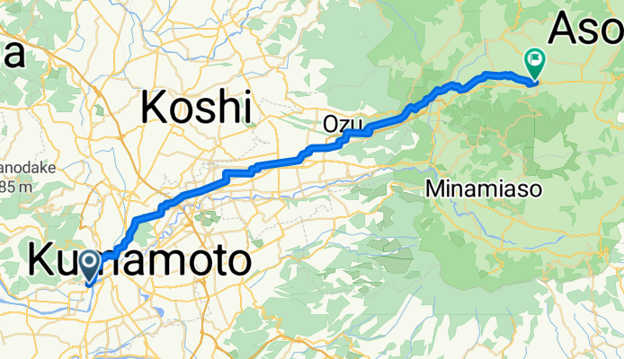
 Kumamoto-Aso
- Distanz
- 46,7 km
- Aufstieg
- 1.218 m
- Abstieg
- 89 m
- Standort
- Kumamoto, Präfektur Kumamoto, Japan
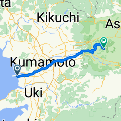 Kumamoto-Aso
- Distanz
- 61,1 km
- Aufstieg
- 1.332 m
- Abstieg
- 192 m
- Standort
- Kumamoto, Präfektur Kumamoto, Japan
 9-39, Jozanhanta 2-Chōme, Nishi, Kumamoto to 1963-2, Sakamoto, Misato, Shimomashiki-Gun
- Distanz
- 35,9 km
- Aufstieg
- 442 m
- Abstieg
- 188 m
- Standort
- Kumamoto, Präfektur Kumamoto, Japan
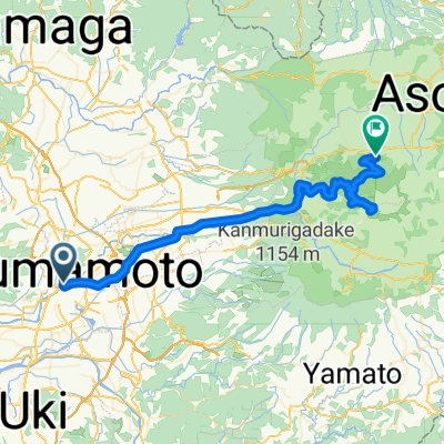 2017/3/3
- Distanz
- 61,6 km
- Aufstieg
- 1.210 m
- Abstieg
- 648 m
- Standort
- Kumamoto, Präfektur Kumamoto, Japan