
Belgrave mit dem Fahrrad
Entdecke eine Karte mit 3 Radrouten und Radwegen rund um Belgrave, erstellt von unserer Community.
Pioniere gesucht
Inspiriere andere Radfahrer mit deiner Route in Belgrave
Bikemap ist eine globale Fahrrad-Community mit Millionen von Routen, die von Radfahrern wie dir erstellt wurden. Es gibt bisher nur wenige Routen in Belgrave, also zeichne deine Lieblingsstrecken jetzt auf der Karte ein, um anderen zu helfen, die besten Radrouten zu finden.
Von unserer Community
Die besten Fahrradrouten in und um Belgrave
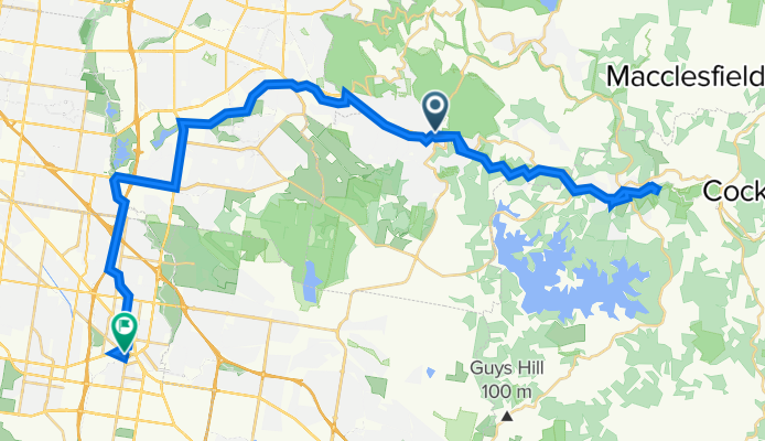
Train to Pufting Billy to Emerald Lake and bike return
Fahrradtour in Belgrave, Victoria, Australien
- 53,1 km
- Distanz
- 671 m
- Aufstieg
- 881 m
- Abstieg


e-MTB Adventure Ride. Belgrave, Gembrook, Yellingbo, Lilydale.
Fahrradtour in Belgrave, Victoria, Australien
General tips and comment.
I ride my e-MTB (Bosch Performance Line CX) with 2 500Wh batteries. The range of some of the rides will require 2 500Wh batteries. If you ride an e-MTB understand the battery range you can get from your e-bike for any given terrain and that you have the capabilities to complete the ride. All my posted routes been ridden and GPS recorded.
If you make use of any of this information in the route/track, in whole or in part, you need to consider the following:
Ride at your own risk. No responsibility is accepted for any inaccuracies or for any mishap or injury that may arise out of the use of any GPS/GPX track or route or any other data or information that may be contained in any route postings.
Tracks, road conditions and water course crossings can change overnight for any number of reasons (weather, landslides, trail closures, flooding, roadworks) making previously good tracks impassable, dangerous and be closed off at any time. Expect the need to detour at any time. Have a ‘Plan B’ and be prepared for any eventuality.
Information provided about each route is the point in time the route was ridden. The difficulty rating may be very different to what constitutes an Intermediate, Experienced or Advanced ride compared to you. Always ride within your capabilities. Treat any ride based on any information supplied with caution, expecting that conditions are likely to be different to what they were when the route was recorded.
Expect steep ascents and descents, loose gravel, ruts, water courses, fallen trees and the need to walk the bike in some instances.
Information provided containing GPS/GPX routes/tracks, are provided "as is" and it is your responsibility to evaluate the information and the suitability for your purposes.
Check CFA Fire Danger Ratings before riding. Do not ride in any conditions with CFA Fire Danger Ratings Scale above: Low - Moderate.
Always inform someone of your intended plans, departure and estimated arrival time.
Have a backup ability to navigate and use navigation devices. A second GPS device or a mobile phone with true GPS capabilities that are not reliant on mobile phone tower reception to function. Install the GPX routes/track into all devices. Or carry a map and compass.
Do not rely on having mobile phone reception available at any time.
On all rides, it is a must that you are self sufficient with food, water and spare parts and have the ability to undertake bicycle repairs.
- 71,7 km
- Distanz
- 734 m
- Aufstieg
- 873 m
- Abstieg