
Sant'Angelo in Pontano mit dem Fahrrad
Entdecke eine Karte mit 13 Radrouten und Radwegen rund um Sant'Angelo in Pontano, erstellt von unserer Community.
Regionenporträt
Lerne Sant'Angelo in Pontano kennen
Finde die richtige Fahrradroute in Sant'Angelo in Pontano, wo wir 13 Fahrradrouten für dich zum Erkunden haben.
575 km
Aufgezeichnete Strecken
13
Fahrradrouten
449
Einwohner
Community
Die aktivsten Nutzer in Sant'Angelo in Pontano


Von unserer Community
Die besten Fahrradrouten in und um Sant'Angelo in Pontano

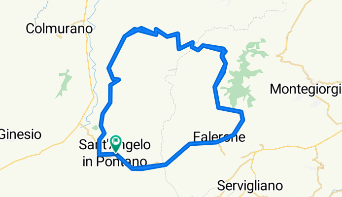
Sant'Angelo in Pontano Cycling
Fahrradtour in Sant'Angelo in Pontano, Marken, Italien
- 20,9 km
- Distanz
- 181 m
- Aufstieg
- 476 m
- Abstieg
Garmin Edge 820®

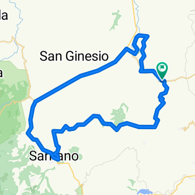
monte montioli
Fahrradtour in Sant'Angelo in Pontano, Marken, Italien
- 57,8 km
- Distanz
- 1.577 m
- Aufstieg
- 1.577 m
- Abstieg

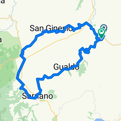
Percorso ad alta velocità in Sant'Angelo in Pontano
Fahrradtour in Sant'Angelo in Pontano, Marken, Italien
- 26,5 km
- Distanz
- 561 m
- Aufstieg
- 575 m
- Abstieg
montappone
Fahrradtour in Sant'Angelo in Pontano, Marken, Italien
- 68,4 km
- Distanz
- 996 m
- Aufstieg
- 996 m
- Abstieg
Mehr Routen entdecken
 Giro a velocità lenta in Sant'Angelo in Pontano
- Distanz
- 44,3 km
- Aufstieg
- 877 m
- Abstieg
- 875 m
- Standort
- Sant'Angelo in Pontano, Marken, Italien
 La Marche grote bergtoer
- Distanz
- 74,3 km
- Aufstieg
- 2.287 m
- Abstieg
- 2.320 m
- Standort
- Sant'Angelo in Pontano, Marken, Italien
 Lago S. Ruffino
- Distanz
- 19,7 km
- Aufstieg
- 727 m
- Abstieg
- 736 m
- Standort
- Sant'Angelo in Pontano, Marken, Italien
 Giro a velocità costante in Sant'Angelo in Pontano
- Distanz
- 28,1 km
- Aufstieg
- 586 m
- Abstieg
- 585 m
- Standort
- Sant'Angelo in Pontano, Marken, Italien
 Giant bergrit La Marche
- Distanz
- 109,7 km
- Aufstieg
- 2.602 m
- Abstieg
- 2.606 m
- Standort
- Sant'Angelo in Pontano, Marken, Italien
 1u marche X
- Distanz
- 22,3 km
- Aufstieg
- 591 m
- Abstieg
- 597 m
- Standort
- Sant'Angelo in Pontano, Marken, Italien
 1 uur marche
- Distanz
- 22,5 km
- Aufstieg
- 583 m
- Abstieg
- 583 m
- Standort
- Sant'Angelo in Pontano, Marken, Italien
 3 uur
3 uur- Distanz
- 41,6 km
- Aufstieg
- 906 m
- Abstieg
- 913 m
- Standort
- Sant'Angelo in Pontano, Marken, Italien