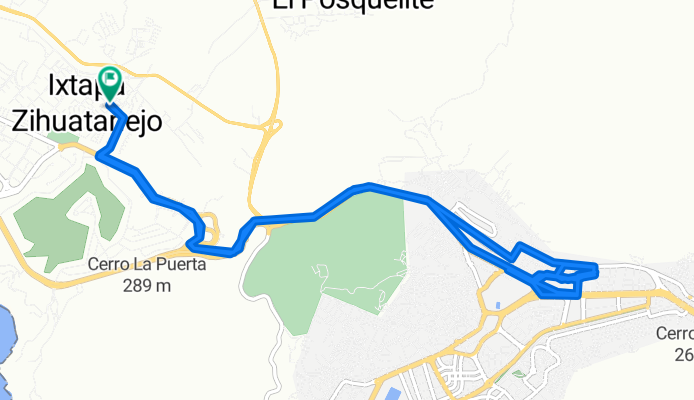
Ixtapa-Zihuatanejo mit dem Fahrrad
Entdecke eine Karte mit 62 Radrouten und Radwegen rund um Ixtapa-Zihuatanejo, erstellt von unserer Community.
Regionenporträt
Lerne Ixtapa-Zihuatanejo kennen
Finde die richtige Fahrradroute in Ixtapa-Zihuatanejo, wo wir 62 Fahrradrouten für dich zum Erkunden haben. Die meisten Leute fahren hier in den Monaten Februar und März Fahrrad.
3.666 km
Aufgezeichnete Strecken
62
Fahrradrouten
61.308
Einwohner
Community
Die aktivsten Nutzer in Ixtapa-Zihuatanejo
Von unserer Community
Die besten Fahrradrouten in und um Ixtapa-Zihuatanejo
Ruta La Paloma Salitrera
Fahrradtour in Ixtapa-Zihuatanejo, Guerrero, Mexiko
- 35,6 km
- Distanz
- 55 m
- Aufstieg
- 98 m
- Abstieg
Zihuatanejo - La Mira, Zihuatanejo a Calle Francisco González Bocanegra 20, Zihuatanejo
Fahrradtour in Ixtapa-Zihuatanejo, Guerrero, Mexiko
- 29 km
- Distanz
- 1.041 m
- Aufstieg
- 1.042 m
- Abstieg
La Puerta, Ixtapa Zihuatanejo a Zihuatanejo
Fahrradtour in Ixtapa-Zihuatanejo, Guerrero, Mexiko
- 20,1 km
- Distanz
- 151 m
- Aufstieg
- 197 m
- Abstieg
Un viaje apasionante
Fahrradtour in Ixtapa-Zihuatanejo, Guerrero, Mexiko
- 395,4 km
- Distanz
- 4.092 m
- Aufstieg
- 2.361 m
- Abstieg
Mehr Routen entdecken
- Zihuatanejo a La puerta, Ixtapa Zihuatanejo
- Distanz
- 7,4 km
- Aufstieg
- 18 m
- Abstieg
- 91 m
- Standort
- Ixtapa-Zihuatanejo, Guerrero, Mexiko
- Calle Paseo de las Golondrinas 177, Ixtapa Zihuatanejo a Calle Paseo de las Golondrinas 183, Ixtapa Zihuatanejo
- Distanz
- 18,1 km
- Aufstieg
- 322 m
- Abstieg
- 474 m
- Standort
- Ixtapa-Zihuatanejo, Guerrero, Mexiko
- primera Ruta
- Distanz
- 12,3 km
- Aufstieg
- 109 m
- Abstieg
- 120 m
- Standort
- Ixtapa-Zihuatanejo, Guerrero, Mexiko
- Ruta moderada en ixtaoa
- Distanz
- 21,9 km
- Aufstieg
- 178 m
- Abstieg
- 177 m
- Standort
- Ixtapa-Zihuatanejo, Guerrero, Mexiko
- La puerta, Zihuatanejo, Majahua, La Puerta, Ixtapa
- Distanz
- 26 km
- Aufstieg
- 155 m
- Abstieg
- 186 m
- Standort
- Ixtapa-Zihuatanejo, Guerrero, Mexiko
- La Puerta, Ixtapa Zihuatanejo a Vallecito de Zaragoza, Gro.
- Distanz
- 60 km
- Aufstieg
- 3.549 m
- Abstieg
- 3.045 m
- Standort
- Ixtapa-Zihuatanejo, Guerrero, Mexiko
- De Calle del Ejido 36–150, Zihuatanejo a Calle Cuauhtémoc 34B, Zihuatanejo
- Distanz
- 31,4 km
- Aufstieg
- 337 m
- Abstieg
- 338 m
- Standort
- Ixtapa-Zihuatanejo, Guerrero, Mexiko
- La puerta a Playa linda Ixtapa Zihuatanejo
- Distanz
- 11,9 km
- Aufstieg
- 20 m
- Abstieg
- 26 m
- Standort
- Ixtapa-Zihuatanejo, Guerrero, Mexiko