
Ballarat Central mit dem Fahrrad
Entdecke eine Karte mit 23 Radrouten und Radwegen rund um Ballarat Central, erstellt von unserer Community.
Regionenporträt
Lerne Ballarat Central kennen
Finde die richtige Fahrradroute in Ballarat Central, wo wir 23 Fahrradrouten für dich zum Erkunden haben.
1.697 km
Aufgezeichnete Strecken
23
Fahrradrouten
5.645
Einwohner


Von unserer Community
Die besten Fahrradrouten in und um Ballarat Central

Ballarat City circuit for windy weather
Fahrradtour in Ballarat Central, Victoria, Australien
- 50,4 km
- Distanz
- 232 m
- Aufstieg
- 222 m
- Abstieg

e-MTB Adventure Ride. Ballarat, Creswick.
Fahrradtour in Ballarat Central, Victoria, Australien
- 29,2 km
- Distanz
- 332 m
- Aufstieg
- 331 m
- Abstieg

e-MTB Adventure Ride. Ballarat to Melbourne
Fahrradtour in Ballarat Central, Victoria, Australien
- 135,3 km
- Distanz
- 467 m
- Aufstieg
- 871 m
- Abstieg

Ballarat to Bacchus Marsh
Fahrradtour in Ballarat Central, Victoria, Australien
- 69,7 km
- Distanz
- 452 m
- Aufstieg
- 778 m
- Abstieg
Mehr Routen entdecken
![[Herald Sun Tour 2009 - Etapa 00] Ballarat](https://media.bikemap.net/routes/327032/staticmaps/in_02180b6f-925d-4083-b153-b186a50069ea_400x400_bikemap-2021-3D-static.png) [Herald Sun Tour 2009 - Etapa 00] Ballarat
[Herald Sun Tour 2009 - Etapa 00] Ballarat- Distanz
- 2,3 km
- Aufstieg
- 19 m
- Abstieg
- 22 m
- Standort
- Ballarat Central, Victoria, Australien
 Stay close to Ballarat - including Buninyong
- Distanz
- 70,6 km
- Aufstieg
- 580 m
- Abstieg
- 580 m
- Standort
- Ballarat Central, Victoria, Australien
 Ballarat To Lara Bikepacking
- Distanz
- 103,6 km
- Aufstieg
- 606 m
- Abstieg
- 1.026 m
- Standort
- Ballarat Central, Victoria, Australien
 Tour Down Under Stage 3 mock course
- Distanz
- 146,5 km
- Aufstieg
- 672 m
- Abstieg
- 516 m
- Standort
- Ballarat Central, Victoria, Australien
 Ballarat - Windermere Hotel
- Distanz
- 34,9 km
- Aufstieg
- 699 m
- Abstieg
- 708 m
- Standort
- Ballarat Central, Victoria, Australien
 FHB Ballarat to Southern Cross Station, leg 6
- Distanz
- 135,8 km
- Aufstieg
- 483 m
- Abstieg
- 898 m
- Standort
- Ballarat Central, Victoria, Australien
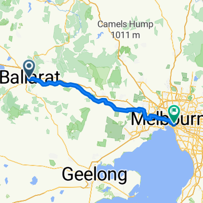 Ballarat to Melbourne
- Distanz
- 124,8 km
- Aufstieg
- 268 m
- Abstieg
- 683 m
- Standort
- Ballarat Central, Victoria, Australien
 Ballarat - Maryborough Trail
- Distanz
- 92,4 km
- Aufstieg
- 375 m
- Abstieg
- 569 m
- Standort
- Ballarat Central, Victoria, Australien