

Mit dem Fahrrad von Pullach im Isartal nach München
Erstelle deine eigene Route auf der Grundlage unserer Vorlage oder lass dich inspirieren, wie unsere Nutzer am liebsten von Pullach im Isartal nach München radeln.
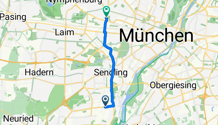
Routenvorlage
Pullach im Isartal nach München

- 47 min
- Dauer
- 13 km
- Distanz
- 43 m
- Aufstieg
- 100 m
- Abstieg
- 16,7 km/h
- Ø-Tempo
- 584 m
- Max. Höhe
Diese entspannte Fahrradtour startet im idyllischen Pullach im Isartal, einem hübschen Vorort südlich von München, bekannt für seine grünen Villengegenden und fantastische Aussicht auf die Isar. Von dort aus radelst du in Richtung Münchner Innenstadt – das sind rund 13 Kilometer, also perfekt für eine kurze Citytour oder einen Pendlerweg.
Die Strecke schlängelt sich größtenteils über asphaltierte Radwege und ruhige Straßen, du fährst fast immer bergab (insgesamt verlierst du rund 100 Höhenmeter – lässt sich also locker meistern!). Die Route verläuft zu über der Hälfte auf Pfaden und zu etwa einem Fünftel auf offiziellen Radwegen. Nur ein winziger Teil ist auf Schotter, also können so gut wie alle Fahrradtypen diese Strecke meistern.
Am Ziel wartet München mit seiner pulsierenden Innenstadt, berühmten Biergärten und unzähligen Sehenswürdigkeiten wie dem Marienplatz oder der Frauenkirche. Ideal, um nach der Fahrt noch ein Eis oder Kaffee zu genießen! Egal, ob du Natur und ruhigere Ecken magst oder das Großstadtleben suchst – diese Tour bietet dir das Beste aus beiden Welten.
Community
Top-Mitglieder in dieser Region


Von unserer Community
Die besten Fahrradrouten von Pullach im Isartal nach München

Isartal
Fahrradtour in Pullach im Isartal, Bayern, Deutschland
- 35,4 km
- Distanz
- 273 m
- Aufstieg
- 301 m
- Abstieg
Baierbrunner Straße, München nach Schulstraße, München
Fahrradtour in Pullach im Isartal, Bayern, Deutschland
- 6,7 km
- Distanz
- 129 m
- Aufstieg
- 156 m
- Abstieg

25D3C2: Schilcherweg - Munich
Fahrradtour in Pullach im Isartal, Bayern, Deutschland
- 10,8 km
- Distanz
- 47 m
- Aufstieg
- 96 m
- Abstieg

Heilmannstraße 35A, München nach Guldeinstraße 31, München
Fahrradtour in Pullach im Isartal, Bayern, Deutschland
- 8,3 km
- Distanz
- 43 m
- Aufstieg
- 121 m
- Abstieg

Schlichtweg 11, München nach Arnulfstraße 52, München
Fahrradtour in Pullach im Isartal, Bayern, Deutschland
- 7,5 km
- Distanz
- 21 m
- Aufstieg
- 29 m
- Abstieg

Gabriel-von-Seidl-Straße 39C, Grünwald nach Klobensteiner Straße 16, München
Fahrradtour in Pullach im Isartal, Bayern, Deutschland
- 5,6 km
- Distanz
- 67 m
- Aufstieg
- 99 m
- Abstieg

Link Geräumt, Grünwalder Forst nach Kiliansplatz 3, München
Fahrradtour in Pullach im Isartal, Bayern, Deutschland
- 12,2 km
- Distanz
- 10 m
- Aufstieg
- 96 m
- Abstieg

Geiselgasteig Geräumt, nach Klobensteiner Straße 15, München
Fahrradtour in Pullach im Isartal, Bayern, Deutschland
- 5,1 km
- Distanz
- 27 m
- Aufstieg
- 69 m
- Abstieg

Thalkirchen-Obersendling-Forstenried-Fürstenried-Solln, München nach Ludwigstraße 16, München
Fahrradtour in Pullach im Isartal, Bayern, Deutschland
- 8,8 km
- Distanz
- 68 m
- Aufstieg
- 29 m
- Abstieg

Quick bike tour from Pullach im Isartal to Munich
Fahrradtour in Pullach im Isartal, Bayern, Deutschland
- 6,7 km
- Distanz
- 29 m
- Aufstieg
- 54 m
- Abstieg

Gmunder Straße 37 - Oskar-von-Miller-Ring 20
Fahrradtour in Pullach im Isartal, Bayern, Deutschland
- 7,8 km
- Distanz
- 15 m
- Aufstieg
- 48 m
- Abstieg

Zentralländstraße 49A, München nach Schäftlarnstraße 15, München
Fahrradtour in Pullach im Isartal, Bayern, Deutschland
- 2,8 km
- Distanz
- 6 m
- Aufstieg
- 15 m
- Abstieg
Mehr Routen entdecken
 Schlichtweg 11, München nach Arnulfstraße 52, München
- Distanz
- 7,5 km
- Aufstieg
- 21 m
- Abstieg
- 29 m
- Standort
- Pullach im Isartal, Bayern, Deutschland
 Gabriel-von-Seidl-Straße 39C, Grünwald nach Klobensteiner Straße 16, München
- Distanz
- 5,6 km
- Aufstieg
- 67 m
- Abstieg
- 99 m
- Standort
- Pullach im Isartal, Bayern, Deutschland
 Link Geräumt, Grünwalder Forst nach Kiliansplatz 3, München
- Distanz
- 12,2 km
- Aufstieg
- 10 m
- Abstieg
- 96 m
- Standort
- Pullach im Isartal, Bayern, Deutschland
 Geiselgasteig Geräumt, nach Klobensteiner Straße 15, München
- Distanz
- 5,1 km
- Aufstieg
- 27 m
- Abstieg
- 69 m
- Standort
- Pullach im Isartal, Bayern, Deutschland
 Thalkirchen-Obersendling-Forstenried-Fürstenried-Solln, München nach Ludwigstraße 16, München
- Distanz
- 8,8 km
- Aufstieg
- 68 m
- Abstieg
- 29 m
- Standort
- Pullach im Isartal, Bayern, Deutschland
 Quick bike tour from Pullach im Isartal to Munich
- Distanz
- 6,7 km
- Aufstieg
- 29 m
- Abstieg
- 54 m
- Standort
- Pullach im Isartal, Bayern, Deutschland
 Gmunder Straße 37 - Oskar-von-Miller-Ring 20
- Distanz
- 7,8 km
- Aufstieg
- 15 m
- Abstieg
- 48 m
- Standort
- Pullach im Isartal, Bayern, Deutschland
 Zentralländstraße 49A, München nach Schäftlarnstraße 15, München
- Distanz
- 2,8 km
- Aufstieg
- 6 m
- Abstieg
- 15 m
- Standort
- Pullach im Isartal, Bayern, Deutschland
Routen von Pullach im Isartal
Mit dem Fahrrad von
Pullach im Isartal nach Neuried
Mit dem Fahrrad von
Pullach im Isartal nach Pasing
Routen nach München
Tagesausflug mit dem Fahrrad von
Gröbenzell nach München
Tagesausflug mit dem Fahrrad von
Augsburg nach München
Mit dem Fahrrad von
Gräfelfing nach München
Mit dem Fahrrad von
Haar bei München nach München