
Routenvorlage
Trebišov nach Košice
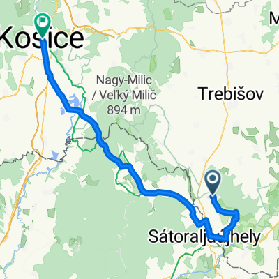
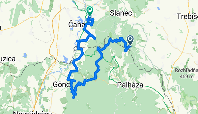
Diese Fahrradroute bringt dich von Trebišov durchs slowakische Hinterland bis nach Košice – perfekt, wenn du Lust auf eine etwas längere Tour mit ein paar knackigen Anstiegen hast! Mit fast 100 Kilometern Strecke und über 1000 Höhenmetern ist ordentlich Bewegung garantiert. Die Route führt dich hauptsächlich über ruhige Straßen und einfache Wege, ideal zum Abschalten und Genießen der Landschaft – du wirst viel Grün und kleine Dörfer sehen. Etwa ein Drittel ist asphaltiert, aber Achtung: Der Untergrund ist nicht überall definiert, sei also auf wechselnde Verhältnisse vorbereitet.
Trebišov selbst ist ein nettes Städtchen mit Geschichte, vor allem bekannt für sein hübsches Schloss und grüne Parks – ein entspannter Auftakt. Als Ziel lockt Košice, die zweitgrößte Stadt der Slowakei, mit ihrer charmanten Altstadt, gemütlichen Cafés und der berühmten Elisabethkathedrale. Eine lohnende Tour für alle, die Lust auf Natur und ein bisschen urbanes Flair am Ende haben!
Community
Top-Mitglieder in dieser Region
Von unserer Community
Die besten Fahrradrouten von Trebišov nach Košice
2010 - Cyklodovolená
Fahrradtour in Trebišov, Košický kraj, Slowakei
- 543,5 km
- Distanz
- 5.542 m
- Aufstieg
- 5.456 m
- Abstieg
Bringahorda 2015 2. nap
Fahrradtour in Trebišov, Košický kraj, Slowakei
- 40,6 km
- Distanz
- 433 m
- Aufstieg
- 548 m
- Abstieg
Északi Zöld 02
Fahrradtour in Trebišov, Košický kraj, Slowakei
- 20,4 km
- Distanz
- 915 m
- Aufstieg
- 1.046 m
- Abstieg
Tv - Branc - Velaty - Michalany - Mikohaza - Hollohaza - Ke
Fahrradtour in Trebišov, Košický kraj, Slowakei
- 74 km
- Distanz
- 521 m
- Aufstieg
- 339 m
- Abstieg
Velaty - Kosice
Fahrradtour in Trebišov, Košický kraj, Slowakei
- 42,4 km
- Distanz
- 468 m
- Aufstieg
- 441 m
- Abstieg
Izra-HU-Jaros 2020
Fahrradtour in Trebišov, Košický kraj, Slowakei
- 41,4 km
- Distanz
- 365 m
- Aufstieg
- 522 m
- Abstieg
7 Mala Trna - Kosice
Fahrradtour in Trebišov, Košický kraj, Slowakei
- 66,4 km
- Distanz
- 587 m
- Aufstieg
- 527 m
- Abstieg
TdV 2018: ETAPA6 Tokaj - Košice
Fahrradtour in Trebišov, Košický kraj, Slowakei
- 71 km
- Distanz
- 440 m
- Aufstieg
- 393 m
- Abstieg
Tv - Branc - Michalany - Mikohaza - Telkibanya - Gonc - Ke
Fahrradtour in Trebišov, Košický kraj, Slowakei
- 90,8 km
- Distanz
- 490 m
- Aufstieg
- 376 m
- Abstieg
Tv - Vranov - Herlany - Ke
Fahrradtour in Trebišov, Košický kraj, Slowakei
- 85,1 km
- Distanz
- 854 m
- Aufstieg
- 599 m
- Abstieg
VKA 2020 Kuzmice,Milič,Lietadlo,Myšľa
Fahrradtour in Trebišov, Košický kraj, Slowakei
- 87,9 km
- Distanz
- 1.582 m
- Aufstieg
- 1.674 m
- Abstieg
Tv+5km - Branc - Velaty - Sl.N.M.-Sat. - Alsoregmec - Palhaza - Hollohaza - Cana - Ke
Fahrradtour in Trebišov, Košický kraj, Slowakei
- 93,2 km
- Distanz
- 527 m
- Aufstieg
- 348 m
- Abstieg
Mehr Routen entdecken
 Velaty - Kosice
- Distanz
- 42,4 km
- Aufstieg
- 468 m
- Abstieg
- 441 m
- Standort
- Trebišov, Košický kraj, Slowakei
 Izra-HU-Jaros 2020
- Distanz
- 41,4 km
- Aufstieg
- 365 m
- Abstieg
- 522 m
- Standort
- Trebišov, Košický kraj, Slowakei
 7 Mala Trna - Kosice
- Distanz
- 66,4 km
- Aufstieg
- 587 m
- Abstieg
- 527 m
- Standort
- Trebišov, Košický kraj, Slowakei
 TdV 2018: ETAPA6 Tokaj - Košice
- Distanz
- 71 km
- Aufstieg
- 440 m
- Abstieg
- 393 m
- Standort
- Trebišov, Košický kraj, Slowakei
 Tv - Branc - Michalany - Mikohaza - Telkibanya - Gonc - Ke
- Distanz
- 90,8 km
- Aufstieg
- 490 m
- Abstieg
- 376 m
- Standort
- Trebišov, Košický kraj, Slowakei
 Tv - Vranov - Herlany - Ke
- Distanz
- 85,1 km
- Aufstieg
- 854 m
- Abstieg
- 599 m
- Standort
- Trebišov, Košický kraj, Slowakei
 VKA 2020 Kuzmice,Milič,Lietadlo,Myšľa
- Distanz
- 87,9 km
- Aufstieg
- 1.582 m
- Abstieg
- 1.674 m
- Standort
- Trebišov, Košický kraj, Slowakei
 Tv+5km - Branc - Velaty - Sl.N.M.-Sat. - Alsoregmec - Palhaza - Hollohaza - Cana - Ke
- Distanz
- 93,2 km
- Aufstieg
- 527 m
- Abstieg
- 348 m
- Standort
- Trebišov, Košický kraj, Slowakei
Routen nach Košice
Tagesausflug mit dem Fahrrad von
Gollnitz nach Košice
Tagesausflug mit dem Fahrrad von
Prešov nach Košice


