

Saint-Sernin-sur-Rance to Albi
Eine Fahrradroute, die in Belmont-sur-Rance, Languedoc-Roussillon-Midi-Pyrénées, France beginnt.
Übersicht
Über diese Route
This was a pretty easy ride on pretty much all zero and low traffic scenic roads, with the only exception being when approaching Albi.
Note that the two spikes in the profile near the end of the ride should be ignored. They're due to going through flat tunnels. As such, the climbing is probably around 480M rather than 630M.
As the tunnels are narrow, though with some lighting, it's best to have both a headlight and taillight for these two tunnels.
- 4 h 29 min
- Dauer
- 53,1 km
- Distanz
- 1.067 m
- Aufstieg
- 1.167 m
- Abstieg
- 11,8 km/h
- Ø-Tempo
- 361 m
- Ø-Tempo

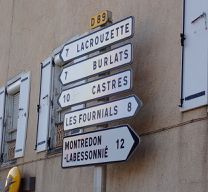
Fotos von der Route


Routenqualität
Wegtypen und Untergründe entlang der Route
Wegtypen
Vielbefahrene Straße
39,2 km
(74 %)
Straße
10,9 km
(21 %)
Untergründe
Befestigt
9,9 km
(19 %)
Asphalt
9,9 km
(19 %)
Undefiniert
43,2 km
(81 %)
Weiter mit Bikemap
Diese Radroute verwenden, bearbeiten oder herunterladen
Du möchtest Saint-Sernin-sur-Rance to Albi fahren oder sie für deine eigene Reise anpassen? Folgendes kannst du mit dieser Bikemap-Route machen:
Gratis Funktionen
- Speichere diese Route als Favorit oder in einer Sammlung
- Kopiere & plane deine eigene Version dieser Route
- Synchronisiere deine Route mit Garmin oder Wahoo
Premium-Funktionen
Kostenlose Testversion für 3 Tage oder einmalige Zahlung. Mehr über Bikemap Premium.
- Navigiere diese Route auf iOS & Android
- Exportiere eine GPX / KML-Datei dieser Route
- Erstelle deinen individuellen Ausdruck (Jetzt kostenlos ausprobieren)
- Lade diese Route für die Offline-Navigation herunter
Entdecke weitere Premium-Funktionen.
Bikemap Premium aktivierenVon unserer Community
Belmont-sur-Rance: Andere beliebte Routen, die hier beginnen
 Saint-Sernin-sur-Rance - Circle through Pousthomy
- Distanz
- 20,8 km
- Aufstieg
- 519 m
- Abstieg
- 514 m
- Standort
- Belmont-sur-Rance, Languedoc-Roussillon-Midi-Pyrénées, Frankreich
 La Loubière-Combret - Circle to Lacaune
- Distanz
- 42,2 km
- Aufstieg
- 905 m
- Abstieg
- 906 m
- Standort
- Belmont-sur-Rance, Languedoc-Roussillon-Midi-Pyrénées, Frankreich
 st sernin bédarrieux par lacaune
- Distanz
- 88,2 km
- Aufstieg
- 818 m
- Abstieg
- 933 m
- Standort
- Belmont-sur-Rance, Languedoc-Roussillon-Midi-Pyrénées, Frankreich
 etape 3
- Distanz
- 88,4 km
- Aufstieg
- ---
- Abstieg
- ---
- Standort
- Belmont-sur-Rance, Languedoc-Roussillon-Midi-Pyrénées, Frankreich
 Saint-Sernin-sur-Rance to Albi
- Distanz
- 53,1 km
- Aufstieg
- 1.067 m
- Abstieg
- 1.167 m
- Standort
- Belmont-sur-Rance, Languedoc-Roussillon-Midi-Pyrénées, Frankreich
 De Saint-Sever 181, Saint-Sever-du-Moustier à Saint-Sever 181, Saint-Sever-du-Moustier
- Distanz
- 47,4 km
- Aufstieg
- 1.195 m
- Abstieg
- 1.198 m
- Standort
- Belmont-sur-Rance, Languedoc-Roussillon-Midi-Pyrénées, Frankreich
 Combret (La Loubière) to Castres
- Distanz
- 75,3 km
- Aufstieg
- 827 m
- Abstieg
- 1.217 m
- Standort
- Belmont-sur-Rance, Languedoc-Roussillon-Midi-Pyrénées, Frankreich
 Saint-Sernin/Rance à Bédarieux
- Distanz
- 100,6 km
- Aufstieg
- 1.164 m
- Abstieg
- 1.298 m
- Standort
- Belmont-sur-Rance, Languedoc-Roussillon-Midi-Pyrénées, Frankreich
In der App öffnen