
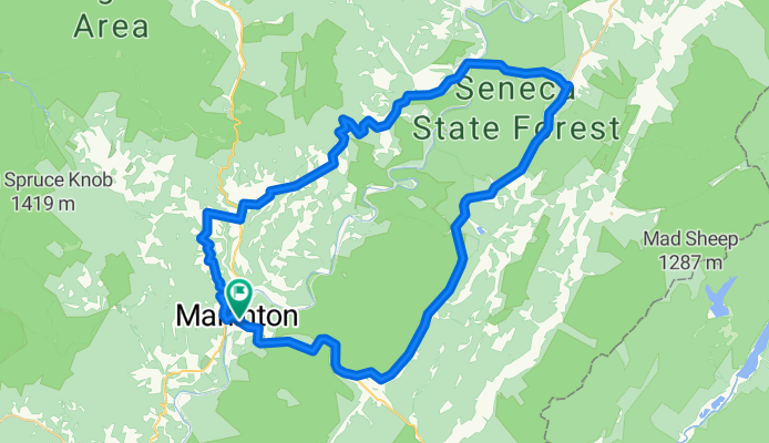
Marlinton-Cloverlick Loop
Eine Fahrradroute, die in Marlinton, West Virginia, Vereinigte Staaten beginnt.
Übersicht
Über diese Route
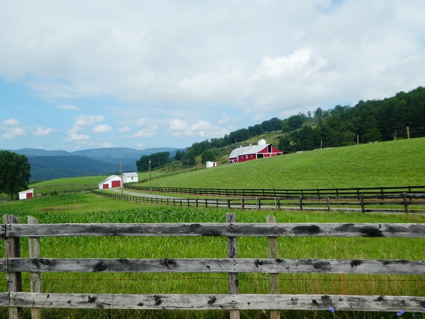
Dies ist eine großartige Runde mit verschiedenen Fahrherausforderungen. Der erste Teil führt über schmale Landstraßen mit vielen Aufs und Abs und zahlreichen kurzen, steilen Anstiegen. Die zweite Hälfte verläuft auf zweispurigen Straßen und insgesamt bergab, ideal für eine schnelle Rückfahrt nach Marlinton. Die letzten 6 Meilen von Huntersville nach Marlinton sind meist der einzige Abschnitt, wo es Verkehrsprobleme geben kann.
Ich starte diese Fahrt normalerweise in Edray, da dort Campingplätze in der Nähe sind, aber ich gebe hier die Wegbeschreibung vom Stadtzentrum Marlinton aus an. Wasser gibt es am Picknickplatz oder im Büro des Seneca State Forest.
0.0 Stadtzentrum Marlinton am Greenbrier River Trail Kreuzung.
0.3 Links auf Rt. 39 am Ende der Brücke.
0.5 Rechts auf Jericho Road<br />
4.3 Links - ganz links, um auf Jericho Rd. fortzufahren.
4.9 Rechts auf Co. Rt. 17 Woodrow Road
6.0 Links auf Rt 219 in Edray. Letzter Laden auf der Route.
6.2 Rechts auf Back Mt. Road am Kirchvorbei. Folge Back Mt. Road bis Cloverlick.<br />
11.8 Die Schleife
16.7 Geradeaus an der Kreuzung in Cloverlick auf Laurel Run Rd. 1/4 und überquere den Greenbrier River. Back Mt. Road geht hier links in Richtung Cass weiter.
21.0 Rechts auf State 28.
33.8 Rechts auf St. 39.
39.0 Ziel<br />
- -:--
- Dauer
- 62,8 km
- Distanz
- 537 m
- Aufstieg
- 537 m
- Abstieg
- ---
- Ø-Tempo
- ---
- Max. Höhe

Routenqualität
Wegtypen und Untergründe entlang der Route
Wegtypen
Straße
31,4 km
(50 %)
Ruhige Straße
1,3 km
(2 %)
Undefiniert
30,2 km
(48 %)
Untergründe
Befestigt
33,9 km
(54 %)
Befestigt (undefiniert)
19,5 km
(31 %)
Asphalt
14,5 km
(23 %)
Undefiniert
28,9 km
(46 %)
Weiter mit Bikemap
Diese Radroute verwenden, bearbeiten oder herunterladen
Du möchtest Marlinton-Cloverlick Loop fahren oder sie für deine eigene Reise anpassen? Folgendes kannst du mit dieser Bikemap-Route machen:
Gratis Funktionen
- Speichere diese Route als Favorit oder in einer Sammlung
- Kopiere & plane deine eigene Version dieser Route
- Synchronisiere deine Route mit Garmin oder Wahoo
Premium-Funktionen
Kostenlose Testversion für 3 Tage oder einmalige Zahlung. Mehr über Bikemap Premium.
- Navigiere diese Route auf iOS & Android
- Exportiere eine GPX / KML-Datei dieser Route
- Erstelle deinen individuellen Ausdruck (Jetzt kostenlos ausprobieren)
- Lade diese Route für die Offline-Navigation herunter
Entdecke weitere Premium-Funktionen.
Bikemap Premium aktivierenVon unserer Community
Marlinton: Andere beliebte Routen, die hier beginnen
 Marlinton Loop
- Distanz
- 63,5 km
- Aufstieg
- 1.209 m
- Abstieg
- 1.208 m
- Standort
- Marlinton, West Virginia, Vereinigte Staaten
 Hillsboro - Droop - Locust Creek Loop
- Distanz
- 28,6 km
- Aufstieg
- 421 m
- Abstieg
- 421 m
- Standort
- Marlinton, West Virginia, Vereinigte Staaten
 Lobelia Loop
- Distanz
- 39,3 km
- Aufstieg
- 690 m
- Abstieg
- 690 m
- Standort
- Marlinton, West Virginia, Vereinigte Staaten
 Three-Mountain Ride CLONED FROM ROUTE 216425
- Distanz
- 110,7 km
- Aufstieg
- 1.909 m
- Abstieg
- 1.711 m
- Standort
- Marlinton, West Virginia, Vereinigte Staaten
 AML (over the ridge)
- Distanz
- 92,8 km
- Aufstieg
- 1.694 m
- Abstieg
- 1.649 m
- Standort
- Marlinton, West Virginia, Vereinigte Staaten
 Clover Lick - Observatory Route
- Distanz
- 64,9 km
- Aufstieg
- 552 m
- Abstieg
- 555 m
- Standort
- Marlinton, West Virginia, Vereinigte Staaten
 Assault on Droop Mountain - Mountain State Wheelers
- Distanz
- 74,8 km
- Aufstieg
- 1.016 m
- Abstieg
- 1.016 m
- Standort
- Marlinton, West Virginia, Vereinigte Staaten
 Marlinton-Cloverlick Loop
- Distanz
- 62,8 km
- Aufstieg
- 537 m
- Abstieg
- 537 m
- Standort
- Marlinton, West Virginia, Vereinigte Staaten
In der App öffnen