

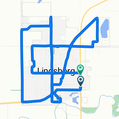
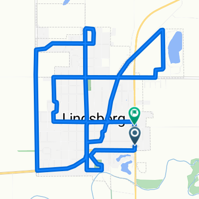
Lindsborg to Coronado Heights
Eine Fahrradroute, die in Lindsborg, Kansas, Vereinigte Staaten beginnt.
Übersicht
Über diese Route
Diese kurze Fahrt von Lindsborg zu Coronado Heights ist eine wunderschöne Möglichkeit, Ihren Tag zu beginnen oder zu beenden.
Eines der bekanntesten Wahrzeichen im Smoky Hill River Valley in Zentral-Kansas ist der Coronado Heights Park, der im Nationalen und im Kansas-Register der historischen Stätten aufgeführt ist und von Mitgliedern der Kansas Sampler Foundation als eines der 8 Wunder der Geografie von Kansas gewählt wurde.
Frühe schwedische Pioniere ließen sich ursprünglich am Fuß des Hügels nieder, zogen jedoch schließlich die Gemeinschaft in den Talboden. Anna Olsson, die Tochter von einem der Gründer von Lindsborg, Rev. Olaf Olsson, schrieb in ihren Erinnerungen Kind der Prärie, dass man, wenn man von der Spitze der Heights blickte und Heimweh hatte, sich vorstellte, bis nach Schweden zu sehen.
Dominierend auf 300 Fuß über dem Smoky Hill River Valley, befindet sich der Coronado Heights, etwa 3 Meilen nordwestlich von Lindsborg, am südlichen Rand einer Folge von sieben Hügeln, die als die Spanish (oder manchmal die Smoky Hill) Buttes bekannt sind. Die Dakota-Formation wurde vor etwa 100 Millionen Jahren abgelagert. Der Coronado Heights bleibt ein natürlicher Lebensraum für Wildblumen und Gräser. Yucca, Stachelbeeren, Prairie Racerunner-Eidechsen, Sumach, Salbei und Spiderwort gedeihen. Wegen seiner natürlichen Schönheit ist er ein beliebter Ort für Hochzeiten und Familientreffen.
Die Entwicklung des Coronado Heights Parks begann 1919 mit der Gründung der Lindsborg Historical Society, der Vorläuferin der Smoky Valley Historical Association. Ein Schutzhaus wurde um den Picknick- und Kochbereich in der Mitte des Hügels gebaut. Die ursprüngliche Straße, um den Zugang für Automobile zur Spitze zu ermöglichen, wurde 1920 erbaut und wurde in Erinnerung an Carl Aaron Swensson, den Gründer des Bethany College, Swensson Drive genannt. Ein Fußweg, jetzt die Treppe in der Mitte des Hügels, wird Olsson Trail genannt, benannt nach Olaf Olsson, dem Leiter einer der ersten Gruppen von Schweden, die sich im Tal niederließen. Früh in der Geschichte des Smoky Valley war es offensichtlich, dass der Coronado Heights Park geschätzt und für alle zugänglich sein sollte. Wie die Skulptur von 1988 von John Whitfield, die halbwegs bis zur Straße steht, sagt: "Ein Ort zum Teilen."
Der Coronado Heights Park ist der Ort, wo die Bewohner des Smoky Valley das stets wechselnde Wetter von Kansas beobachten. Künstler und Fotografen haben sich seit Jahren auf Coronado Heights zu einem außergewöhnlichen Panorama versammelt. Der weiche einheimische Dakota-Sandstein ist übersät mit Namen und Daten aus vergangenen Jahren. Wander- und Radwege schlängeln sich um den Hügel. Auch wenn einige die falsche Vorstellung haben, Coronado selbst habe die spanisch inspirierte Burg gebaut, wurde sie tatsächlich 1936 von Arbeitern der Works Progress Administration erbaut. Es ist der Ort, um einen Sonnenaufgang oder Sonnenuntergang zu beobachten. Es ist der perfekte Ort, um einen Drachen oder ein Modellflugzeug fliegen zu lassen, ein Picknick zu machen, Freunde zu treffen und Besucher zu zeigen, die Landschaft des Smoky Valley.
- -:--
- Dauer
- 14,7 km
- Distanz
- 106 m
- Aufstieg
- 106 m
- Abstieg
- ---
- Ø-Tempo
- ---
- Max. Höhe

Fotos von der Route


Routenqualität
Wegtypen und Untergründe entlang der Route
Wegtypen
Ruhige Straße
7,6 km
(52 %)
Straße
7 km
(48 %)
Untergründe
Unbefestigt
1,6 km
(11 %)
Schotter
1,6 km
(11 %)
Undefiniert
13,1 km
(89 %)
Weiter mit Bikemap
Diese Radroute verwenden, bearbeiten oder herunterladen
Du möchtest Lindsborg to Coronado Heights fahren oder sie für deine eigene Reise anpassen? Folgendes kannst du mit dieser Bikemap-Route machen:
Gratis Funktionen
- Speichere diese Route als Favorit oder in einer Sammlung
- Kopiere & plane deine eigene Version dieser Route
- Synchronisiere deine Route mit Garmin oder Wahoo
Premium-Funktionen
Kostenlose Testversion für 3 Tage oder einmalige Zahlung. Mehr über Bikemap Premium.
- Navigiere diese Route auf iOS & Android
- Exportiere eine GPX / KML-Datei dieser Route
- Erstelle deinen individuellen Ausdruck (Jetzt kostenlos ausprobieren)
- Lade diese Route für die Offline-Navigation herunter
Entdecke weitere Premium-Funktionen.
Bikemap Premium aktivierenVon unserer Community
Lindsborg: Andere beliebte Routen, die hier beginnen
 Cole1
Cole1- Distanz
- 16,1 km
- Aufstieg
- 83 m
- Abstieg
- 62 m
- Standort
- Lindsborg, Kansas, Vereinigte Staaten
 South Cole Street to South Cole Street
- Distanz
- 16 km
- Aufstieg
- 81 m
- Abstieg
- 56 m
- Standort
- Lindsborg, Kansas, Vereinigte Staaten
 Lindsborg/Roxbury/Gypsum Loop
- Distanz
- 76,2 km
- Aufstieg
- 198 m
- Abstieg
- 200 m
- Standort
- Lindsborg, Kansas, Vereinigte Staaten
 Välkommen Trail - Lindsborg
- Distanz
- 5 km
- Aufstieg
- 11 m
- Abstieg
- 9 m
- Standort
- Lindsborg, Kansas, Vereinigte Staaten
 Lindsborg to Maxwell Wildlife Refuge
- Distanz
- 70,8 km
- Aufstieg
- 298 m
- Abstieg
- 300 m
- Standort
- Lindsborg, Kansas, Vereinigte Staaten
 Lindsborg via the Meadowlark Trail to Marquette
- Distanz
- 49 km
- Aufstieg
- 86 m
- Abstieg
- 89 m
- Standort
- Lindsborg, Kansas, Vereinigte Staaten
 708 Emerald Dr, Lindsborg to Bethany Dr, Lindsborg
- Distanz
- 22,6 km
- Aufstieg
- 154 m
- Abstieg
- 152 m
- Standort
- Lindsborg, Kansas, Vereinigte Staaten
 Falun Classic - Lindsborg to Falun Loop
- Distanz
- 49,1 km
- Aufstieg
- 135 m
- Abstieg
- 133 m
- Standort
- Lindsborg, Kansas, Vereinigte Staaten
In der App öffnen