
Cycling in Thurnau
Discover a map of 64 cycling routes and bike trails near Thurnau, created by our community.
Region portrait
Get to know Thurnau
Find the right bike route for you through Thurnau, where we've got 64 cycle routes to explore. Most people get on their bikes to ride here in the months of May and August.
2,809 km
Tracked distance
64
Cycle routes
4,502
Population


From our community
The best bike routes in and around Thurnau

Stard und Ziel Thurnau
Cycling route in Thurnau, Bavaria, Germany
Die Strecke verläuft auf ruhigen Straßen in wunderschöner Landschaft
Die Steigungen sind hügelig , manchmal steil - maximale Steigung 13%
- 81.3 km
- Distance
- 1,173 m
- Ascent
- 1,146 m
- Descent

Thurnau über Trebgast nach Bayreuth Bahnhofstraße
Cycling route in Thurnau, Bavaria, Germany
Lockere 36 km, viel auf Radwegen und wenig befahrenen Straßen.
Die Radwege sind gut gekennzeichnet. Ab Lindau geht es eher flach dahin; vorher teilweise kurze leichte- mittlere Steigungen.
Für Rennrad unter umständen geeignet, macht aber mit Mtb mehr Spaß, weil die Wege eben nicht a
- 36.2 km
- Distance
- 218 m
- Ascent
- 238 m
- Descent

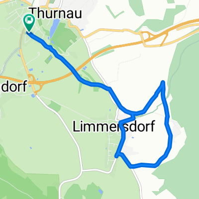
Limmesdorf, Langenstadt, Hutschdorf, Heubsch, Thurnau Limmersdorf
Cycling route in Thurnau, Bavaria, Germany
Auch für Kinder geeignet. Dauer ca, 2,5 Std.
- 21.2 km
- Distance
- 143 m
- Ascent
- 172 m
- Descent

Discover more routes
 Tria-MD-Teilstrecke
- Distance
- 22.6 km
- Ascent
- 191 m
- Descent
- 155 m
- Location
- Thurnau, Bavaria, Germany
 Racing Kids Ausfahrt verkürzt
- Distance
- 46.5 km
- Ascent
- 466 m
- Descent
- 475 m
- Location
- Thurnau, Bavaria, Germany
 Thurnau-Neubürg
- Distance
- 56 km
- Ascent
- 607 m
- Descent
- 607 m
- Location
- Thurnau, Bavaria, Germany
 Stammtisch
- Distance
- 8.5 km
- Ascent
- 109 m
- Descent
- 111 m
- Location
- Thurnau, Bavaria, Germany
 Weg umsonst^^
- Distance
- 7.1 km
- Ascent
- 77 m
- Descent
- 77 m
- Location
- Thurnau, Bavaria, Germany
 Waldhütte über Mosing retour
- Distance
- 25.8 km
- Ascent
- 352 m
- Descent
- 352 m
- Location
- Thurnau, Bavaria, Germany
 Mainzusammenfluss Rundweg
- Distance
- 31.1 km
- Ascent
- 194 m
- Descent
- 202 m
- Location
- Thurnau, Bavaria, Germany
 Lange Ausfahrt durch Thurnau
- Distance
- 45.7 km
- Ascent
- 409 m
- Descent
- 410 m
- Location
- Thurnau, Bavaria, Germany