
Cycling in Free State of Thuringia
Discover a map of 40,299 cycling routes and bike trails in Free State of Thuringia, created by our community.
Region portrait
Get to know Free State of Thuringia
Find the right bike route for you through Free State of Thuringia, where we've got 40,299 cycle routes to explore. Most people get on their bikes to ride here in the months of May and July.
2,079,791 km
Tracked distance
40,299
Cycle routes
Community
Most active users in Free State of Thuringia


Handpicked routes
Discover Free State of Thuringia through these collections

Tour
Herkules-Wartburg-Radweg
6 routes
From our community
The best bike routes in Free State of Thuringia


Storchmühlenweg 17, Erfurt nach Karlstraße 10b, Erfurt
Cycling route in Erfurt, Free State of Thuringia, Germany
- 19.5 km
- Distance
- 141 m
- Ascent
- 145 m
- Descent

SRO - Magersdorf - Maua - Zöllnitz -SRO
Cycling route in Stadtroda, Free State of Thuringia, Germany
- 27.9 km
- Distance
- 254 m
- Ascent
- 282 m
- Descent

qd-dopingfrei-Tour Thüringen 2009
Cycling route in Saalfeld, Free State of Thuringia, Germany
ad hoc geänderte Tour von geplanten 117km und 2640 Höhenmetern
- 104.8 km
- Distance
- 1,055 m
- Ascent
- 1,055 m
- Descent

EF-Ilmtal-Riechheim-EF
Cycling route in Mönchenholzhausen, Free State of Thuringia, Germany
Start und Ende Erfurt SüdOst Parkplatz / Strassenbahn Urbicher Kreuz
5-7 Stunden einplanen / reizvolle Landschaft
Buchfahrt bis Kranichfeld auf Ilm-Radweg
einige erprobte gute Gasthäuser / Eisdiele Tannroda/ Riechheimer Berg
interressant auch Forsthaus Willro
- 54.7 km
- Distance
- 388 m
- Ascent
- 266 m
- Descent
Discover more routes
 Bad Klosterlausnitz- Köstritz-Gera
- Distance
- 50.5 km
- Ascent
- 333 m
- Descent
- 333 m
- Location
- Bad Klosterlausnitz, Free State of Thuringia, Germany
 Heichelheim klein
- Distance
- 16.1 km
- Ascent
- 99 m
- Descent
- 100 m
- Location
- Heichelheim, Free State of Thuringia, Germany
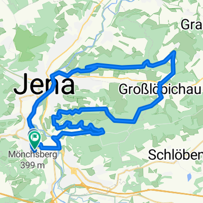
 Chillige Abendtour durch die westlichen Berge Jenas
- Distance
- 49.9 km
- Ascent
- 469 m
- Descent
- 459 m
- Location
- Sulza, Free State of Thuringia, Germany
 : Halbtagestour mit Kindern
- Distance
- 29.6 km
- Ascent
- 185 m
- Descent
- 201 m
- Location
- Jena, Free State of Thuringia, Germany
 Trainingsrunde
- Distance
- 34.9 km
- Ascent
- 559 m
- Descent
- 558 m
- Location
- Jena, Free State of Thuringia, Germany
 2. Rad n Roll MTB Marathon
- Distance
- 28.6 km
- Ascent
- 607 m
- Descent
- 494 m
- Location
- Jena, Free State of Thuringia, Germany
 Lutherstein Tour
- Distance
- 45.8 km
- Ascent
- 133 m
- Descent
- 143 m
- Location
- Erfurt, Free State of Thuringia, Germany
 Unstrut-Radweg
- Distance
- 188.8 km
- Ascent
- 84 m
- Descent
- 374 m
- Location
- Kefferhausen, Free State of Thuringia, Germany
Cycling regions in Free State of Thuringia
See where people are biking in Germany
Popular cycling regions in Germany


