
Cycling in Stöttwang
Discover a map of 36 cycling routes and bike trails near Stöttwang, created by our community.
Region portrait
Get to know Stöttwang
Find the right bike route for you through Stöttwang, where we've got 36 cycle routes to explore.
1,291 km
Tracked distance
36
Cycle routes
1,847
Population
Community
Most active users in Stöttwang


From our community
The best bike routes in and around Stöttwang
Auerberg
Cycling route in Stöttwang, Bavaria, Germany
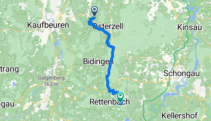
von Stöttwang über Oberzell zum Auerberg (Rettenbach am Auerberg)
- 20.5 km
- Distance
- 358 m
- Ascent
- 114 m
- Descent

Hausrunde Stöttwang (lang)
Cycling route in Stöttwang, Bavaria, Germany
von Stöttwang über Bidingen auf den Kalvarienberg, über Ödwang, Mooshütte, Hirschzell und Frankenhofen zurück.
- 40.4 km
- Distance
- 378 m
- Ascent
- 378 m
- Descent


Discover more routes
 Ummenhofen
- Distance
- 39.8 km
- Ascent
- 235 m
- Descent
- 234 m
- Location
- Stöttwang, Bavaria, Germany
 Ettwieser Weiher
- Distance
- 24.9 km
- Ascent
- 173 m
- Descent
- 139 m
- Location
- Stöttwang, Bavaria, Germany
 Martin Hawangen
- Distance
- 54.9 km
- Ascent
- 198 m
- Descent
- 265 m
- Location
- Stöttwang, Bavaria, Germany
 Martin Hawangen
- Distance
- 58.9 km
- Ascent
- 228 m
- Descent
- 297 m
- Location
- Stöttwang, Bavaria, Germany
 Hohenfurch
- Distance
- 23.1 km
- Ascent
- 247 m
- Descent
- 251 m
- Location
- Stöttwang, Bavaria, Germany
 Schmuttersee mit Trail
- Distance
- 38.1 km
- Ascent
- 270 m
- Descent
- 183 m
- Location
- Stöttwang, Bavaria, Germany
 Weichberg
- Distance
- 35.3 km
- Ascent
- 332 m
- Descent
- 332 m
- Location
- Stöttwang, Bavaria, Germany
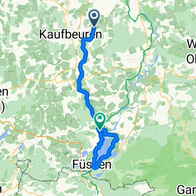 Füssen und um den Forggensee
- Distance
- 65.7 km
- Ascent
- 364 m
- Descent
- 257 m
- Location
- Stöttwang, Bavaria, Germany