
Cycling in Reut
Discover a map of 75 cycling routes and bike trails near Reut, created by our community.
Region portrait
Get to know Reut
Find the right bike route for you through Reut, where we've got 75 cycle routes to explore. Most people get on their bikes to ride here in the month of August.
3,259 km
Tracked distance
75
Cycle routes
1,793
Population
Community
Most active users in Reut


From our community
The best bike routes in and around Reut

3 Tagestour Deutschland, Österreich. (Tauplitzalm, Sölkpaß, Obertauern
Cycling route in Reut, Bavaria, Germany
Anspruchsvolle Tour mit Rucksack. Übernachtung Tauplitzalm Hütte 220 Km. weiter Sölkpaß, Obertauern, Hallein Übernachtung, 215 Km.
Nach Hause 173 Km.
- 608.3 km
- Distance
- 4,052 m
- Ascent
- 4,052 m
- Descent
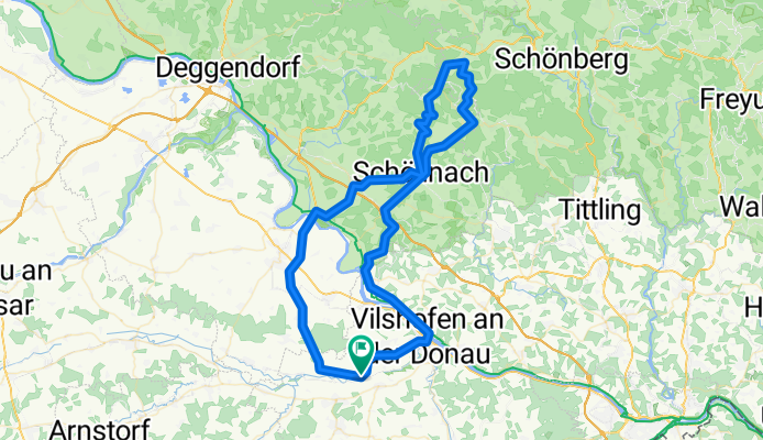

Bürgermeister-Fischer-Straße 11, Vilshofen an der Donau nach Bürgermeister-Fischer-Straße 11, Vilshofen an der Donau
Cycling route in Reut, Bavaria, Germany
- 19.8 km
- Distance
- 416 m
- Ascent
- 419 m
- Descent

Discover more routes
 3 Tagestour Bayerischer Wald
- Distance
- 462 km
- Ascent
- 5,483 m
- Descent
- 5,172 m
- Location
- Reut, Bavaria, Germany
 Arber
Arber- Distance
- 168.9 km
- Ascent
- 2,983 m
- Descent
- 2,854 m
- Location
- Reut, Bavaria, Germany
 Bürgermeister-Fischer-Straße 11, Vilshofen an der Donau nach Bürgermeister-Fischer-Straße 11, Vilshofen an der Donau
- Distance
- 19.5 km
- Ascent
- 399 m
- Descent
- 374 m
- Location
- Reut, Bavaria, Germany
 Birnbachrunde
- Distance
- 67.6 km
- Ascent
- 558 m
- Descent
- 509 m
- Location
- Reut, Bavaria, Germany
 Brotjackelriegel + Umrundung
- Distance
- 99.7 km
- Ascent
- 1,032 m
- Descent
- 1,031 m
- Location
- Reut, Bavaria, Germany
 Haidenburg- Wisseldorf-Forsthart-Künzing-Alkofen
- Distance
- 85.9 km
- Ascent
- 552 m
- Descent
- 552 m
- Location
- Reut, Bavaria, Germany
 ortenburg -sandbachrunde
- Distance
- 45 km
- Ascent
- 510 m
- Descent
- 487 m
- Location
- Reut, Bavaria, Germany
 Sankt-Nikola-Straße 6, Vilshofen an der Donau nach Sankt-Nikola-Straße 6, Vilshofen an der Donau
- Distance
- 8.1 km
- Ascent
- 108 m
- Descent
- 110 m
- Location
- Reut, Bavaria, Germany