
Cycling in Schlaiten
Discover a map of 14 cycling routes and bike trails near Schlaiten, created by our community.
Region portrait
Get to know Schlaiten
Find the right bike route for you through Schlaiten, where we've got 14 cycle routes to explore.
394 km
Tracked distance
14
Cycle routes
Community
Most active users in Schlaiten


From our community
The best bike routes in and around Schlaiten

Großglockner
Cycling route in Schlaiten, Tyrol, Austria
Garmin Edge 705: 2100 Hm
ab Heiligenblut 16km immer 10 - 12 %
- 66.3 km
- Distance
- 2,108 m
- Ascent
- 460 m
- Descent

Kalser Glocknerstrasse Lucknerhaus
Cycling route in Schlaiten, Tyrol, Austria
- 48.3 km
- Distance
- 2,533 m
- Ascent
- 2,433 m
- Descent

lienzer hütte - hochschober hütte
Cycling route in Schlaiten, Tyrol, Austria
gyalog
- 4.7 km
- Distance
- 430 m
- Ascent
- 691 m
- Descent

Discover more routes
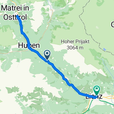 LIENZ MATREI
- Distance
- 43.1 km
- Ascent
- 254 m
- Descent
- 332 m
- Location
- Schlaiten, Tyrol, Austria
 Mesnerdorf 57, Schlaiten nach Mesnerdorf 57, Schlaiten
- Distance
- 7.1 km
- Ascent
- 1,049 m
- Descent
- 651 m
- Location
- Schlaiten, Tyrol, Austria
 Dobbiaco
- Distance
- 63.5 km
- Ascent
- 568 m
- Descent
- 77 m
- Location
- Schlaiten, Tyrol, Austria
 Route nach Felbertauern-Bundesstraße 72, Lienz
- Distance
- 11.5 km
- Ascent
- 16 m
- Descent
- 75 m
- Location
- Schlaiten, Tyrol, Austria
 Mesnerdorf 57, Schlaiten nach Mesnerdorf 57, Schlaiten
- Distance
- 9.7 km
- Ascent
- 1,095 m
- Descent
- 709 m
- Location
- Schlaiten, Tyrol, Austria
 Mesnerdorf 57, Schlaiten nach Mesnerdorf 57, Schlaiten
- Distance
- 9.7 km
- Ascent
- 1,108 m
- Descent
- 720 m
- Location
- Schlaiten, Tyrol, Austria
 Ainet - Misurinasee
- Distance
- 88.3 km
- Ascent
- 1,819 m
- Descent
- 790 m
- Location
- Schlaiten, Tyrol, Austria
 hschober hütte parkolo
- Distance
- 7.1 km
- Ascent
- 0 m
- Descent
- 1,555 m
- Location
- Schlaiten, Tyrol, Austria