
Cycling in Adliswil / Sonnenberg
Discover a map of 75 cycling routes and bike trails near Adliswil / Sonnenberg, created by our community.
Region portrait
Get to know Adliswil / Sonnenberg
Find the right bike route for you through Adliswil / Sonnenberg, where we've got 75 cycle routes to explore. Most people get on their bikes to ride here in the month of April.
1,838 km
Tracked distance
75
Cycle routes
1,283
Population
Community
Most active users in Adliswil / Sonnenberg


From our community
The best bike routes in and around Adliswil / Sonnenberg

Von Adliswil, Rüschlikon, Horgenser Bergweiher, Hirzel, Baar Zug Zuger See, und über Sihlbrugg zurück nach ADLISWIL
Cycling route in Adliswil / Sonnenberg, Canton of Zurich, Switzerland
Die Strecke ist ab und zu schon etwas steiler, sonst kommt man aber stätig immer höher. Sehr schön und typisch schweizerische Natur. Wechselt zwischen Waldstrecke und Sonnenstrecken ab und zu schöne Aussichtspunkte zum Zürisee und Zuger See.
Dauer 5 Stunden, und 50 km später.
<
- 47.7 km
- Distance
- 416 m
- Ascent
- 436 m
- Descent

Adliswil-Susten
Cycling route in Adliswil / Sonnenberg, Canton of Zurich, Switzerland
Long tour from Adliswil to Sustenpass
- 242.3 km
- Distance
- 3,013 m
- Ascent
- 3,013 m
- Descent

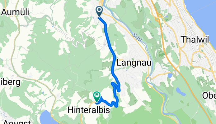
Waldistrasse 10, Adliswil to Waldistrasse 10, Adliswil
Cycling route in Adliswil / Sonnenberg, Canton of Zurich, Switzerland
- 16.8 km
- Distance
- 198 m
- Ascent
- 197 m
- Descent
VCA Adliswil - Albis
Cycling route in Adliswil / Sonnenberg, Canton of Zurich, Switzerland
- 4.9 km
- Distance
- 333 m
- Ascent
- 45 m
- Descent
Discover more routes
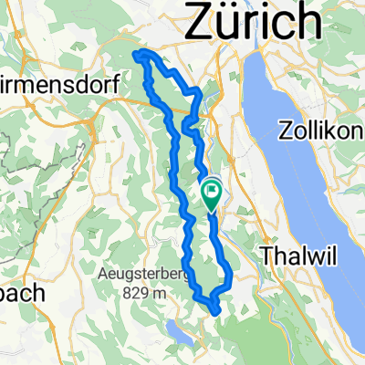
 kleine Trainingsrunde 1000 höhenmeter
- Distance
- 29.7 km
- Ascent
- 989 m
- Descent
- 991 m
- Location
- Adliswil / Sonnenberg, Canton of Zurich, Switzerland
 Da Felseneggweg, Stallikon a Langwiesstrasse 18–24, Uitikon Waldegg
- Distance
- 11.3 km
- Ascent
- 131 m
- Descent
- 294 m
- Location
- Adliswil / Sonnenberg, Canton of Zurich, Switzerland
 immenser
- Distance
- 0.2 km
- Ascent
- 0 m
- Descent
- 0 m
- Location
- Adliswil / Sonnenberg, Canton of Zurich, Switzerland
 13.06.21
- Distance
- 28.1 km
- Ascent
- 939 m
- Descent
- 926 m
- Location
- Adliswil / Sonnenberg, Canton of Zurich, Switzerland
 Aiyara
- Distance
- 7.3 km
- Ascent
- 64 m
- Descent
- 375 m
- Location
- Adliswil / Sonnenberg, Canton of Zurich, Switzerland
 Sonnenbergstrasse, Adliswil nach Sonnenbergstrasse, Adliswil
- Distance
- 27.8 km
- Ascent
- 953 m
- Descent
- 953 m
- Location
- Adliswil / Sonnenberg, Canton of Zurich, Switzerland
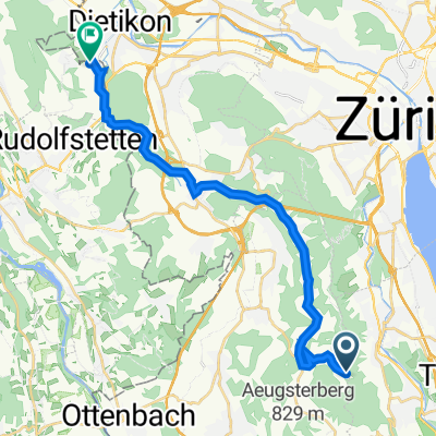 Zürich-Zugerland-Panoramaweg, Stallikon to Erlenstrasse 7, Bergdietikon
- Distance
- 19.4 km
- Ascent
- 133 m
- Descent
- 456 m
- Location
- Adliswil / Sonnenberg, Canton of Zurich, Switzerland
 Buchenegg-Richterswil
- Distance
- 30.8 km
- Ascent
- 429 m
- Descent
- 649 m
- Location
- Adliswil / Sonnenberg, Canton of Zurich, Switzerland