Premium Badge Download on the App Store Get it on Google Play Turn-by-turn Navigation Offline Maps Bike Type Optimized Routing Premium Maps Custom Bike Computer Export Routes Route Previews Fall Detection Premium Support

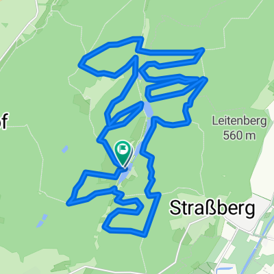
Cycling Route in Wehringen, Bavaria, Germany

650 Hm - Westliche Wälder - Burgwalden - Anhausen

1
Open this route in the Bikemap app

Open this route in the Bikemap app

Open this route in Bikemap Web

Open this route in Bikemap Web

42 km
Distance
556 m
Ascent
556 m
Descent
-:-- h
Duration
-- km/h
Avg. Speed
--- m
Max. Elevation

About This Route

Bei dieser Tour wird kein Höhenmeter der Region ausgelassen! Ein bisschen Kondition sollte man also mitbringen.

Technik ist dagegen kaum gefragt.

Eine wirklich super Tour inkl. kurzem Single-Trail!

This cycling route is ideal for: MTB

You will cycle on the following surfaces: Unpaved Gravel

Highlights Along The Route

POI Photo 1: Loup69

Photo

Scheppacher Kapelle

POI Photo 2: Loup69

Photo

Anhauser Weiher

Customize this cycling route with the Bikemap route planner.

Make it yours!

Did you know? You can use this route as a template in our cycling route planner if you don't wish to start from scratch. Customize it based on your needs to plan your perfect cycling tour.

Open it in the app