

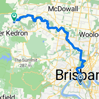
Highvale via Roma St and the Enoggera Creek bikeway
A cycling route starting in South Brisbane, Queensland, Australia.
Overview
About this route
- -:--
- Duration
- 42 km
- Distance
- 444 m
- Ascent
- 358 m
- Descent
- ---
- Avg. speed
- 135 m
- Max. altitude

Route quality
Waytypes & surfaces along the route
Waytypes
Cycleway
13 km
(31 %)
Quiet road
12.6 km
(30 %)
Surfaces
Paved
39.9 km
(95 %)
Asphalt
22.7 km
(54 %)
Concrete
12.2 km
(29 %)
Continue with Bikemap
Use, edit, or download this cycling route
You would like to ride Highvale via Roma St and the Enoggera Creek bikeway or customize it for your own trip? Here is what you can do with this Bikemap route:
Free features
- Save this route as favorite or in collections
- Copy & plan your own version of this route
- Sync your route with Garmin or Wahoo
Premium features
Free trial for 3 days, or one-time payment. More about Bikemap Premium.
- Navigate this route on iOS & Android
- Export a GPX / KML file of this route
- Create your custom printout (try it for free)
- Download this route for offline navigation
Discover more Premium features.
Get Bikemap PremiumFrom our community
Other popular routes starting in South Brisbane
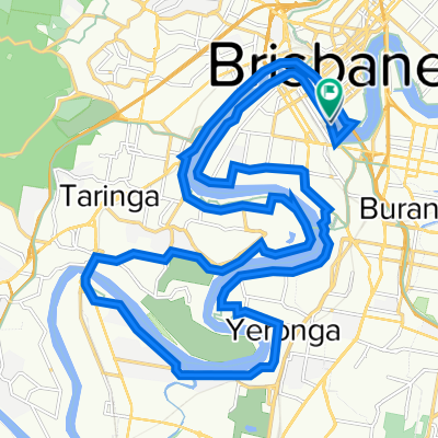 Brisbane River Loop
- Distance
- 34.7 km
- Ascent
- 222 m
- Descent
- 221 m
- Location
- South Brisbane, Queensland, Australia
 Brisbane River Loop Extended with Cootha
- Distance
- 52.5 km
- Ascent
- 781 m
- Descent
- 780 m
- Location
- South Brisbane, Queensland, Australia
 Brisbane to Gold Coast 2010 + extra 50 kms
- Distance
- 155.7 km
- Ascent
- 194 m
- Descent
- 210 m
- Location
- South Brisbane, Queensland, Australia
 Wynnum Loop
- Distance
- 51.1 km
- Ascent
- 268 m
- Descent
- 271 m
- Location
- South Brisbane, Queensland, Australia
 Dornoch Terrace 196, Highgate Hill to Stanley Street East 922, East Brisbane
- Distance
- 2.8 km
- Ascent
- 0 m
- Descent
- 37 m
- Location
- South Brisbane, Queensland, Australia
 Brisbane River Loop
- Distance
- 93.7 km
- Ascent
- 216 m
- Descent
- 197 m
- Location
- South Brisbane, Queensland, Australia
 Little Stanley St, South Brisbane to McGinn Rd, Ferny Grove
- Distance
- 23 km
- Ascent
- 238 m
- Descent
- 184 m
- Location
- South Brisbane, Queensland, Australia
 mt coot-tha challenge 2012
- Distance
- 84.4 km
- Ascent
- 596 m
- Descent
- 600 m
- Location
- South Brisbane, Queensland, Australia
Open it in the app