
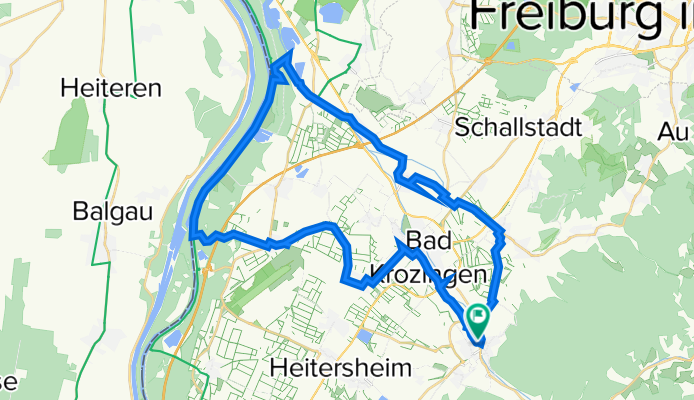
44 Von Staufen zum Rhein
A cycling route starting in Bad Krozingen, Baden-Wurttemberg, Germany.
Overview
About this route
Through the gentle Breisgau to the banks of the Rhine - almost continuously without annoying car traffic. A relaxed tour for the touring bike or e-bike.
- -:--
- Duration
- 44 km
- Distance
- 147 m
- Ascent
- 148 m
- Descent
- ---
- Avg. speed
- 285 m
- Max. altitude

Route quality
Waytypes & surfaces along the route
Waytypes
Quiet road
15.4 km
(35 %)
Track
14.5 km
(33 %)
Surfaces
Paved
27.3 km
(62 %)
Unpaved
10.1 km
(23 %)
Asphalt
26 km
(59 %)
Gravel
8.4 km
(19 %)
Continue with Bikemap
Use, edit, or download this cycling route
You would like to ride 44 Von Staufen zum Rhein or customize it for your own trip? Here is what you can do with this Bikemap route:
Free features
- Save this route as favorite or in collections
- Copy & plan your own version of this route
- Sync your route with Garmin or Wahoo
Premium features
Free trial for 3 days, or one-time payment. More about Bikemap Premium.
- Navigate this route on iOS & Android
- Export a GPX / KML file of this route
- Create your custom printout (try it for free)
- Download this route for offline navigation
Discover more Premium features.
Get Bikemap PremiumFrom our community
Other popular routes starting in Bad Krozingen
 Tour 2025 2. Tag
- Distance
- 62.6 km
- Ascent
- 387 m
- Descent
- 396 m
- Location
- Bad Krozingen, Baden-Wurttemberg, Germany
 Wieden - um den Belchen
- Distance
- 72 km
- Ascent
- 2,310 m
- Descent
- 1,978 m
- Location
- Bad Krozingen, Baden-Wurttemberg, Germany
 Staufen Zurück
- Distance
- 4.8 km
- Ascent
- 259 m
- Descent
- 239 m
- Location
- Bad Krozingen, Baden-Wurttemberg, Germany
 Markgräfler Impressionen
- Distance
- 44 km
- Ascent
- 1,124 m
- Descent
- 1,122 m
- Location
- Bad Krozingen, Baden-Wurttemberg, Germany
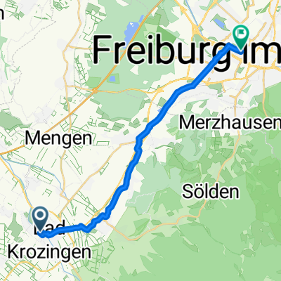 Schlatter Straße, Bad Krozingen nach Stürtzelstraße, Freiburg im Breisgau
- Distance
- 16.6 km
- Ascent
- 110 m
- Descent
- 74 m
- Location
- Bad Krozingen, Baden-Wurttemberg, Germany
 Staufen-St.Ulrich-Horben-Schauinsland-Todtnau-Utzenfeld-Wiedener Eck-Münstertal
- Distance
- 84.4 km
- Ascent
- 2,103 m
- Descent
- 2,106 m
- Location
- Bad Krozingen, Baden-Wurttemberg, Germany
 Staufen-Münsterhalden-Lipple-Badenweiler-Staufen
- Distance
- 63.3 km
- Ascent
- 1,384 m
- Descent
- 1,386 m
- Location
- Bad Krozingen, Baden-Wurttemberg, Germany
 44 Von Staufen zum Rhein
- Distance
- 44 km
- Ascent
- 147 m
- Descent
- 148 m
- Location
- Bad Krozingen, Baden-Wurttemberg, Germany
Open it in the app